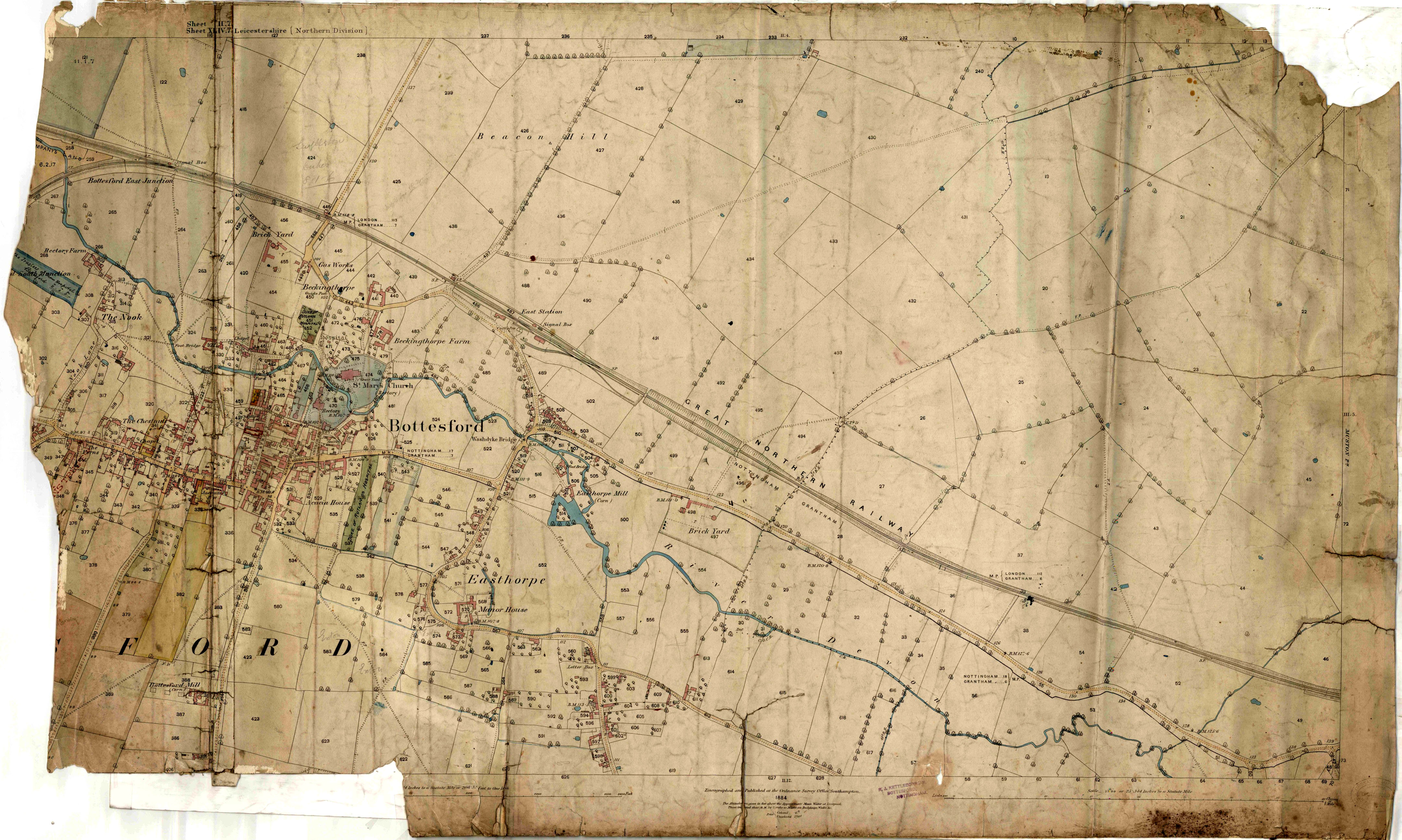
Detailed Bottesford village map of 1884, Ordnance Survey
Bottesford, 1884
From paper copy donated by Mr Michael Sauders
An excellent record of the village at around 1884, this map was prepared by the OS at a large scale. All the fields are numbered, and this map was presumably made for property valuation and rating purposes.
Creator
OS and estate surveyor Place
Bottesford Reference number
BOT/046/003 Storage location
Digital copy of original photograph held by Bottesford Community Heritage Project 
No Comments
Add a comment about this page