Not Forgetting - Chapter 12: A Tour of Muston
Neil Fortey & Sue Dunsmore


Introduction
Muston is a peaceful farming village close to the busy A52, at the northern tip of Leicestershire, embedded in the farmlands of the Vale of Belvoir. William White’s History, Gazetteer and Directory of the Counties of Leicester and Rutland, 1863, describes it as “a neat village on the banks of the River Deven” with “1623 acres … chiefly of strong clay”. The area has been long been known for wheat, wool and dairy produce. Ridge-and-furrow can still be seen in many of its fields.
Muston was not separately mentioned in the Domesday Book, but was included under the entry for Bottesford, according to Nichols. Following the Black Death, the Colville family granted their Muston Manor (which was on or near the site of Hospital farm) to Owston (or Ovelston) Abbey, which was in the Charnwood area of NW Leicestershire. Later, following the Dissolution of the monasteries, the area was granted to the Earl of Rutland. The Victoria History of Leicestershire states that Muston had been completely enclosed by the end of the 17th Century (considerably earlier than neighbouring Bottesford), though it is probable that many of the field boundaries have been changed since then.
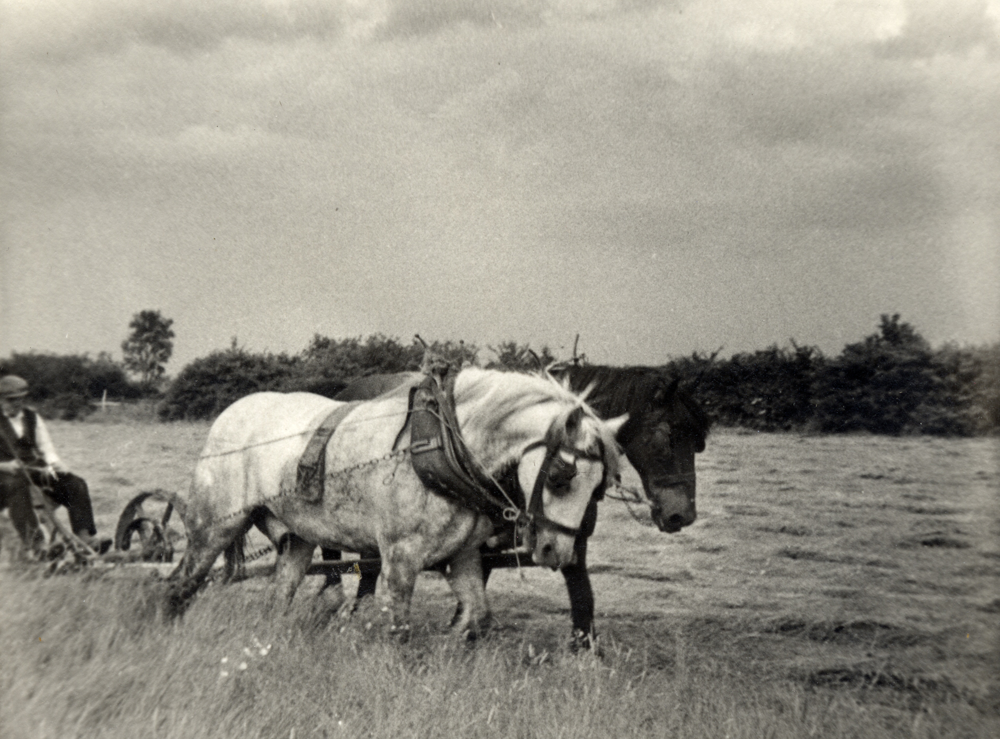
The village has retained its rural character. In the past it had its own Rector, Chapel, shops, school, post-office and sports teams which challenged Bottesford and other villages in friendly rivalry. In 1863, there were two grocers, butcher, baker, another shop, tailor, shoemaker, blacksmith, joiner and coal merchant. The 19th Century village was a busier place than today. Most men worked out of doors, on the farms and railway. There were large numbers of dairy cattle and other livestock in the fields, cows driven along the streets for milking, pigs and poultry in the village gardens. People walked or rode everywhere. Everyone knew each other, and news travelled by word of mouth to a far larger extent than today. On the other hand, there was poverty and illness, as can be seen from the school records. Local farmers worked hard, and none seem to have been gentlemen of leisure. The village population was declining gradually, as people left to find work in the industrial towns or a new life overseas.
In the mid 19th Century, there were eleven working farms in Muston, the larger farms employing as many as fifteen people. Labourers and their families living in tenements had separate gardens and also rented gardens where modern housing is sited today. The villagers had a degree of self-sufficiency, but it must have been hard to enjoy it at times. By 1941, there were twelve farmers, cowkeepers and graziers, but shops and trades had gone save for a tobacconist and two other small shops. There are only three working farms today.
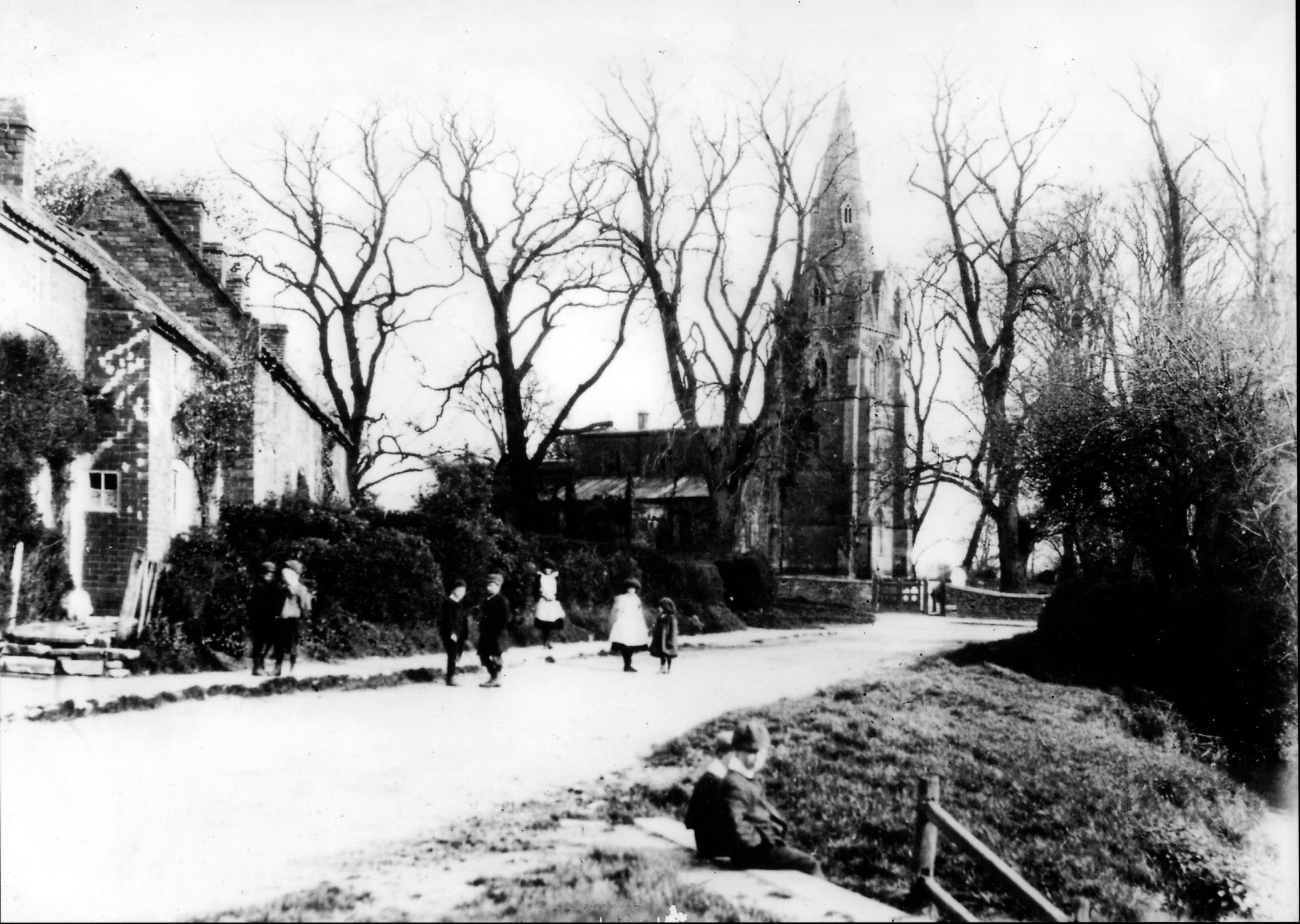
The plan of the village is essentially that of two hundred years ago, and most probably much earlier. Modern houses have been built to infill spaces between the older buildings, but there have been no major developments in the village. In essence, there are two streets, Main Street and Woolsthorpe Lane, along which farms and cottages stood at intervals, separated by fields. Church Lane connected them, via the bridge across the River Devon where the parish church and glebe house are also situated. Beyond the church, it continued northwards, out of the village, to join the Grantham turnpike at the Wheatsheaf (now the Gap Inn). Other than a row of tenements by the junction with Woolsthorpe Lane, there were no houses on Church Lane until the post-war era.
The A52 itself is a straight, modern main road, but before the early 1980s it followed a twisting course past Muston and dipped beneath the bridge of the old mineral railway. It acquired a reputation for motoring accidents, and its straightening shortly before the Bottesford by-pass was built was welcomed.
Building styles
The buildings in Muston reflect distinct episodes in the village’s history. The parish church is medieval, built of local orange-yellow Marlstone (a ferruginous limestone which was quarried in the escarpment a short distance to the south) and grey Ancaster limestone, though extensively restored by the Victorians. Several farm buildings and cottages incorporate stone masonry built of the local orange-yellow Marlstone, as in the older parts of Hospital Farm. There are also small amounts of a grey flaggy (or flaky) limestone from small pits in the fields. Some have evidence of timber framework, as in Hospital Cottage. These probably represent prosperity and expansion in the later 1600s. At any rate, their stonework is in many cases seen underneath brickwork constructed using unusually small bricks, typically 2¼ inches thick. These walls were probably built in the 18th Century, when locally made bricks had become cheap and plentiful (and fashionable) enough to have ousted stone. The size of bricks appears to have increased in the later 18th Century, probably influenced by the notorious brick tax that was introduced to raise money for the wars of that time. In the 19th Century tenements and other buildings, such as the Glebe House, the bricks are larger and more uniform in size. Few buildings were put up in Muston during the early 20th Century, and between the World Wars there was little building, although four council houses were constructed. However, since 1945 there has been the gradual addition of new houses on plots where older houses had stood, that had been gardens or allotments, or on old pastures between earlier houses.
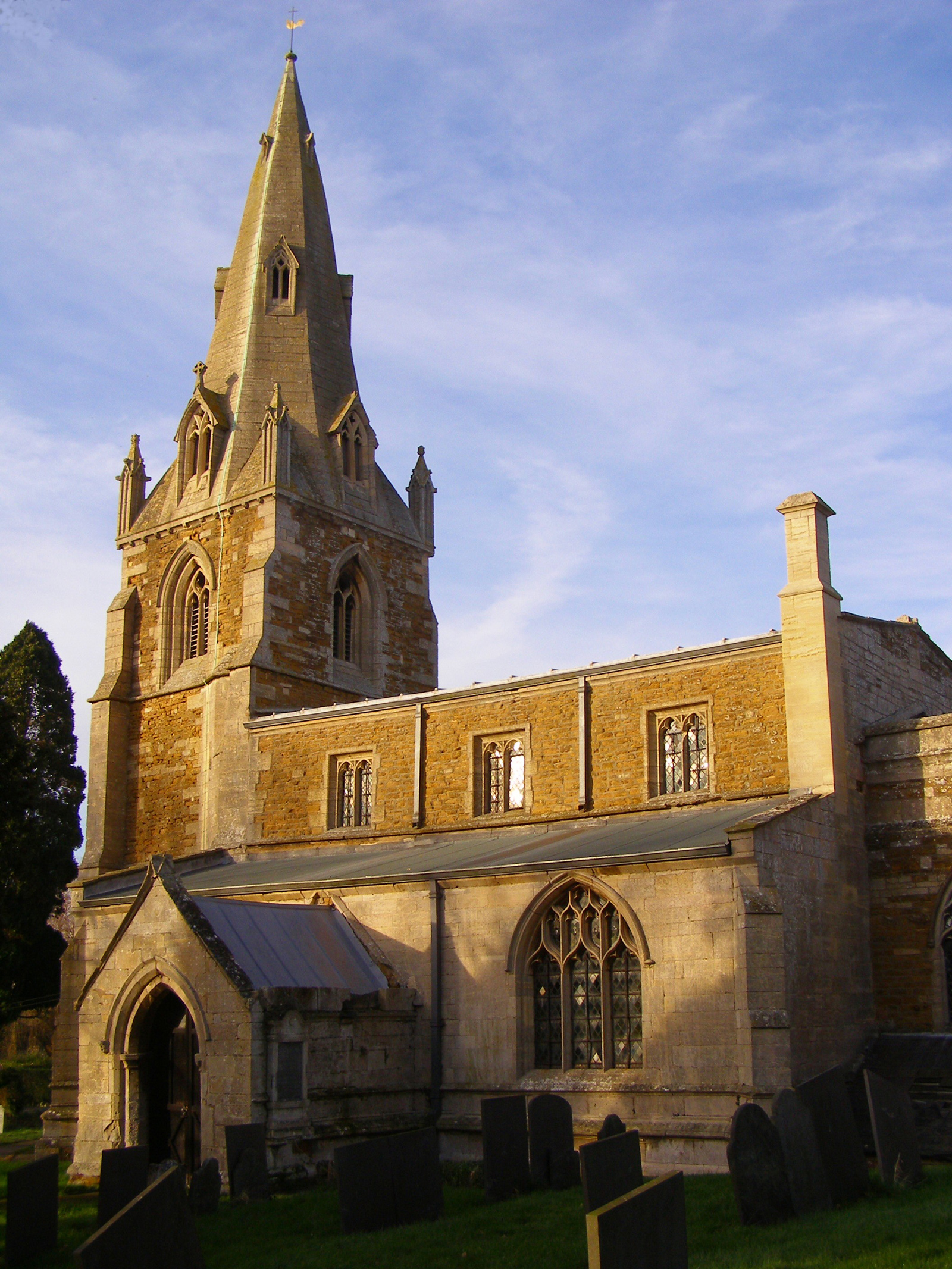
St John the Baptist parish church
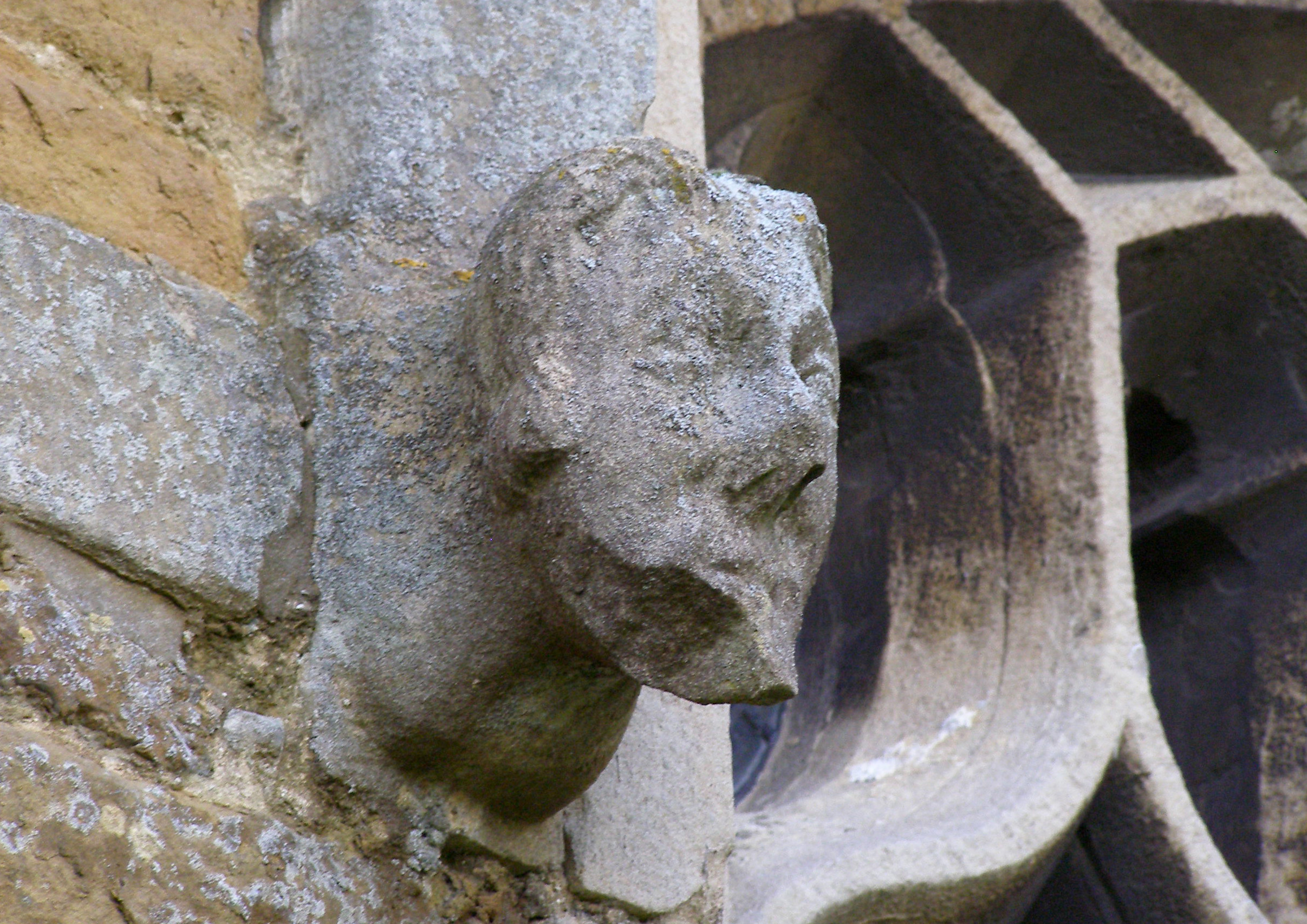
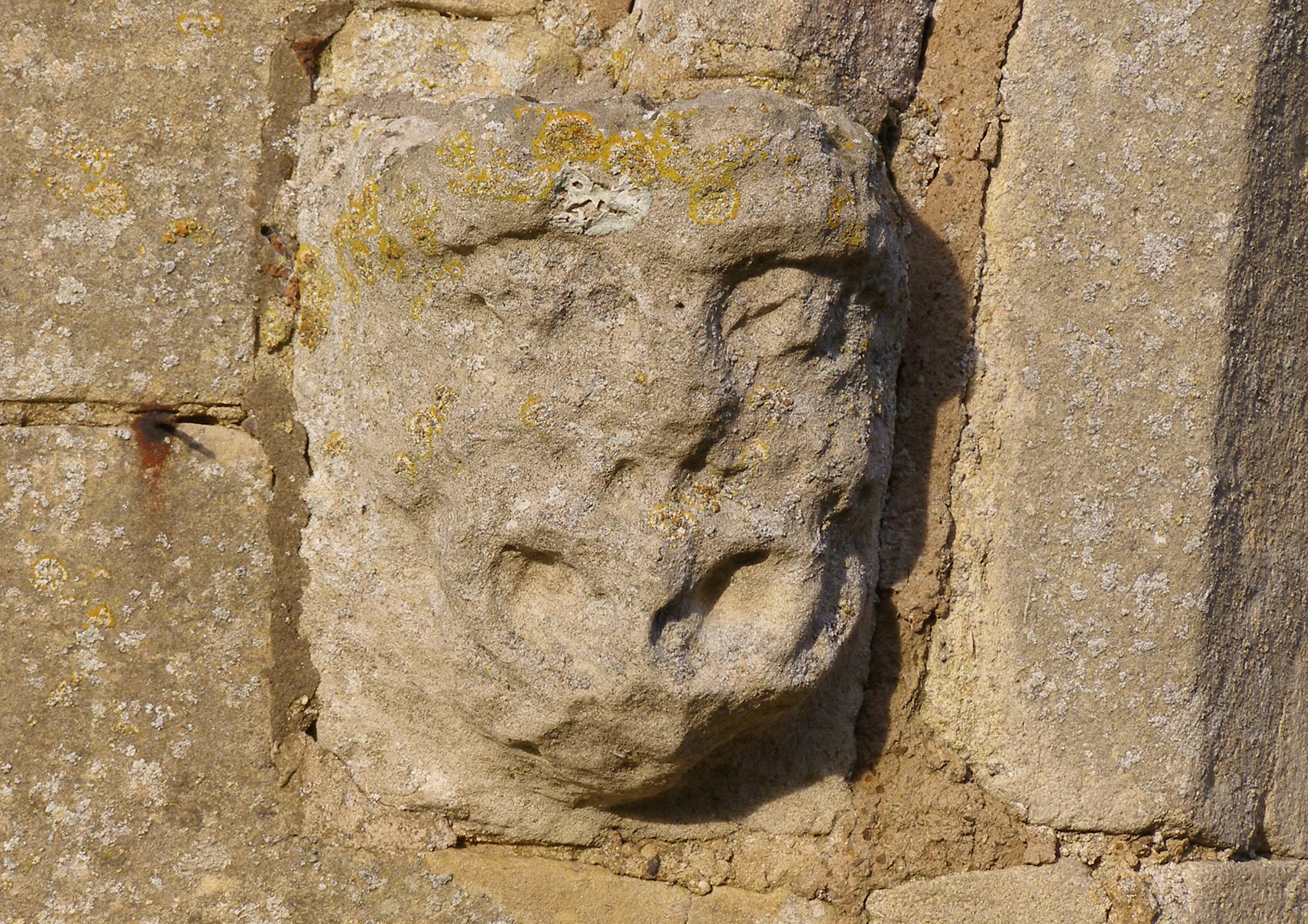
St John the Baptist1 stands at the heart of the village, a compact but handsome medieval building of local ironstone (Marlstone Rock) and Lincolnshire limestone under the patronage of the crown. There is an excellent leaflet describing the church, listing rectors from 1200 to the present day. Among them was Dr Robert Sanderson (1632-1642), chaplain to King Charles I and later Bishop of Lincoln, one of the clergy who produced the Book of Common Prayer in 1662. Another was the poet George Crabbe (1780-1814), whose poem ‘The Borough’ inspired Benjamin Britten’s opera ‘Peter Grimes’.
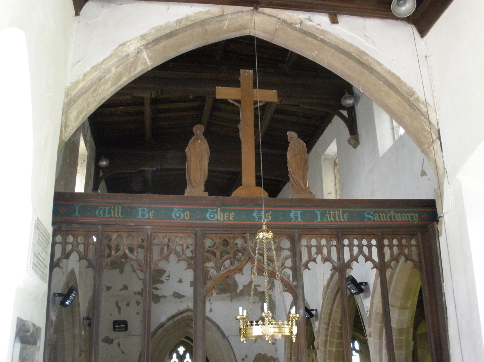
The church, entered through an ornate stone porch, has a handsome medieval carved font, a 15th Century rood screen and beautifully carved 15th Century bench ends some displaying the arms of the Colville and Charnell families. Memorials include plaques to past rectors including Dr Sanderson, and to Sarah Crabbe. Headstones in the churchyard date back to the 17th Century. There are also graves of 20th Century servicemen and the War Memorial.
Next to the church is the handsome mid-19th Century Rectory, often known as the Glebe House2, behind an avenue of horse chestnuts. This was built during the prolonged rectorship of George Gordon (1821-1872) to replace the building that had housed George Crabbe and his successor Henry Byron, uncle of poet Lord Byron. There are no visible remains of the older building, although traces may lie beneath the present house.
Muston and Bottesford were brought together as a joint parish in 1936, but they did not share a joint Rector until after 1959 (Canon Metcalfe). The church became part of the Belvoir Team Benefice, led by Reverend Charles Bradshaw, in 2000.
Main Street
Main Street runs from the church to the northwestern end of the village. Most individual houses did not have formal postal addresses until the 20th Century, and the streets were un-named. Main Street is thus a relatively modern name. At first it runs straight, but then comes a ‘dog-leg’ of two curves, the second very sharp by the small green where Skerry Lane branches off. After this another straight stretch reaches the end of the village and the street turns sharply again, by Corner House Farm.
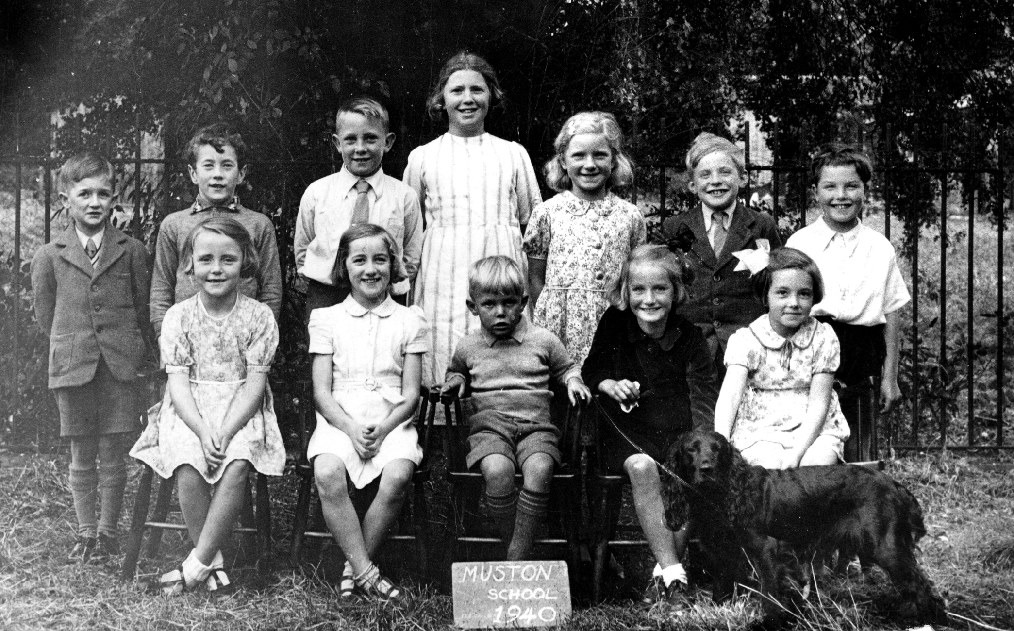
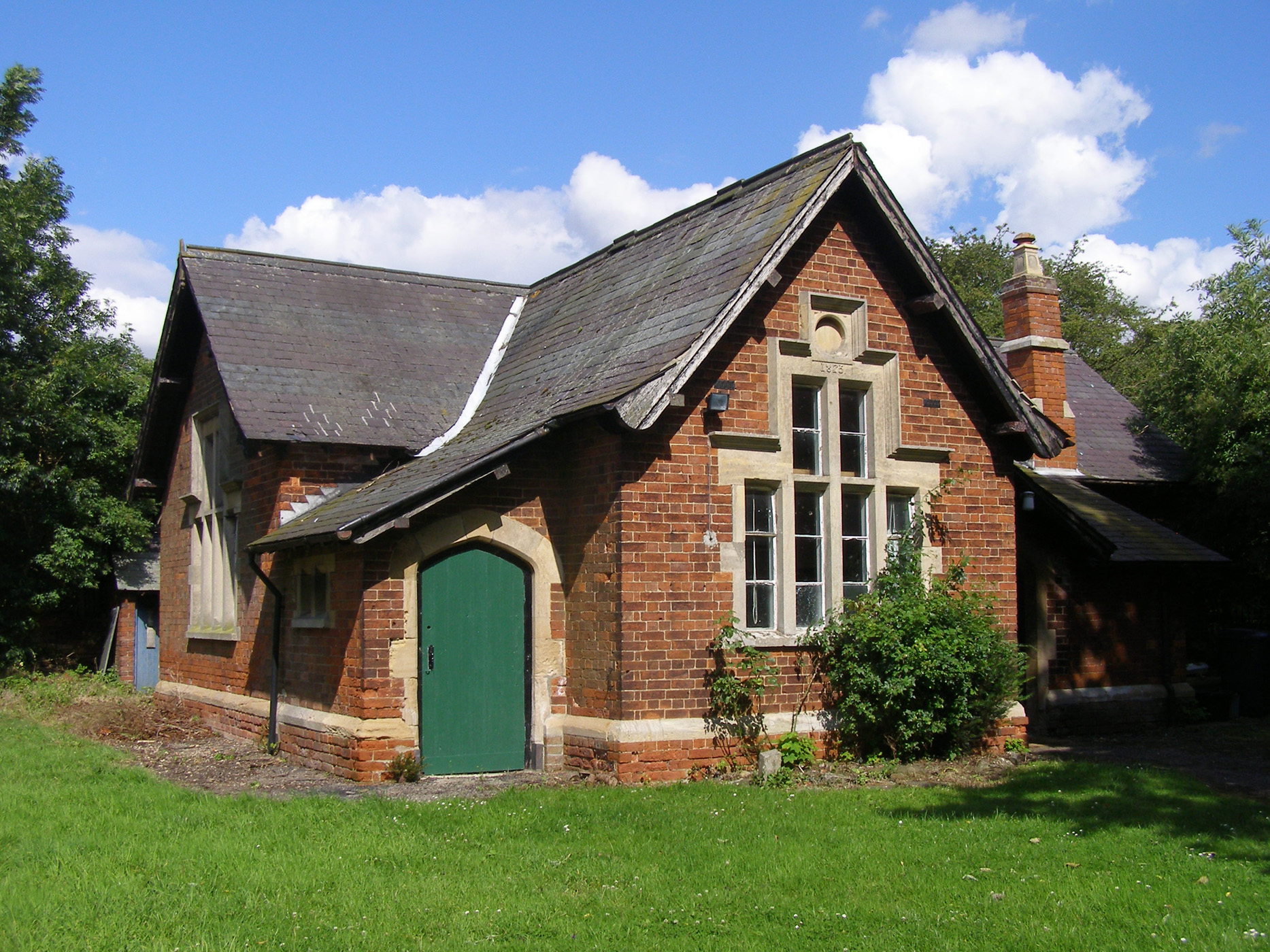
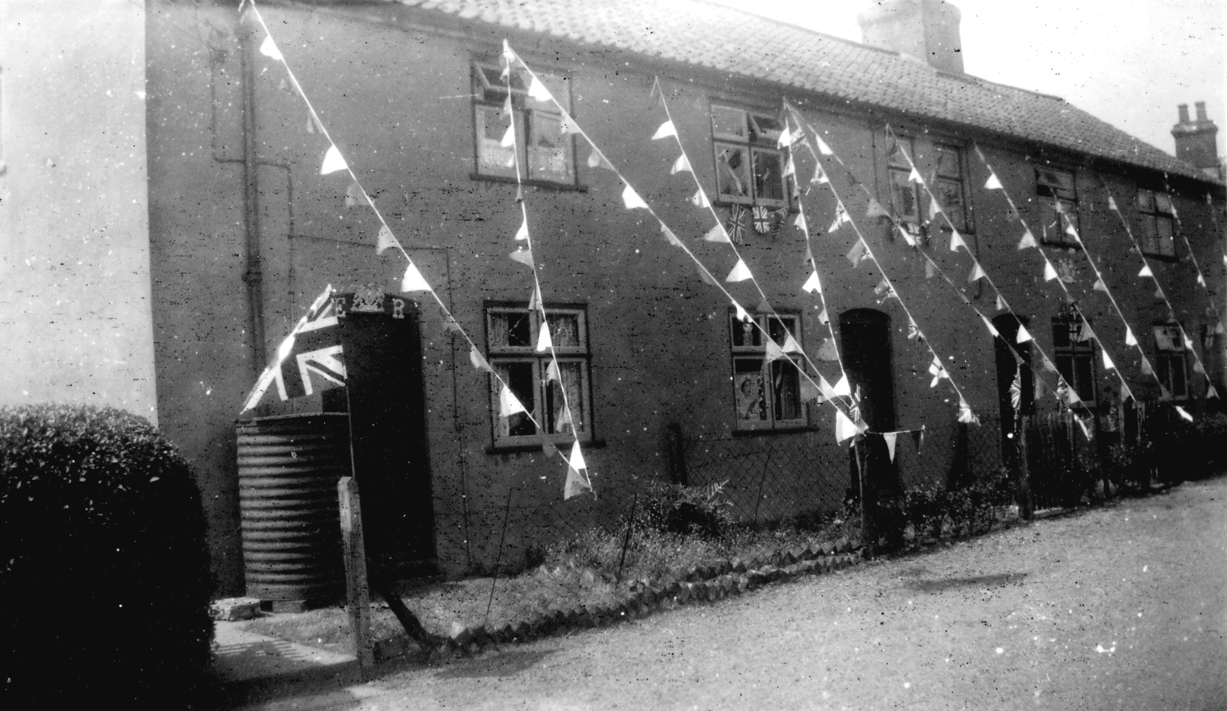
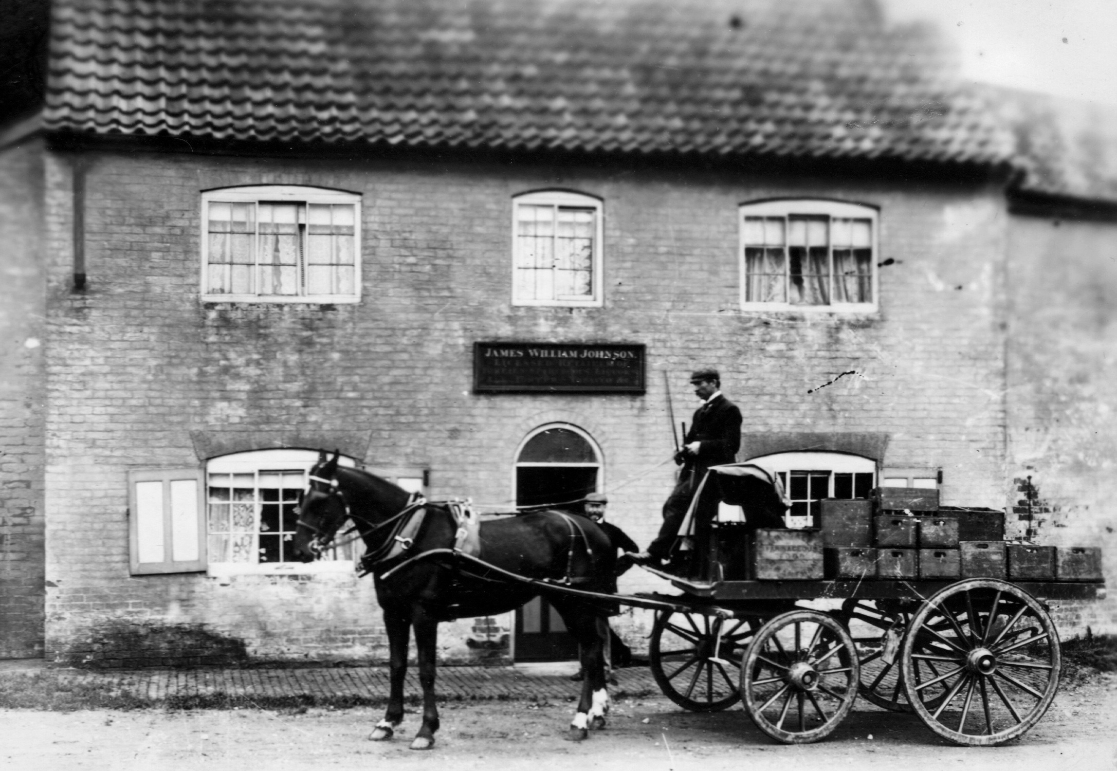
The Old Forge tearoom3 is on the site of Thomas Lord’s blacksmith’s workshop. The bus shelter, close by, raises a smile because no bus service has ever passed it. Opposite the tearoom is the modern Brinsley House. It is difficult to imagine that in 1851, 54 people lived in the 7 tenements where Brinsley House is situated today. The 19th Century village population was much larger than today, most of them agricultural labourers and their families. Next comes the ‘Public Elementary School’ building of 1875, now the village meeting room4. This is in fact the second village schoolhouse: a ‘Free School’ built in 1841 stood on the same site. Next door is the former school master’s house, standing oblique to the street, with its octagonal chimney stacks. Then come two 1930s council houses before Cherry Cottage, which, like many village houses, was once a row of small cottages.
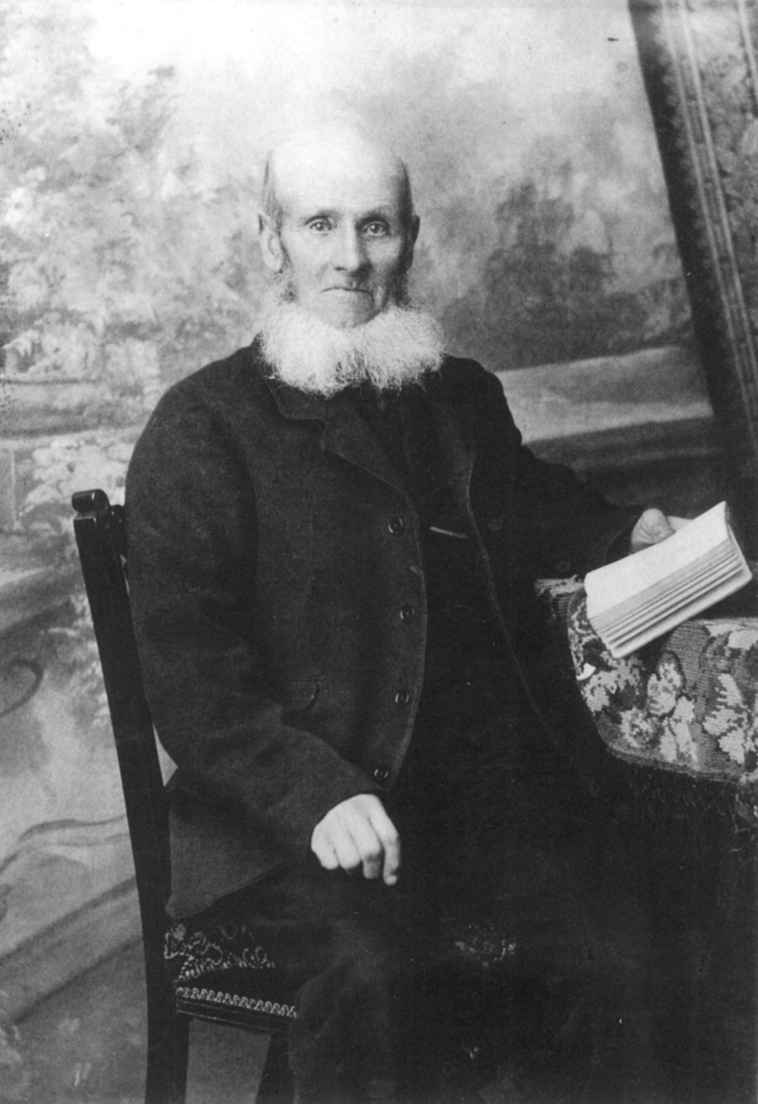
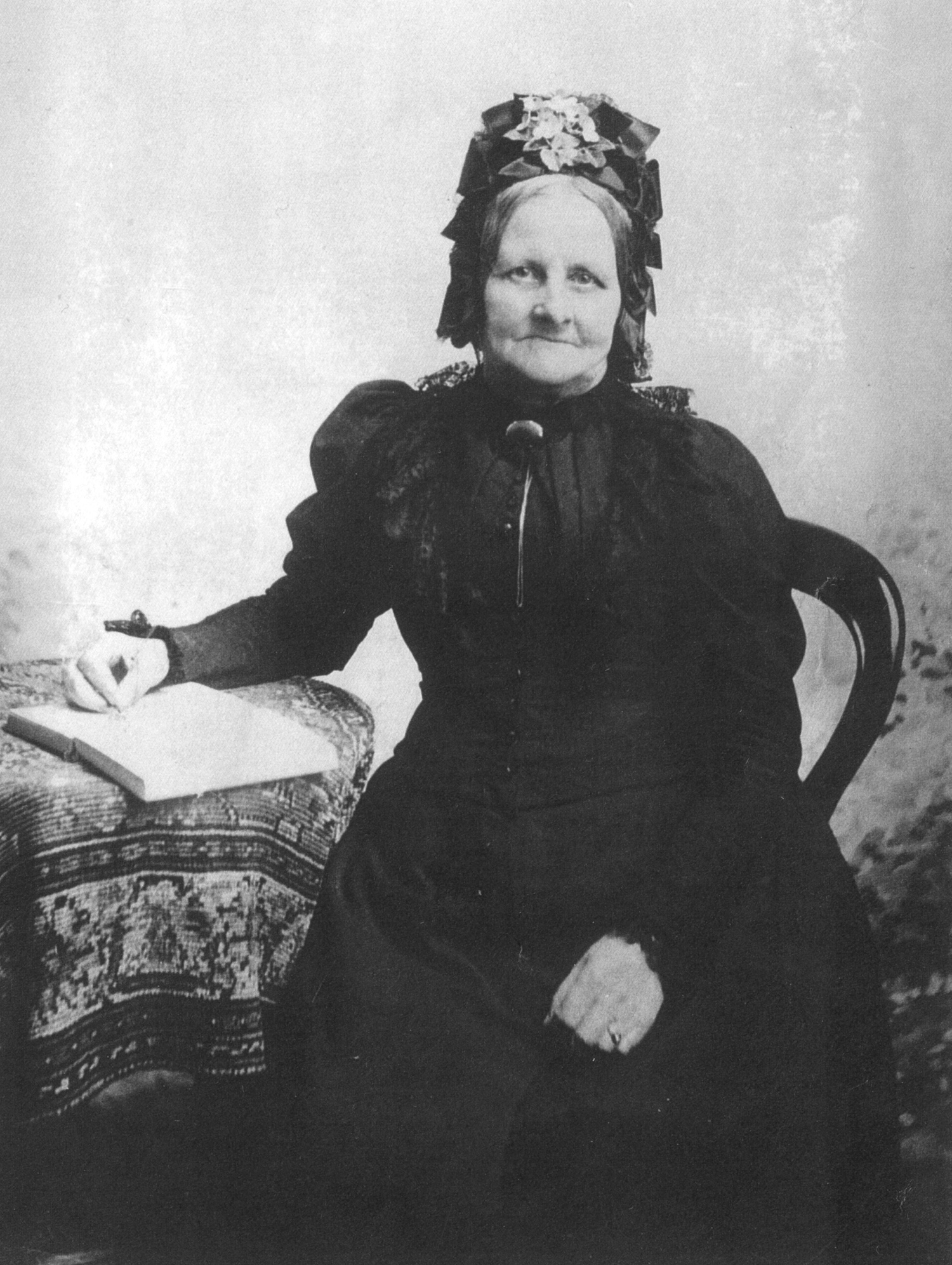
The Duke’s Cottages, opposite5, was once a tenement of at least four terraced cottages built by the Duke of Rutland. Here lived Robert Tinkler, parish clerk and sexton from before 1855 to after 1899. He died on May 15th, 1908, aged 79, and his wife Adeliza died five days later, aged 76: their grave carries an epitaph, “Peace, Perfect Peace”.
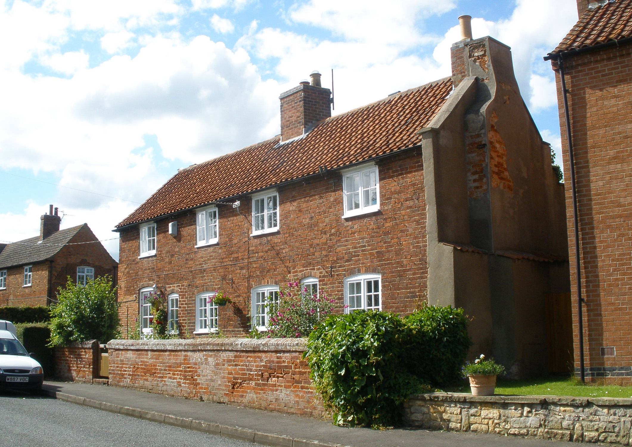
No.15 Main Street is an 18th Century cottage, in part of the old 2¼ inch thick bricks. In the mid 19th Century, cottager Elizabeth Bray lived here and rented fields at the back of her house and across the road. Main Street bends right, then sharply left at junction with Skerry Lane. No.32 on the right here is a 19th Century farmhouse, probably once a terrace of cottages.
Passing Skerry Lane to the right, No.34 Main Street6 is a cottage with small bricks in the lower part of its front wall. It was originally three cottages, one being the parcels office. The building used to adjoin a farm house at the corner of Skerry Lane and still has the chimney of the old farmhouse attached. Like many cottages, it has a large garden where villagers grew vegetables and raised pigs, whose sty still stands against the rear wall.
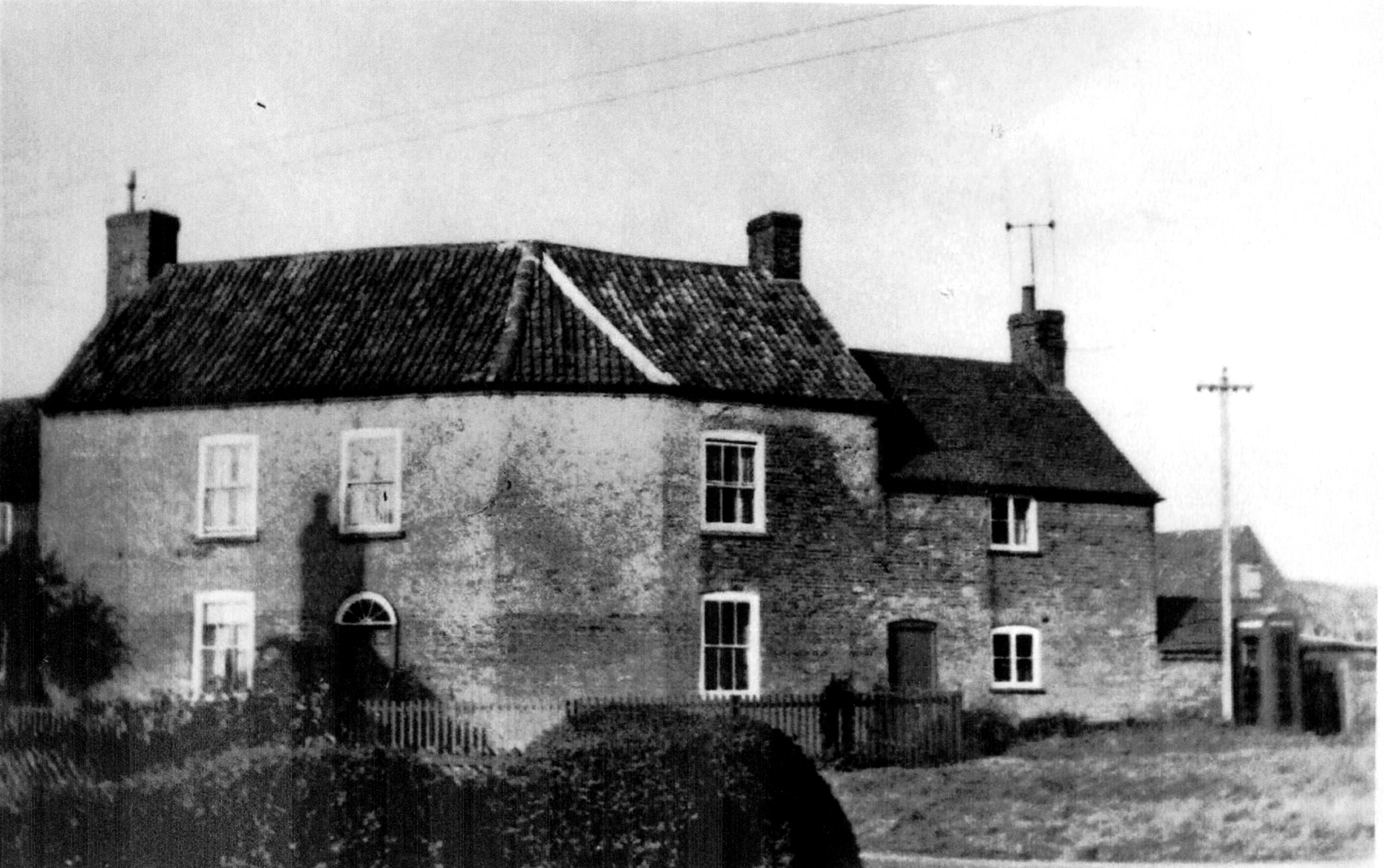
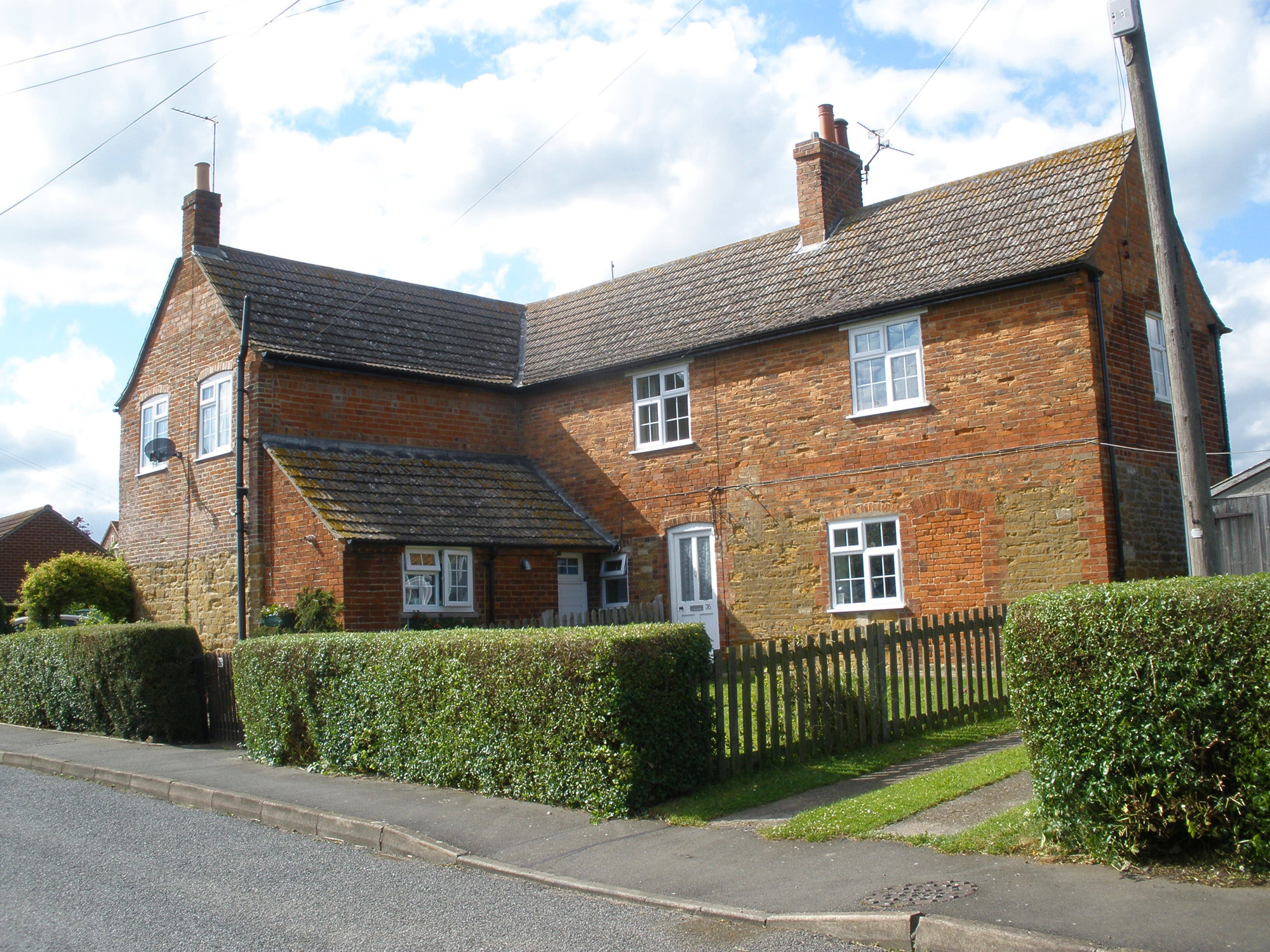
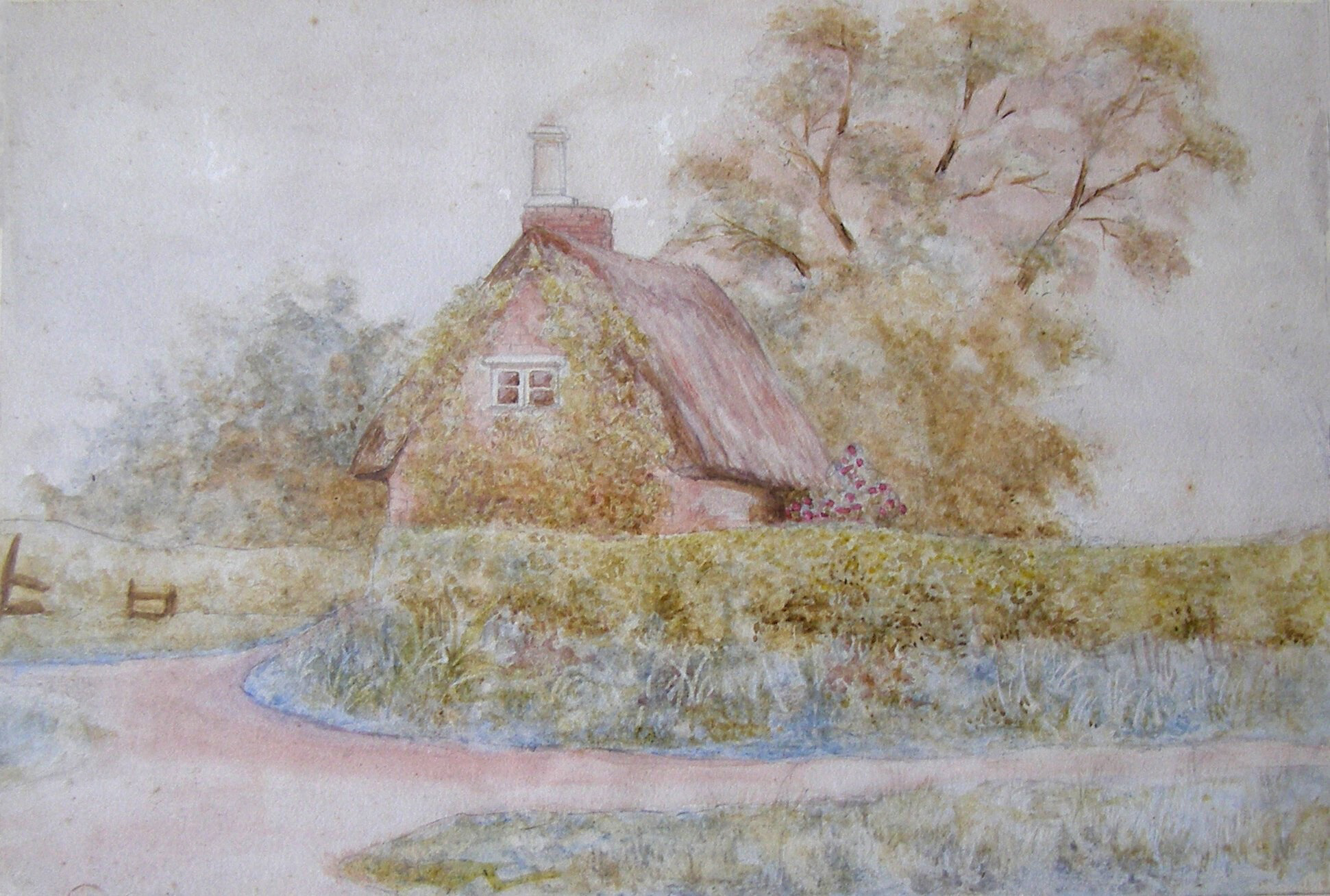
No.387, ‘Hospital Cottage’, shows four stages of construction: ironstone masonry and remnants of timber framework suggest a 17th Century origin. There is early brickwork in the gable facing the road, but the upper brickwork was added during later creation of upstairs bedrooms. It was thatched until the severe winter of 1962/3. Opposite, in a garden hedge, is an old village pump that was re-erected some four years ago. Manor House, 33 Main Street, is unusual; it was once labourers’ accommodation and the front of the house faces to the rear, towards Belvoir castle instead of Main Street. No.448, Stonehouse, has complete ironstone walls and ashlars, beneath its hipped pantiled roof. Between this and No.38 there used to be a village pond.
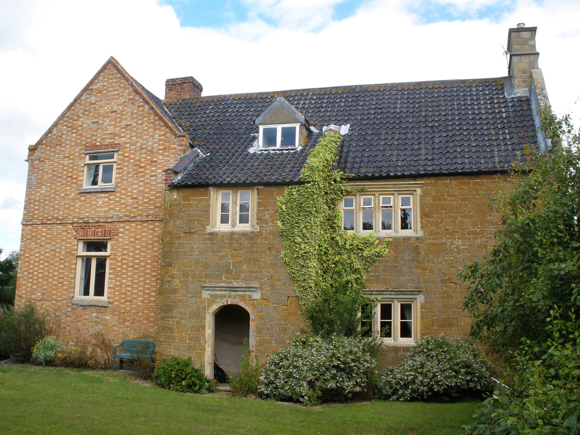
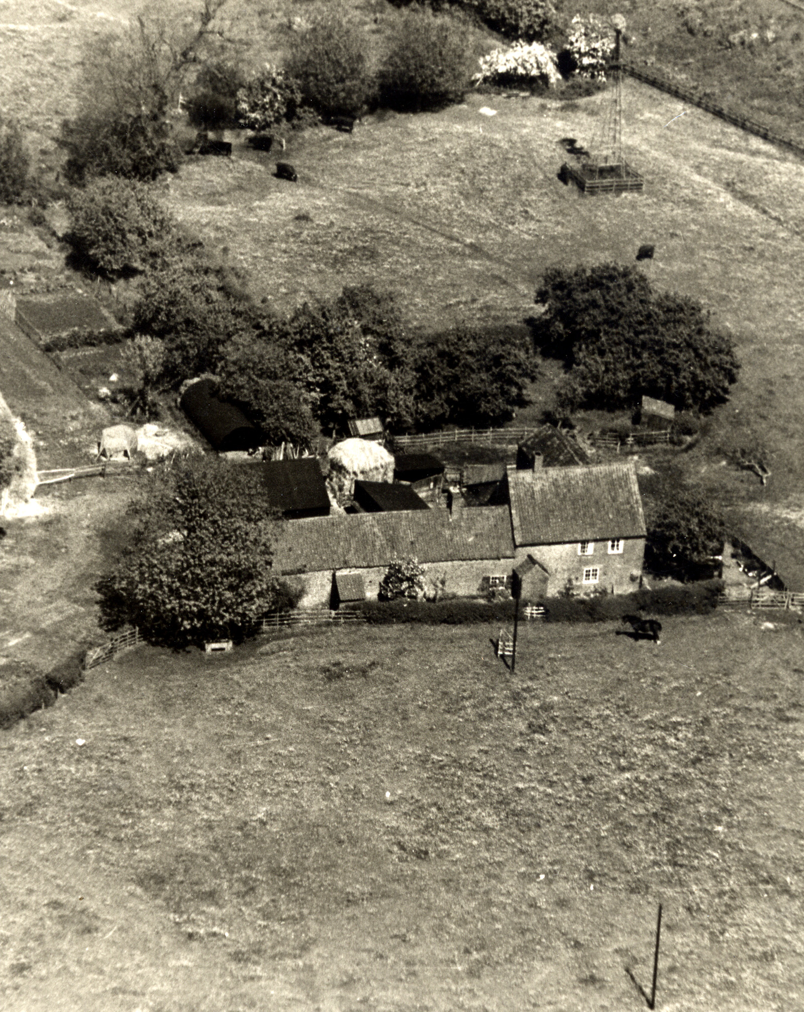
Main Street turns sharply right at Corner House Farm, where master maltster William Hickson, in 1851, probably supplied the local inns with beer. Set back on the left here is Hospital Farm9, so named because it was owned by the Earl of Rutland’s Hospital at Bottesford. The oldest part is a 17th Century ironstone farmhouse, with carved oval panels mounted high on the gable. An 18th Century brick range adjoins it at right angles. The barn displays the date 1807 in its brickwork, perhaps marking the prosperity of farmers during the Napoleonic Wars.
The River Devon flows behind Hospital Farm. On the opposite (southern) bank are ditches (moat) and banks10 on the site of a probable pre-Reformation monastic grange farm (a Scheduled Ancient Monument). The site is reached by a public footpath which passes to the left of the modern barns at Hospital Farm then crosses a concrete footbridge over the Devon.
Church Lane
The Muston Gap pub21, formerly the Wheatsheaf, is located where Church Lane met the Grantham turnpike (now the A52). This is a modernised pub and restaurant, but the original building dates from the 18th Century, if not earlier. The wooded embankment behind the pub carpark is a disused mineral railway22, constructed in the 1880s to carry iron ore from the quarries near Harston. It runs through wooded cuttings and embankments behind (east of) Muston church and Rectory, where it marks the parish and county boundary. Further southwards, towards Woolsthorpe, it has been adopted as part of the Sustrans National Cycling Network. Pedestrians and cyclists can reach the wooded trackway from a small carpark on Woolsthorpe Lane between Muston and Muston Bridge, which is also a good place from which to start a visit to Muston Meadows.
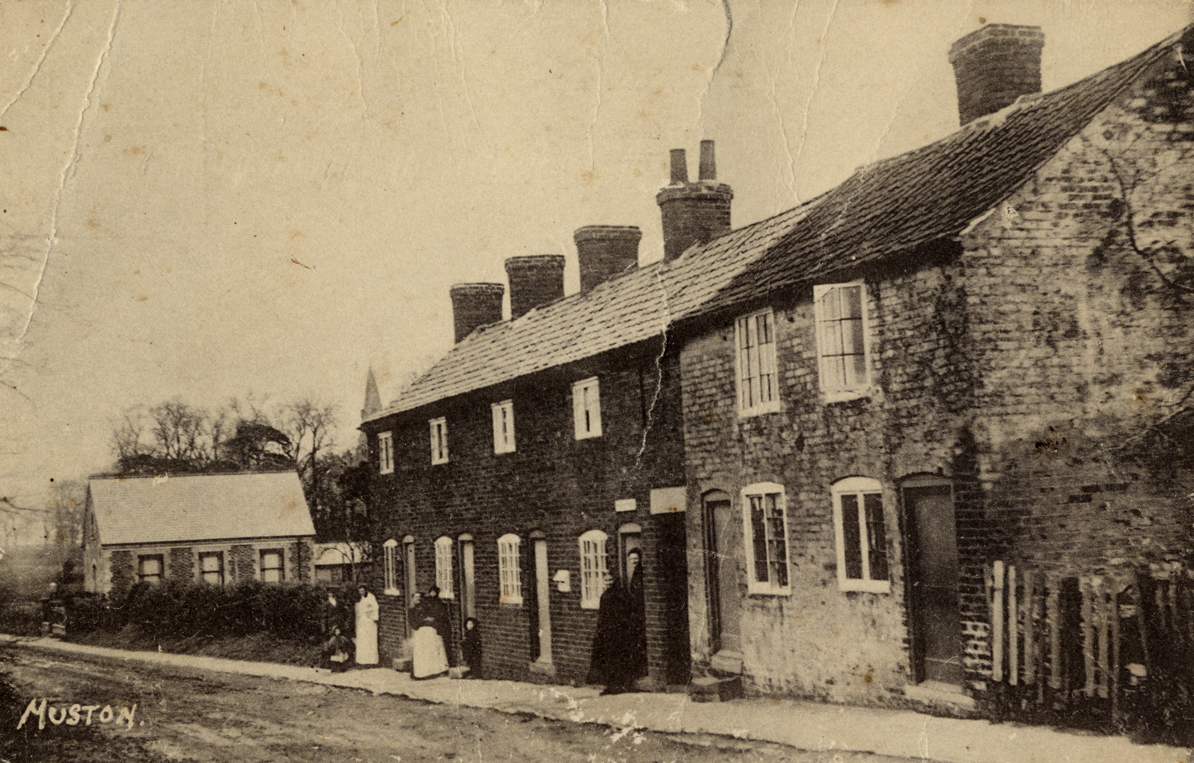
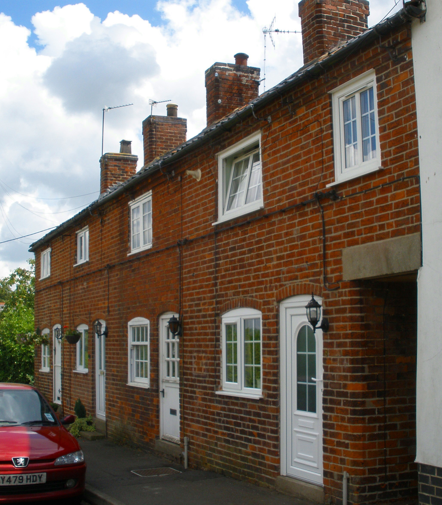
Returning to the parish church, Church Lane can be followed, crossing the bridge over the Devon. On the left is the small United Methodist Free Church building of 187911 (now a private house), facing the parish church across the stream. Wright’s Directory of 1888 records an earlier, Primitive Methodist, chapel of 1802, but where it was is uncertain. Further on the left is Post Office Row12, a tenement (terrace) of labourer’s cottages, one of which housed the village shop and post office.
Woolsthorpe Lane
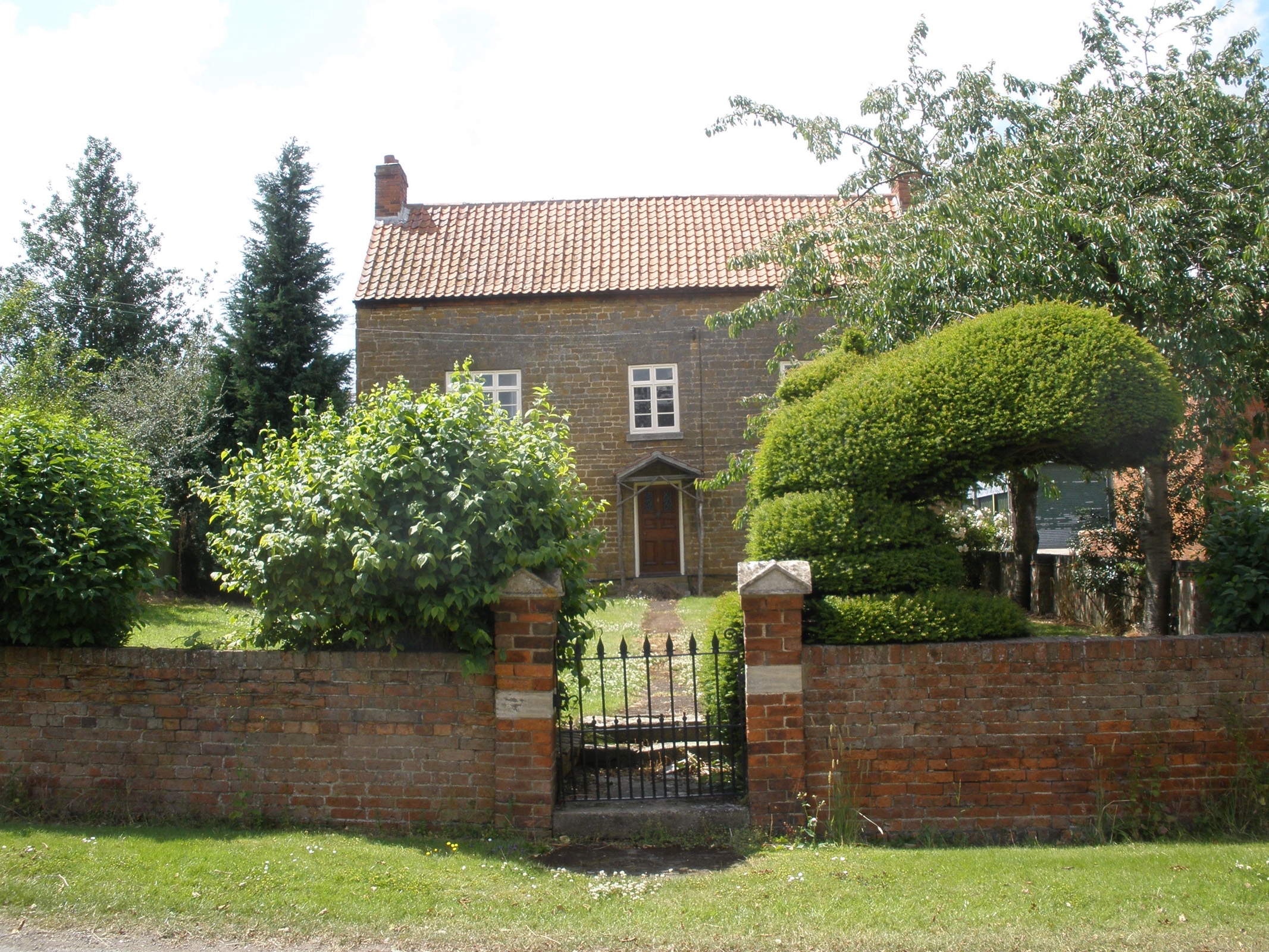
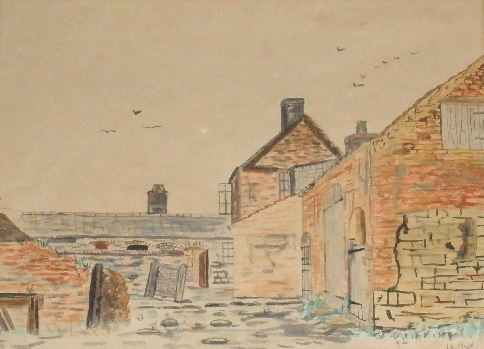
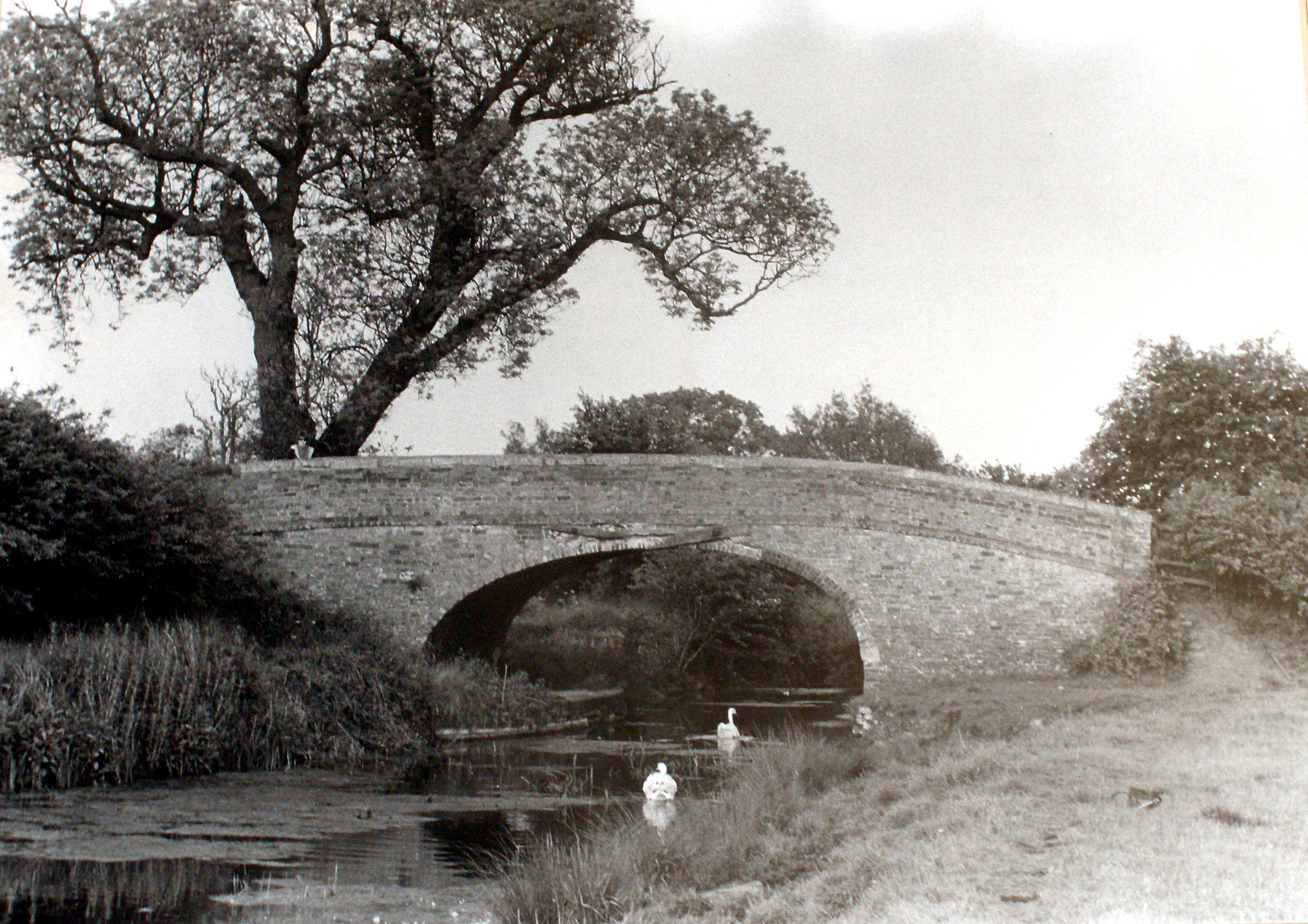
Woolsthorpe Lane is part of the old coach road from Easthorpe via Muston to Woolsthorpe-by-Belvoir. To the right it is called Easthorpe Lane until it nears Easthorpe, at which point it has become Muston Lane. At the junction of Church Lane with Woolsthorpe Lane, an old farm cottage13 on the right displays two stages of brickwork, possibly late 18th and early 19th Century. Facing it are the barns and outhouses of Spray Farm. Many farms in the area have seen their buildings and yards converted to private housing, but these are still in use and keep their former appearance, the handsome ironstone and brick barn and sheds extending back from the road. More 17th Century ironstone walling can be seen adjoining the brick-built roadside barn close to Peacock Farm, another fine stone farm house14. The peacock is the emblem of the Manners family, the Dukes and Duchesses of Rutland. Next door, No.6 is a smaller brick built farm house, its outbuildings converted to private housing.
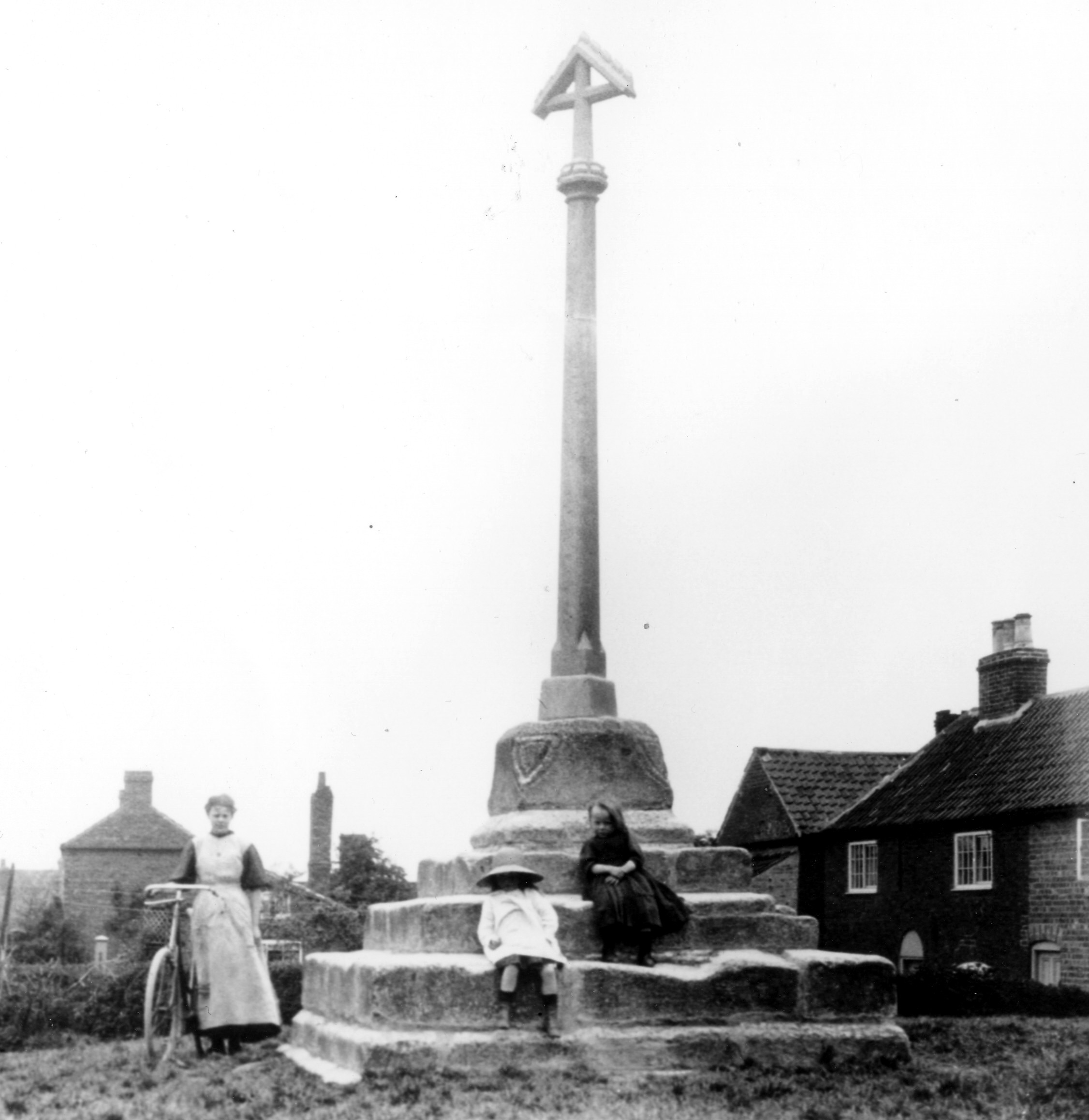
Opposite Peacock Farm is Branston House, probably late 18th Century. The small leafy village green15 extends back from the street. This is where May Day celebrations used to be held. At its centre is a Victorian stone cross mounted on the original medieval plinth, defaced coats of arms at its four corners, possibly marking the site of a village market. At the back of the green, to the right, is Holly Cottage, a low, stone-built cottage of considerable age. To its left another row of cottages extends beside the footpath down to the river; a small pub was known to be sited at one of these cottages.
At the right hand corner of The Green is another old terrace, converted into one house, which once housed another blacksmith’s premises. There is old ironstone and grey flaggy limestone masonry in the wall of No.15, Glen Cottage, and its modern version in a recent extension of the building. The farmhouse opposite, No.14, is where the coaches and post used to stop. At the end of Woolsthorpe Lane is Thatch Cottage16, originally a single-storey farmworker’s dwelling, but no longer thatched.
At this point Woolsthorpe Lane bears to the right towards the southeast. The lane to the left is Sykes Lane, leading to what was known as Sykes Lane Farm once worked by the Calcraft family whose name can be traced hereabouts for centuries. A wind pump once stood in an adjoining field, pumping water from the Devon to other nearby farmhouses.
Further afield
The southern part of Muston parish is crossed by the disused Grantham Canal17, opened on February 1st, 1797, to join Grantham and the Vale with the Trent at West Bridgford. The canal tow-path provides a delightful walk. Belvoir Castle dominates the skyline. Most of the village and surrounding land formed part of the Duke of Rutland’s estates, though some changed hands in the sale of 1920. Woolsthorpe Lane crosses the canal via a restored humpbacked bridge. Longore Bridge18 stands a short way westwards along the canal, a good example of an un-restored bridge. Beyond it the towpath reaches the modern bridge at Muston Gorse Farm19. Here, a canal basin was constructed at the foot of the Belvoir Castle tramway (the ‘Duke’s Railway’). Opened in 1815, the line remained in operation until the early years of the 20th Century, horse power having given way to steam. A short length of rail and wagons is preserved at the terminus in the cellars of Belvoir Castle.
Muston Meadows National Nature Reserve20, administered by Natural England, is easily reached from Woolsthorpe Lane or the canal towpath. This is a rare example of untreated meadowland rich in wild plants, most notably the green-winged orchid. Visitors are welcome to walk on the designated paths through the fields, but must take care not to trample the rare flora or otherwise damage the site.


No Comments
Add a comment about this page