Not Forgetting - Chapter 2: A Village Tour
Neil Fortey


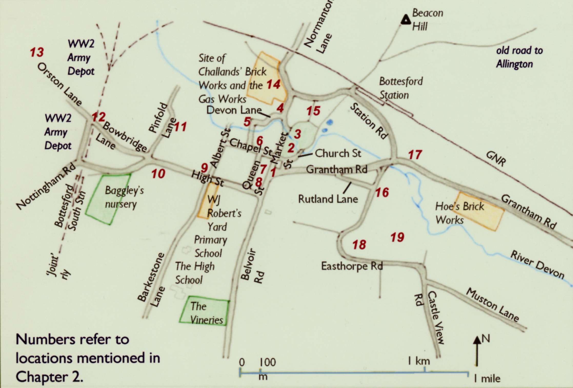
[Please note, the numbers in brackets refer to the map displayed here and in the introductory page]
This chapter takes you on a ‘whistle stop’ tour of Bottesford and the neighbouring communities of Easthorpe and Normanton. Many of the places mentioned are described in detail in the following chapter, “Shops and Trades”. Another chapter is devoted to Muston, which was a separate parish until 1936. Old postcards are used to give an idea of how Bottesford looked in the past.
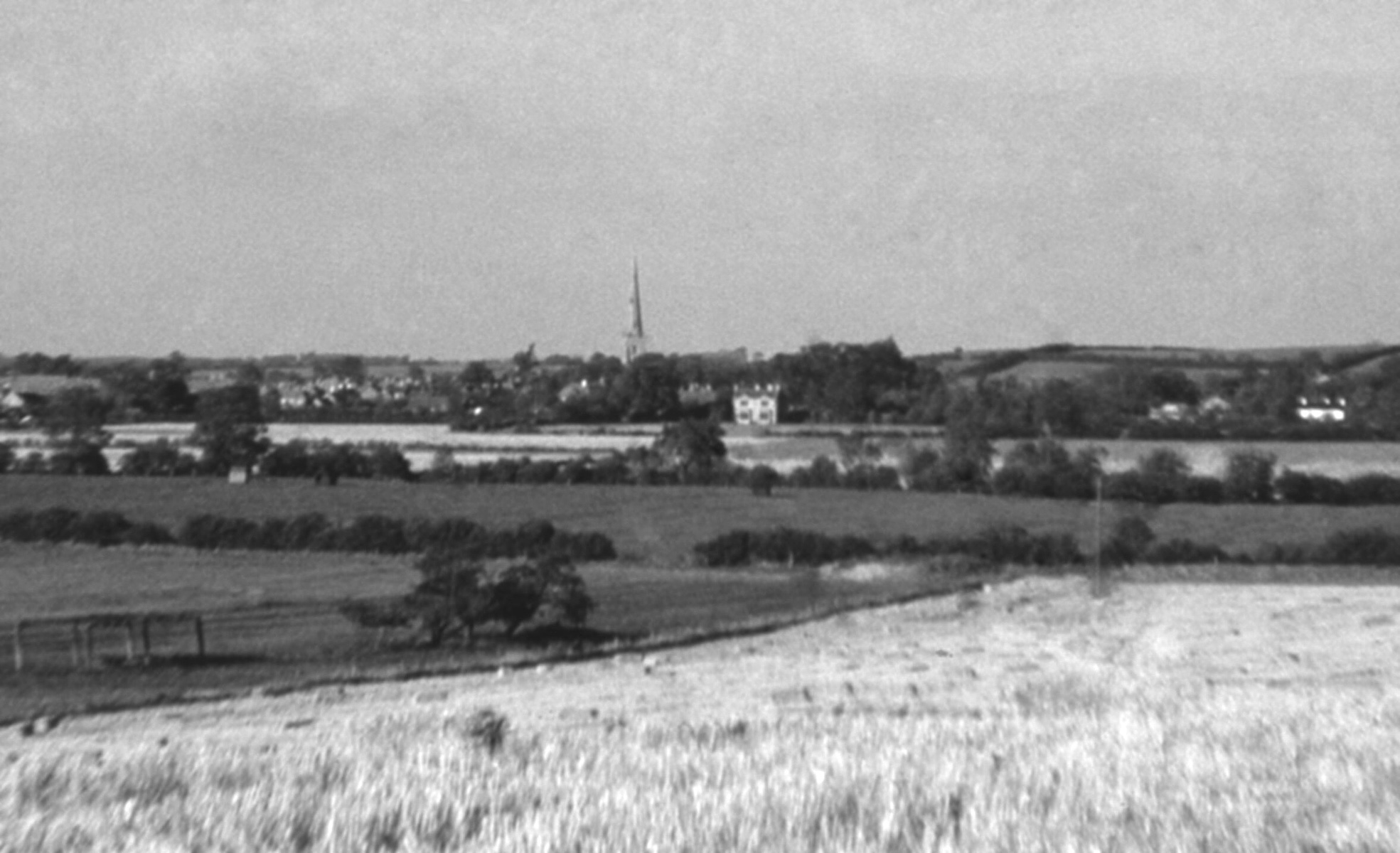
A good way to approach Bottesford is from the south, along the road from Harby, through one of the most attractive parts of the Vale of Belvoir. On crossing the Grantham Canal at Toston Hill, Bottesford is spread at your feet, its church centre stage, beyond the busy bypass and electricity pylons. Once over the bypass and the narrow bridge over the Winterbeck, you enter the village along Belvoir Road. On the left are Edwardian villas as well as modern houses and the well laid out 1950s council-built housing of Keel Drive. Opposite are modernised 1930s council houses, the cricket and bowls clubs and the sports field, overlooked by the village hall, the Victory Commemoration Hall, opened in 2003 to replace the original village ‘VC’ Hall. At the rear of the sports grounds is an isolated Edwardian farmhouse, The Elms.
Market Street and The Cross
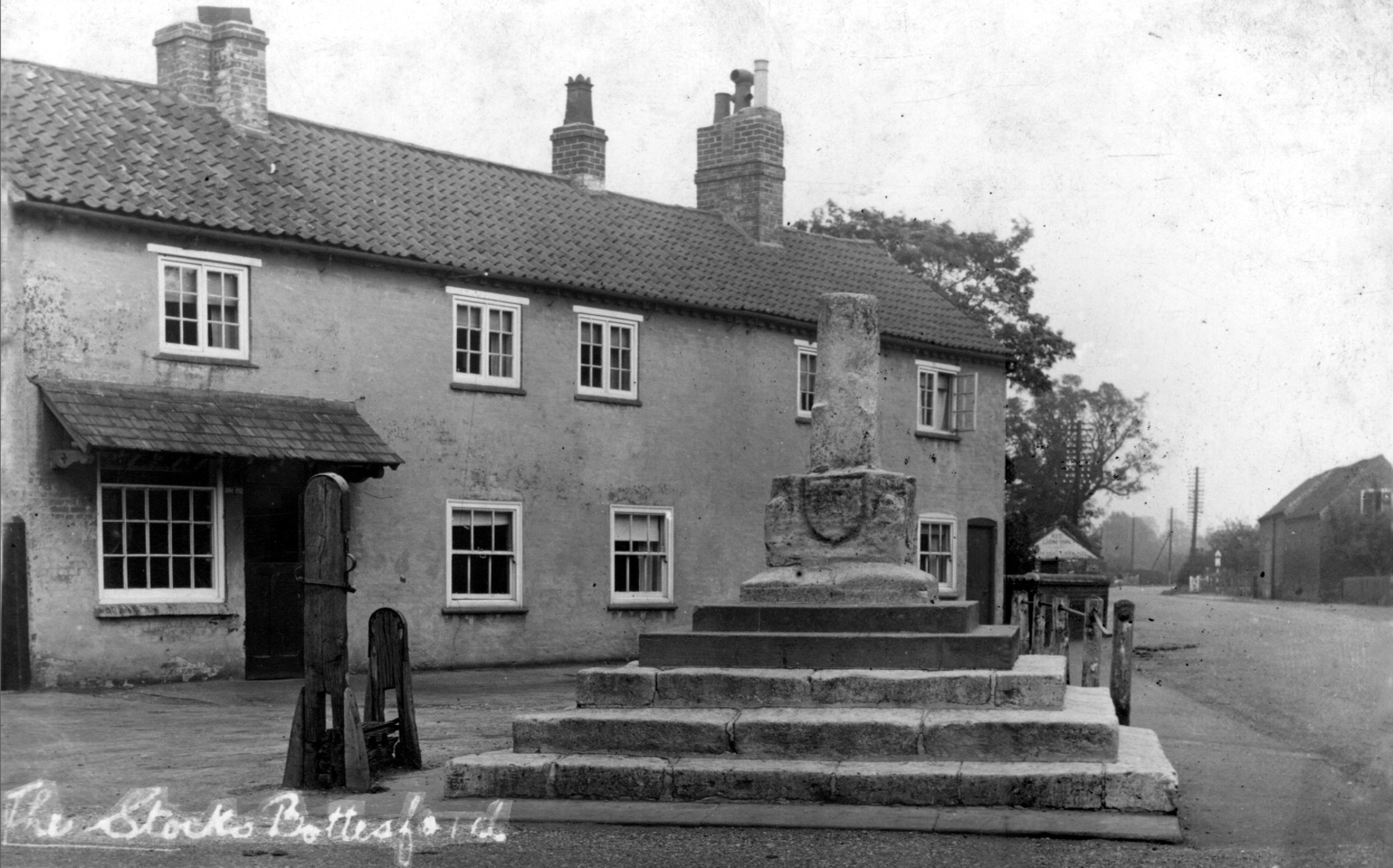
The line of Belvoir Road passes straight through Bottesford, changing its name to Market Street, Rectory Lane and, on fording the River Devon, Normanton Lane. High Street, the old main road from Nottingham, joins from the left, then after a few yards Grantham Road departs eastwards, creating a dog-leg crossroads. Here stand the plinth and partial shaft of Bottesford’s Market Cross (late 14th or15th Century) [1], together with the restored village stocks and whipping post. Taylor’s butcher’s shop, behind the cross, has been here over a century, one of three butchers in the village some twenty years ago.
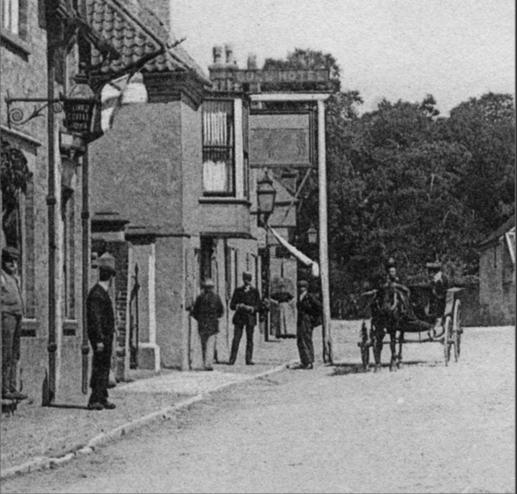
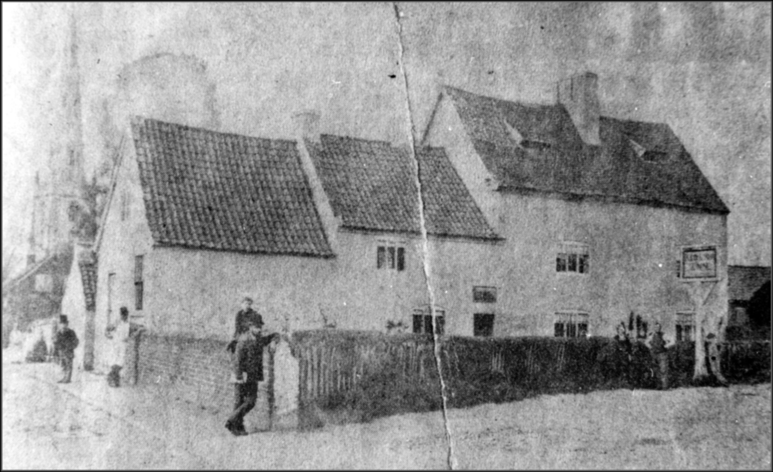
The Bull Inn, probably the oldest pub in the village, has a sign recording the visit in 1953 of the comedians Laurel and Hardy, when Olga Healey, sister of Stan Laurel, was landlady. Next door is the former Belvoir Coffee House, 1881, built in the heyday of the Temperance Movement. Opposite is the converted barn of Acacia Farm, whose 19th Century farmhouse is screened from the road by trees.
A few steps along Grantham Road is the 18th Century Red Lion Inn. A forge and wheelwright’s shop once occupied what is now the car park. Then, beyond the narrow ‘jitty’ called St Mary’s Lane, are Wyggeston’s Cottages, a row of late 18th Century cottages built on land which belonged to the medieval Wyggeston’s Hospital in Leicester. These cottages once had gardens that extended to the Victorian school master’s house further along Grantham Road.
Opposite, on the southern side of Grantham Road is the sombre red brick village school building of 1855, extended in 1878, now containing Bottesford Library, the Parish Meeting Room (Fuller Room) and the Youth Club. The Diamond Jubilee Clock of 1897, mounted high in its gable, still tells the correct time. The school and extension were built by the Rector Canon Frederick Norman, and his wife Lady Adeliza Norman, daughter of the Duke of Rutland. The buildings to the left (east) of the Fuller Room include 17th Century cottages still with parts of their original stone walls. Canal Farmhouse, standing back from the road, is of 18th Century construction, but the barn with its stone footings is of earlier origin. This was the farm of Daniel Richmond Daybell, father and son, pig breeders who won 174 prizes at Smithfield and the Royal Show.
Branching off Grantham Road is Rutland Lane, now a quiet side road, but before 1928 the main road eastwards. Allotments once occupied all the ground from Rutland Lane to the River Devon, but were greatly reduced when Grantham Road was straightened and a new bridge built over the river in 1928. Parts of the old allotment area are still in use, and others now form the Millenium Green and War Memorial, and the Skatepark opposite.
Church Street and the Church Yard
From the Red Lion, St Mary’s Lane leads into Church Street, on the corner of which is Six Bells, an 18th Century house that was an alehouse before the 1st World War. To the left, No.7 Church Street is a well-proportioned Georgian house bearing a date-stone of 1761. Behind the wrought iron gates opposite lie formal gardens and the Old Rectory [2], early 18th Century, a handsome light stone building adorned by a sun dial. The gardens, extending to the River Devon, were up to the 1980s the site of well-remembered church fêtes, beneath the great copper beech and other fine trees. The Rector had a private footbridge to the church, and the river was wide enough for rowing within people’s memory.
Church Street ends at Fleming’s Bridge, an arched sandstone packhorse bridge of 1620 built by the Rector Dr Samuel Fleming. The story is that he ordered its construction after being swept from his horse and nearly drowned. Over Fleming’s Bridge, the entrance to St Mary’s churchyard is through the set of wrought iron gates.
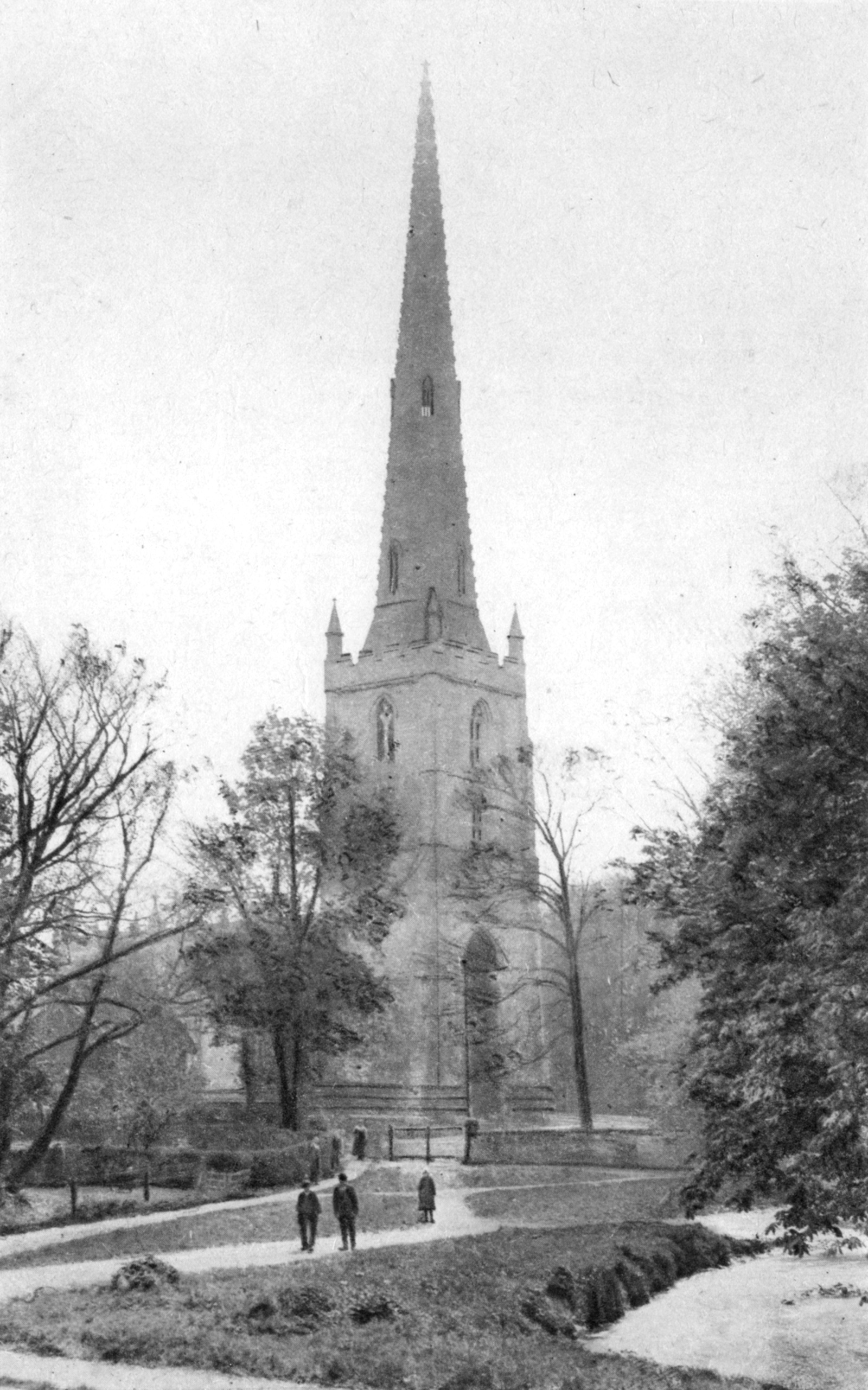
St Mary’s Church [3] and its churchyard should be visited for its history, its architecture and the famous 16th and 17th Century monuments to the Earls of Rutland, including the famous “Witchcraft Tomb” of Francis Manners, the 6th Earl.
St Mary’s churchyard is extensive. A survey made in 1987 recorded over 1000 graves, the oldest being the Parker headstone of 1669. The churchyard is still in active use.
By the gate to Rectory Lane, past the west door of the church where plaques display heraldic symbols and the de Roos arms, Providence Cottage displays the date 1723 picked out in its gable brickwork, but its stone masonry is older. On the other side of the ford lies an open paddock, a survivor of the paddocks and orchards that were once widespread within the village.
Devon Lane and The Green
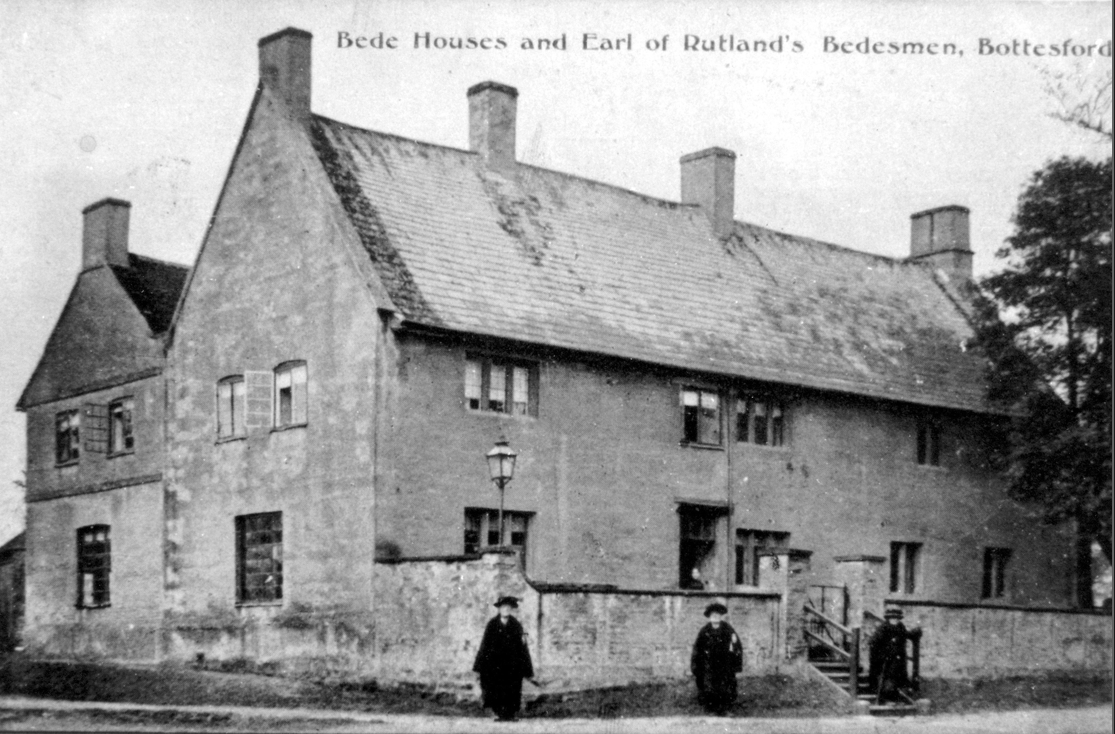
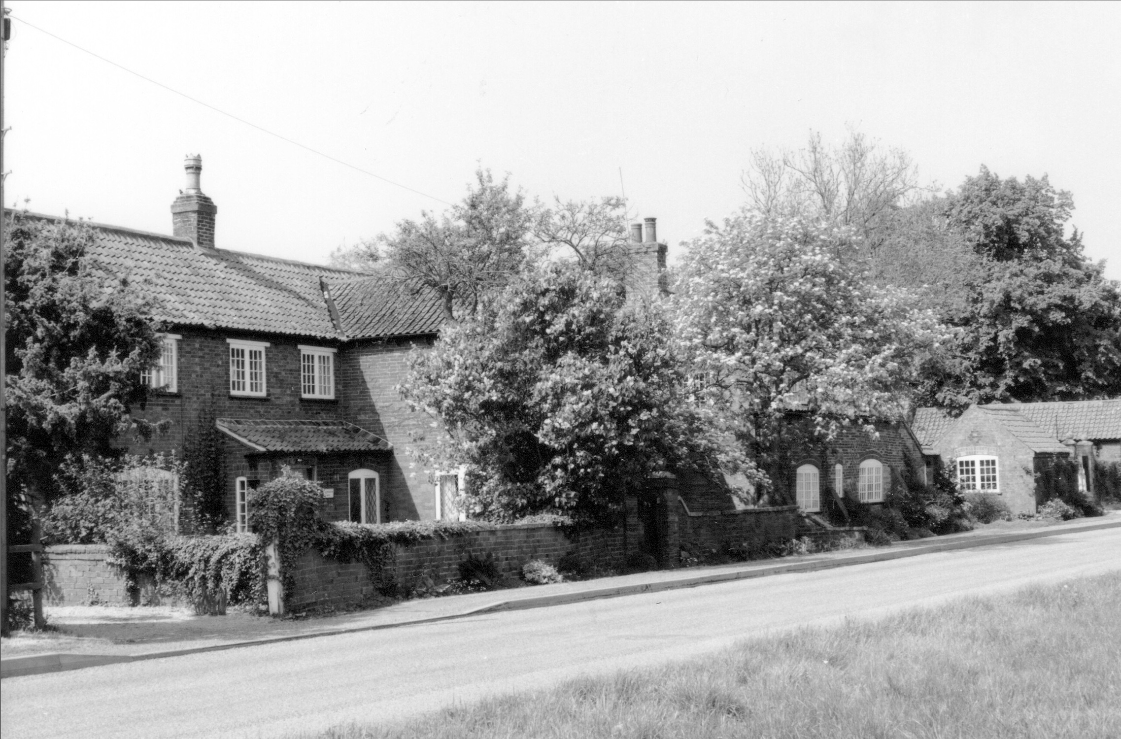
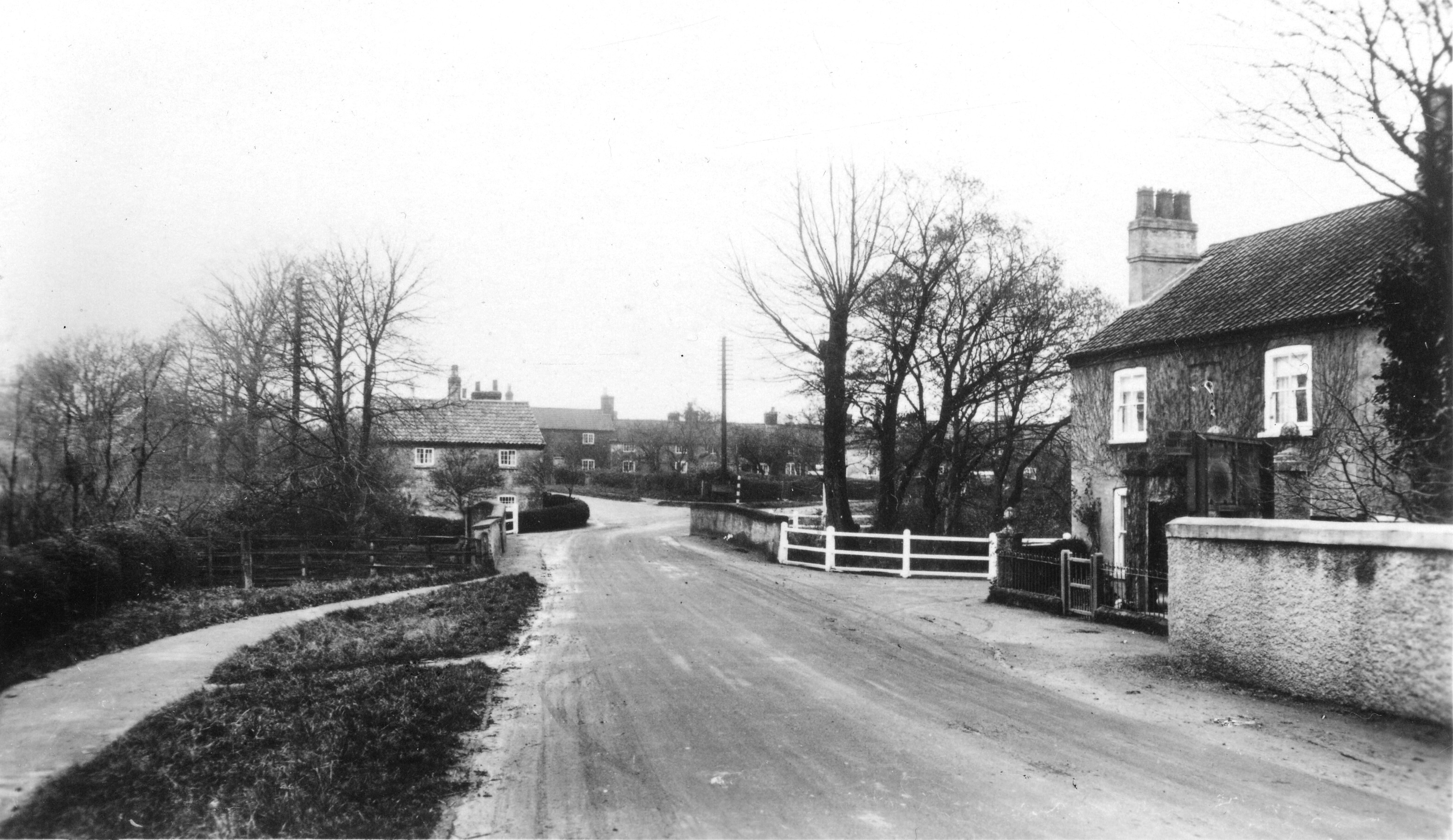
The Earl of Rutland’s Hospital [4] was begun in 1593 by the Countess of Rutland as a home for eight elderly Bottesford men, Bedesmen, who wore an elaborate uniform to church. The masonry of alternating bands of pale Ancaster Stone and the local brown iron-rich Marlstone Rock is seen in the gable. A gargoyle gazes from the centre of the front facade. The rear of the building is an 18th Century brick enlargement. A separate women’s hospital, Dr. Fleming’s Hospital (1620), stands on Market Street.
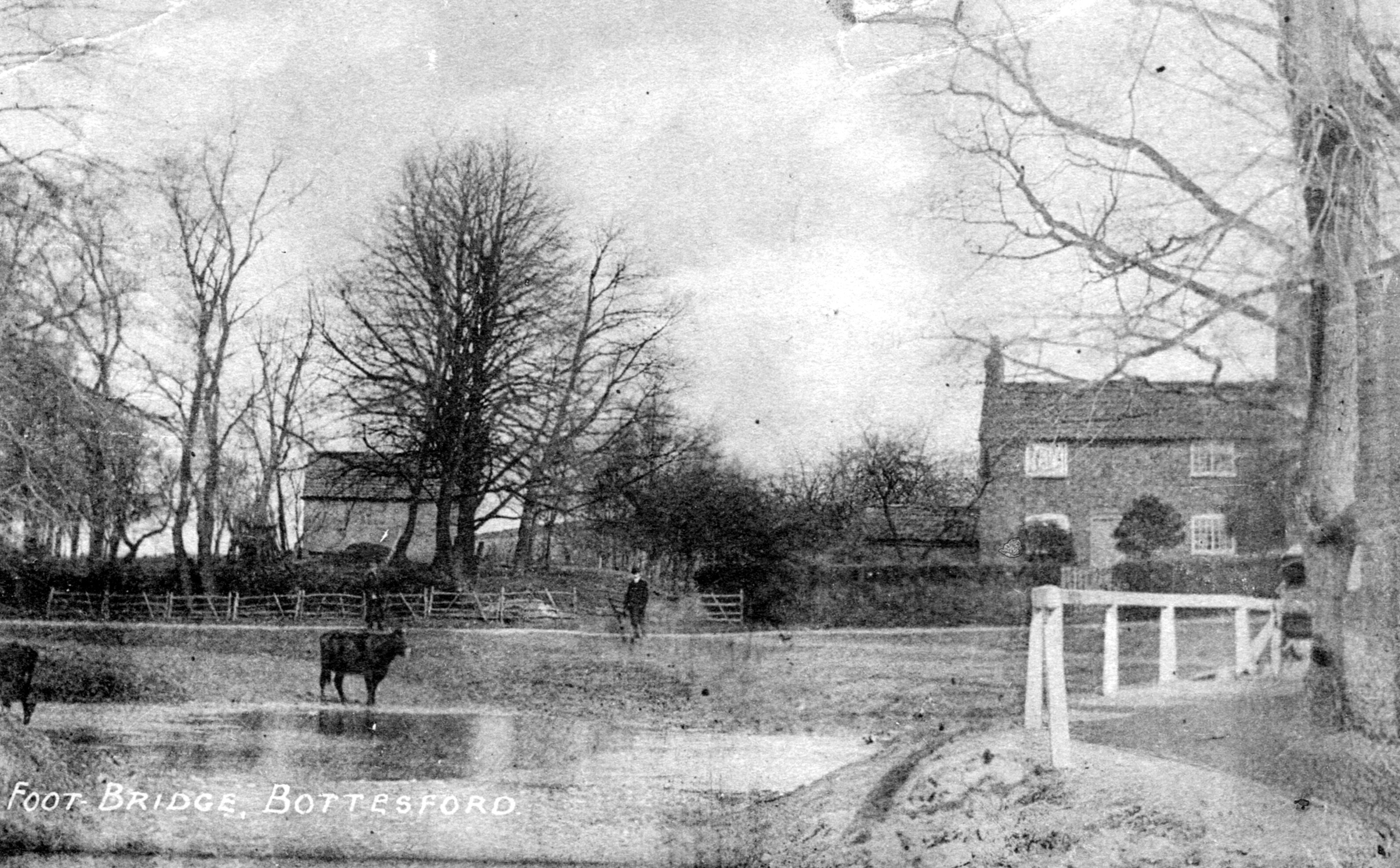
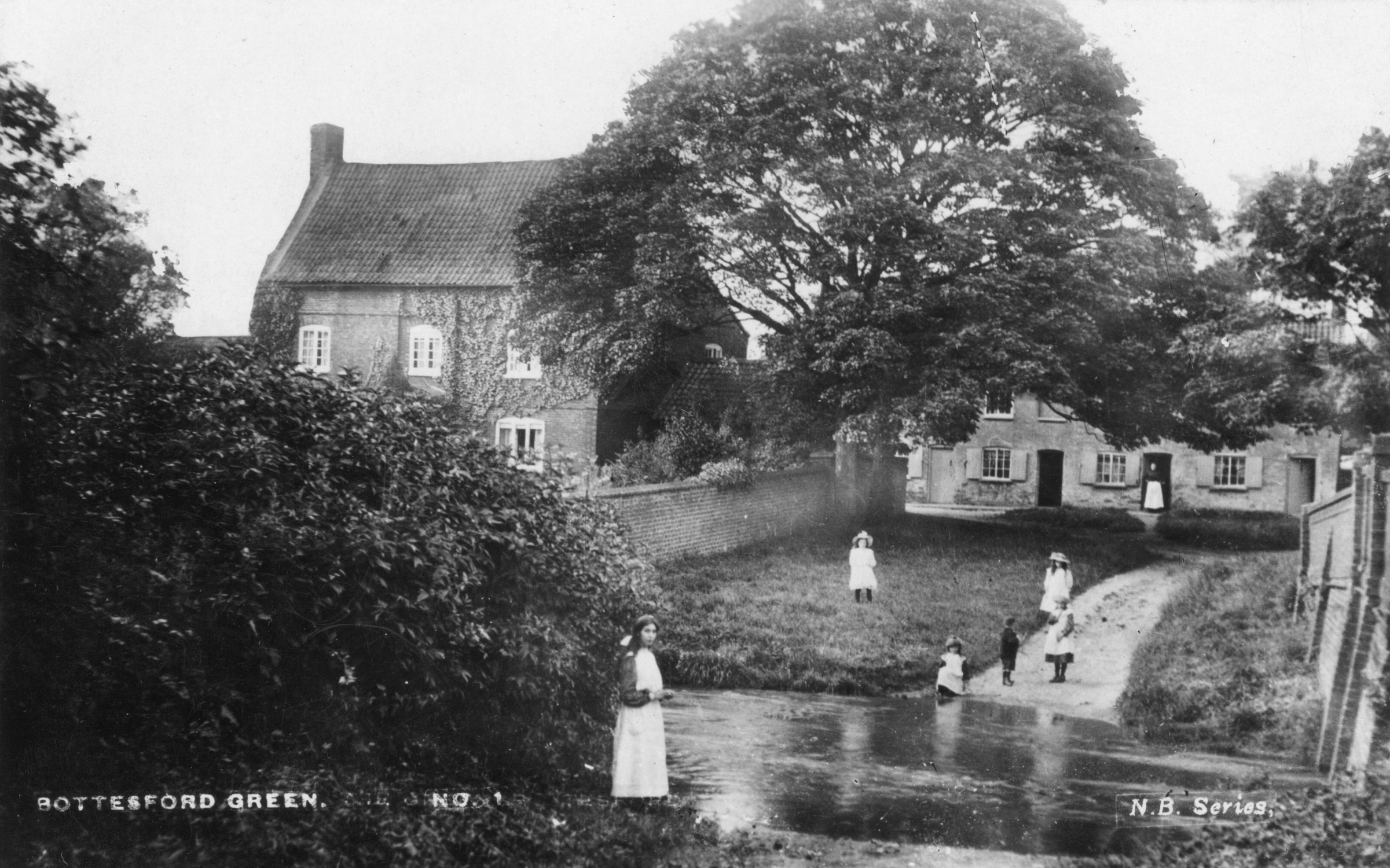
Devon Lane, passing to the left of the “Earl’s Hospital”, leads to a second, deeper ford, by a small area of grass. This tranquil locality has long been known collectively as The Green [5], the name also adopted by the old farmhouse on the corner, with a date-stone of 1621 on its gable. To the right is the Primitive Methodist Chapel of 1820. The 18th Century footbridge by the ford gives an excellent view of St Mary’s spire and leads on to Chapel Street, named after its Wesleyan Chapel of 1845 (now private housing).
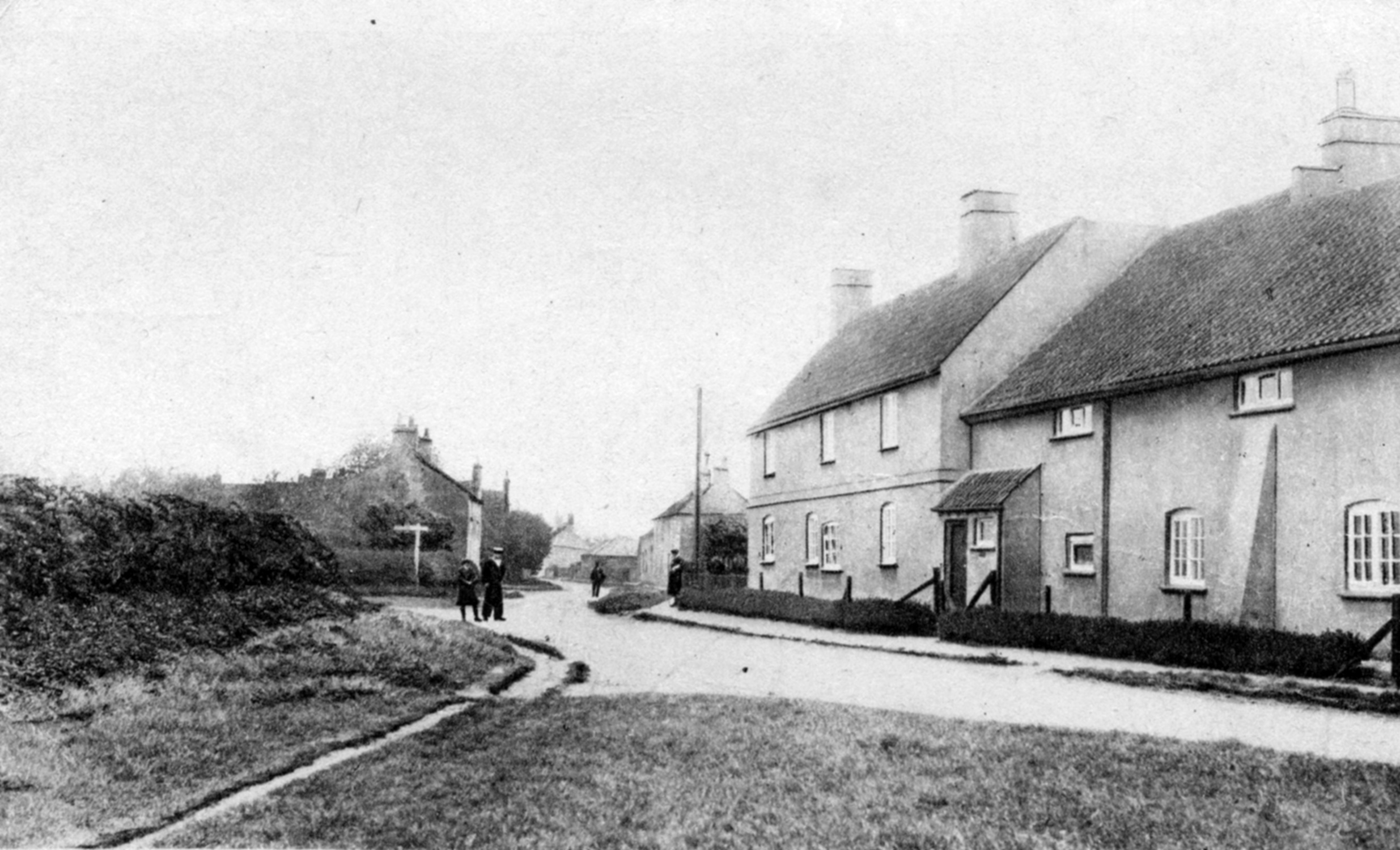
Chapel Street and Queen Street
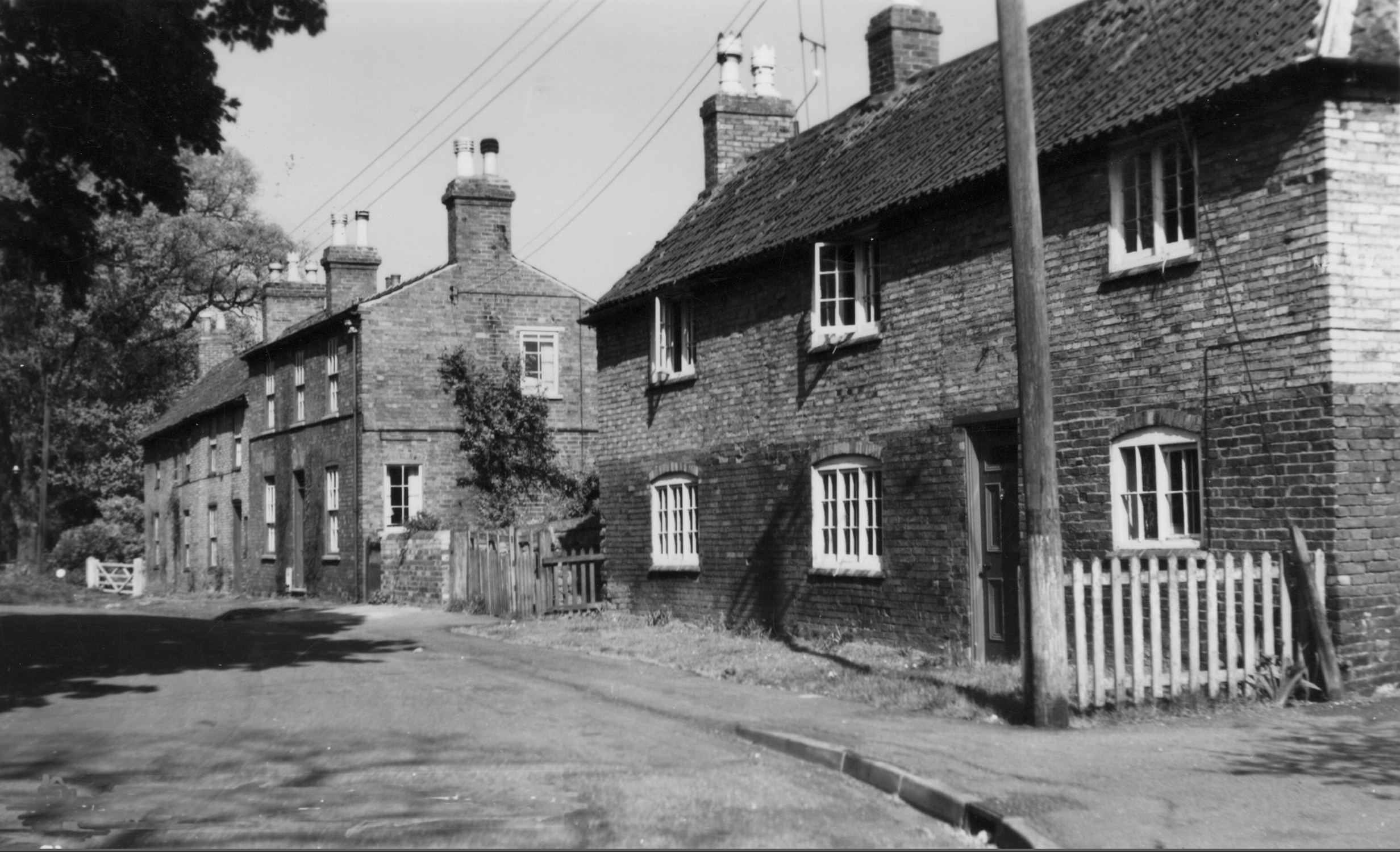
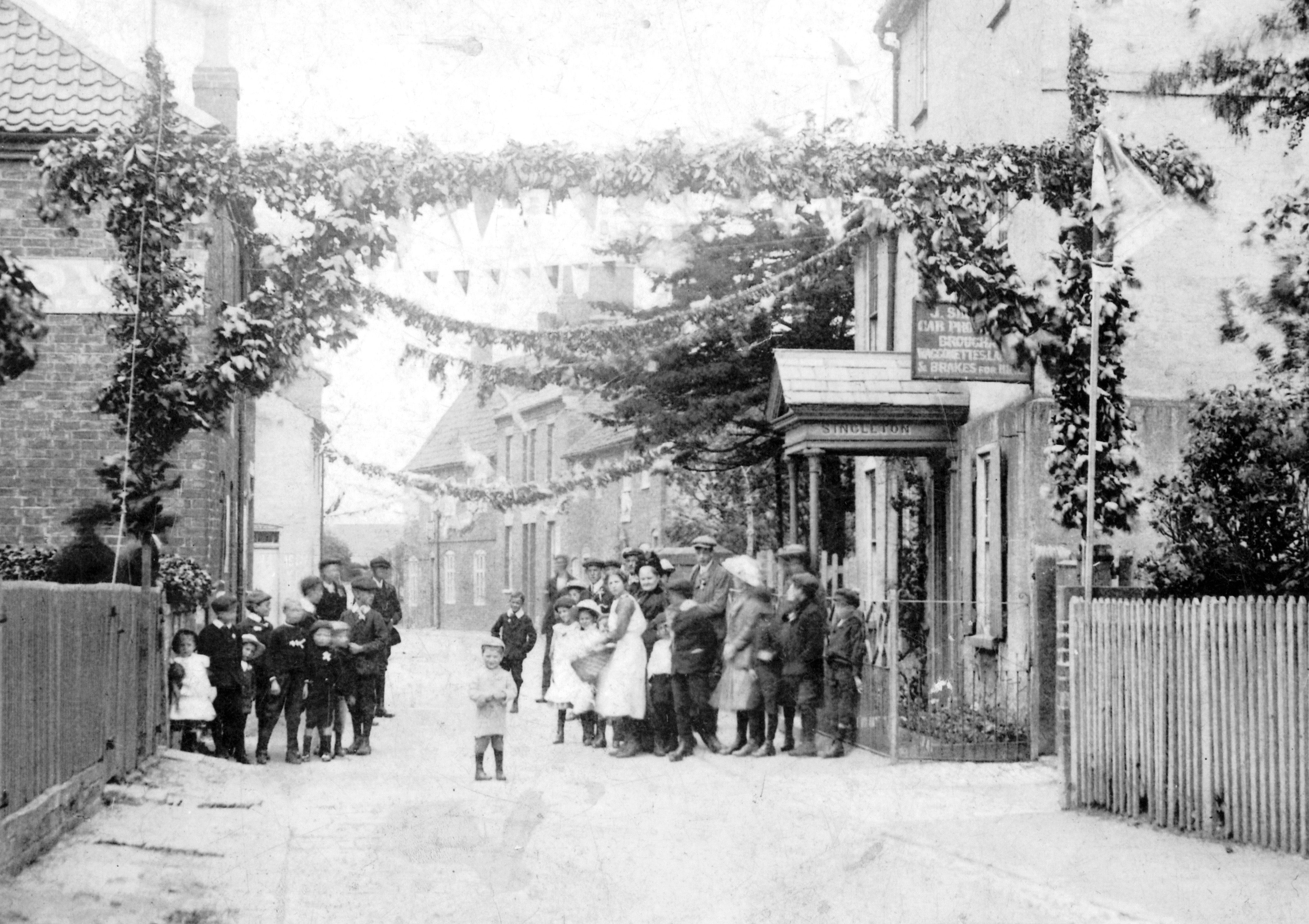
On the corner opposite the Wesleyan Chapel is the Old Bakery, with a very faint dated stone reading, probably, 1704 [6]. The old houses further to the left along Chapel Street include 18th Century Dyers Cottage. Until the 1960s, an enclosed close of labourer’s cottages stood behind this cottage, reached through the arched passageway that is still there. Further on was Singleton’s Farmhouse, an imposing 18th century building demolished and replaced by new homes in the 1960s.
Queen Street was named in honour of Queen Victoria, being previously known as Main Street. There have long been several shops here, as described in the next chapter. The Police Station [7], with its blue lamp, was built in 1842. Almost opposite is an old cottage with attractively cross-hatched brickwork, next to the site of the former Queen Street Mill and Steam Laundry, now apartments. A windmill stood here in the 19th Century. A delicatessen and hairdresser’s occupy the former village malthouse. No.4 Queen St used to be the Marquis of Granby (sometimes called the Granby and Railway), one of five village pubs during the 19th Century (now down to three).
At the junction of Chapel Street with Market Street is another 18th Century farmhouse, once the glebe farm or curate’s house. Opposite is Doctor Fleming’s Hospital. Though the building has undergone partial re-building, some of its early stone walling remains. A plaque, “Dr Fleming’s Hospital 1620”, over the doorway commemorates its establishment. Both this and the Earl’s Hospital are still managed by charitable trusts set up since the 16th Century. Next door is the 18th Century Craven House, and further on a 19th Century close of cottages, still with its communal water pump. Mains water did not reach the village until 1947.
The High Street and Albert Street
Many of the old buildings have gone from the High Street. Opposite the imposing 19th Century red-brick Rutland Arms [8] stood a series of shops and tenements. Most have disappeared, save the former Rutland Restaurant, now a café once more. In the 1880s this was the Post Office and a glazier’s shop. Further on was a terrace known as Butcher’s Row, part owned by the Hand’s Charity. The later Post-Office, from the 1890s to 2000, is now a private house but the stamp-dispensing machine is still in place (but not in use!). Next door was a butcher’s shop, more recently the GPO sorting office, but now also demolished.
On the other side, at the corner of Queen Street, is a short terrace of Georgian cottages. Several more old cottages stood along this northern side of High Street, where the former bank building (now a hair-dresser’s) and the modern grocery store and Post-Office are located. High Street crosses Barkestone Lane and its northward extension, Albert Street. The modern estate at the corner of Barkestone Lane occupies the site of the former yard and offices of W.J. Roberts Builders and Undertakers, then, more recently, of Bullock and Driffill Ltd. Barkestone Lane, an older route into the Vale than Belvoir Road, passes modern estates, Bottesford Church of England Primary School and Belvoir High School before reaching the bypass, then continues “as straight as a die” through the fields, past isolated farmhouses, before crossing the parish boundary at a stream called ‘The Grimmer’, and on to Barkestone-le-Vale itself.
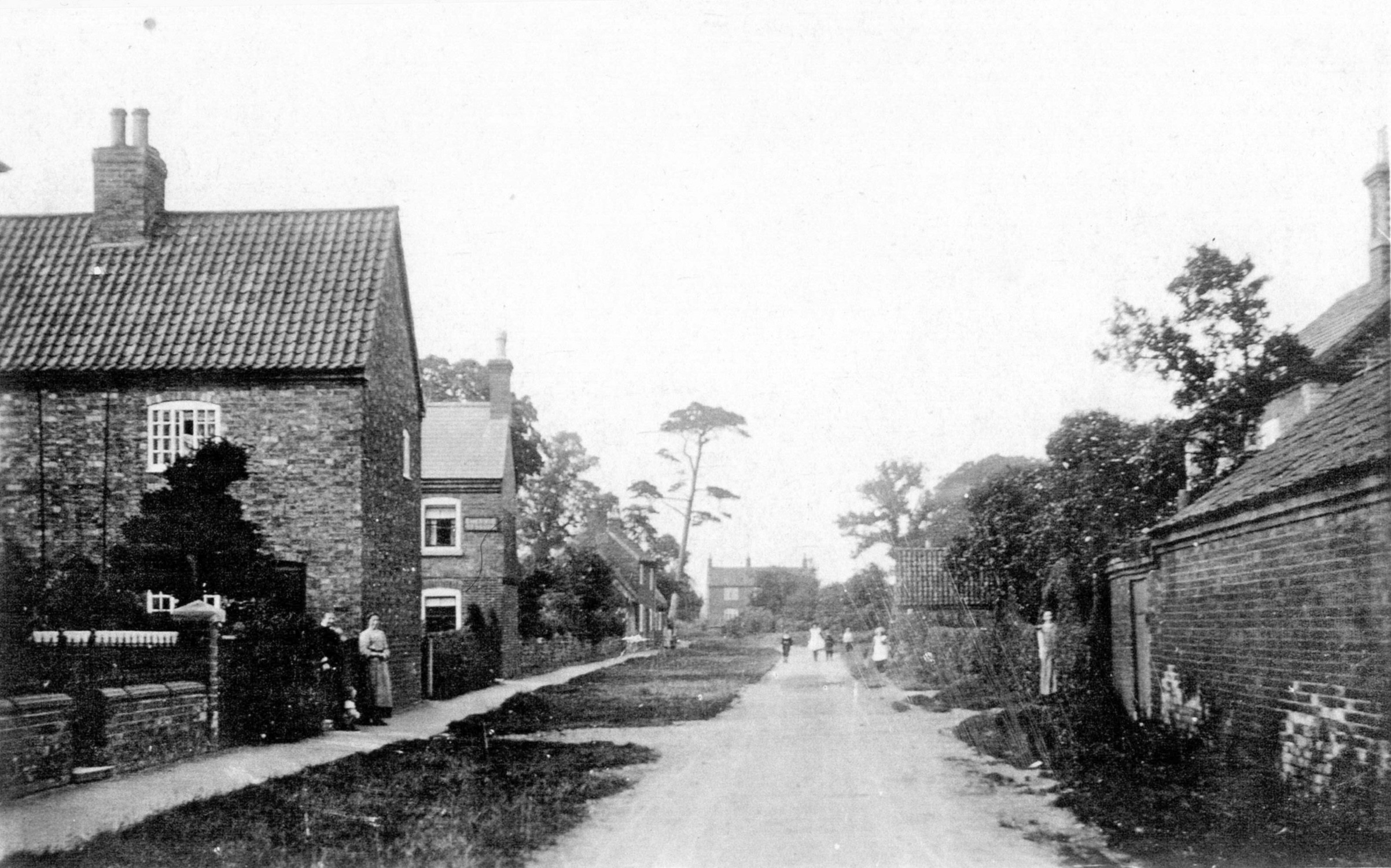
Albert Street, once called Back Street, used to be a lane between cottages, small farms and fields. A Gas Showroom stood on the corner with High Street [9]. The house behind No.7, Forge Cottage (once indeed a forge), was once a barn that was converted in the 18th Century into house the Salem Independent (Calvinist) Chapel upstairs. Further along, old cottages forming three sides of a square include a small farmhouse, whose field opposite is now taken up by the Walford Close sheltered housing and Bottesford’s two surgeries. One of these is named after Dr Norah Woll, a remarkable and well remembered General Practitioner. Chapel Street, which here joins Albert Street, is flanked by post-war houses, including The Square. It was once a path across the field. Land west of Albert Street, occupied by the Church View estate, used to be the fields of Nook Farm and Chestnut Farm. At the far end of Albert St, a bridge leads to Devon Farm, one of the few working farms remaining.
High Street continues westwards past Barkestone Lane. Old houses on the north side include The Thatch, Claremont House and adjoining buildings, with Chestnut Farmhouse set back behind modern houses. The buildings on the south side include more 18th and 19th Century farmhouses, among which The Ferns and adjoining cottages make a fine ensemble [10]. Woodhouse and Carman’s garage is of pre-war origin, when it was Christmas and Chorlton’s. Next to The Ferns is a striking detached Edwardian villa, reputedly the first village house to have electric lighting (supplied privately by Christmas & Chorlton’s), and the place to recharge your radio “accumulators” in the 1930s.
The ‘West End’
High Street ends at the junction with Pinfold Lane and Bowbridge Lane, the site of the former turnpike gate. The old main road continues as Nottingham Road, crossing the “approach bridge” over the bed of the disused ‘Joint’ Railway line from Melton Mowbray. Bottesford South station lay just south of the bridge, and the railwaymen’s cottages are still there.
Pinfold Lane, originally known as ‘The Nook’, runs past modern houses, pre-war council-built houses and allotments, to Rectory Farm. A track to the right passes Nook Farmhouse itself [11], surrounded by trees, and dating from the 17th Century, perhaps the oldest farmhouse in the village.
Bowbridge Lane passes by the 1970s Bowbridge Gardens estate, before crossing the path of the ’Joint’ railway line at the site of the Orston Lane level crossing [12]. Here it joins the road leading down from the approach bridge, flanked by a modern industrial estate. This road is called, misleadingly, Long Hedge Lane, though it is unlikely ever to have formed part of the medieval and earlier routeway of this name. The industrial estate occupies what was part of the wartime army camp. The remainder was on the other side of Orston Lane. An old Nissen hut and sleeping quarters can still be seen close to Orston Lane a little futher out of the village [13]. From the railway crossing, trackways (no right of way) follow the lines of the old railway junction, enclosing an area of rough grass and birch woods designated a “Site of Importance to Nature Conservation”.
Normanton Lane and Station Road
Returning to the ford by the Earl of Rutland’s Hospital, Normanton Lane crosses the railway and climbs over the end of Beacon Hill to the ancient hamlet of Normanton. A modern industrial estate and domestic-waste recycling centre by the level crossing occupy the site of Challands’ brick and tile works [14]. Bricks, pantiles (including the “Bottesford Blue” pantiles seen on several of the older buildings) and drainpipes were produced here probably up to the First World War. Afterwards, the clay pit became a rubbish tip until the present industrial estate was developed by Mr Ken Greasley. The modern housing on the opposite side of Normanton Lane was once a field belonging to Beckingthorpe Farm.
Station Road, which branches off Normanton Lane, was considered part of Normanton in the 19th Century. It ran through Beckingthorpe Farm, the farmhouse (Beckingthorpe House) on one side, barns and sheds (now converted into houses) opposite, the land behind now occupied by another housing development. Alongside Beckingthorpe House runs Church Lane [15] past the former Church Farm, which once provided twice-daily milk deliveries to the villagers. It was once called the Dorking Poor Farm, a name derived from the medieval charity that originally owned it
Local trains stop at Bottesford, but much of the old station has gone, including the ticket-office, waiting room, signal box, warehouse and sidings. The remaining buildings, one erected in 1850 by Nottingham architect T.C. Hine for the Boston and Ambergate Railway, are private houses, as is the crossing keeper’s house.
Normanton
On the other side of Beacon Hill lies Normanton itself. A ‘pill-box’ concrete gun emplacement stands in the field to the left as you enter it. Normanton has always been a separate hamlet, which had its own system of medieval open fields comparable in area to that of Bottesford itself. Farmhouses and ornate 19th Century estate cottages are spaced out along the road. There are handsome farmhouses, including Greenacres, Normanton Hall and Normanton House, though most of the farm buildings have been redeveloped and modern houses occupy many of the intervening gaps. Even so, Normanton’s rural, leafy character remains.
This really is the northern tip of Leicestershire. The road continues, along the perimeter of the wartime airfield, past the isolated Normanton Lodge, to the junction with the lane to Staunton (in Nottinghamshire) and the entrance to the Roseland Industrial Estate. This is close by the Three Shires Bush, marking the junction of the three counties, Leicestershire, Nottinghamshire and Lincolnshire.
Easthorpe
Easthorpe is essentially a peaceful, scattered hamlet less than a mile southeast of Bottesford. It used to be a separate community covering an area comparable to that of Bottesford and, like Normanton, had its own set of medieval open fields. The boundary with Bottesford once ran along the centre of Church Street, to include the Red Lion and the land further east. One side of Church Street was in Easthorpe, the other in Bottesford. The boundary crossed Grantham Road and presumably ran beneath the middle of the Fuller Room.
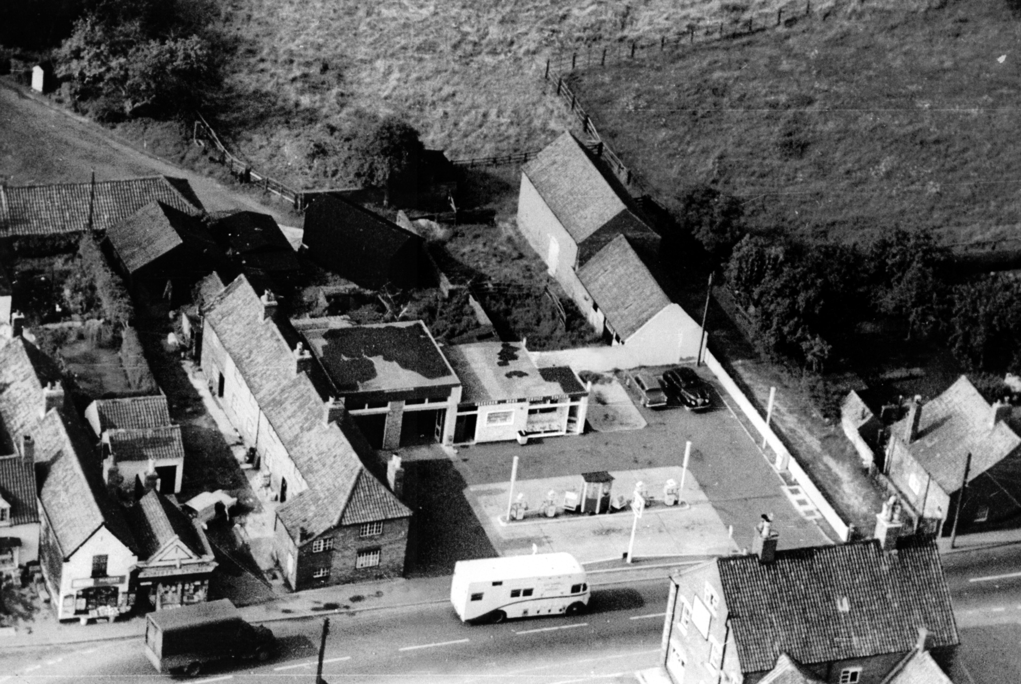
Before the re-alignment of Grantham Road in 1936, the route out of Bottesford ran along Rutland Lane to the junction with Easthorpe Lane [16], then turned sharply to cross the River Devon via the former Washdyke Bridge, before bending eastwards past the end of Station Road and so towards Grantham. Ornate estate cottages stand at the junction with Rutland Lane, with allotments behind. Mill Lane ran from the Washdyke bridge to Easthorpe water mill, still operated in the 1940s by ‘Jocky’ Baines; on the corner was Allen’s Tea Garden. On the other side of the bridge were the Bunkers Hill (or Blue Bank) Cottages [17], built “For the Poor” in 1779. Another cottage, also called Bluebank, opposite the modern filling station, was the last building on Grantham Road. In the 19th Century, Hoe’s brickyard and clay pit, now an area of land-fill, lay south of Grantham Road further along. Modern houses now extend far along Grantham Road, including the site of the former timber yard (Mould & Bloomer’s, later Walker’s Wood Yard).
Turning right at the junction with Rutland Lane, Easthorpe Lane passes a second pair of estate cottages, then follows the curving perimeter of Easthorpe Manor [18], a cluster of farmhouses and barns standing on an ancient, almost circular site with the remains of a moat. The rough field behind contains earthworks which may mark an abandoned village [19]. The Manor and earthworks are a Scheduled Ancient Monument. At this point Easthorpe Lane is joined from the west by Granary Lane, now a footpath following the Rundle ditch back to the centre of the playing field and VC Hall.
From Easthorpe Manor, the lane continues past old cottages and farm buildings, then Easthorpe Lodge and an Arts and Crafts-style house called Three Gables. It turns right into the main part of Easthorpe hamlet, passing Corner House, once a row of small cottages. Castle View Road, once called Belvoir Road, is the old route southwards towards Belvoir Castle. The cottages and farmhouses here include a small mud-walled cottage. Beyond the bypass, the last house in Easthorpe is an isolated farmhouse called “California”. The other way out of Easthorpe is along Muston Lane, the old road to Muston, Woolsthorpe and Denton. Here again, old cottages and small farmhouses are interspersed with modern houses. This lane makes a good walking route to Muston, for those with energy to spare.


No Comments
Add a comment about this page