Not Forgetting - Chapter 1: An Introduction to the Villages
A brief history
Neil Fortey


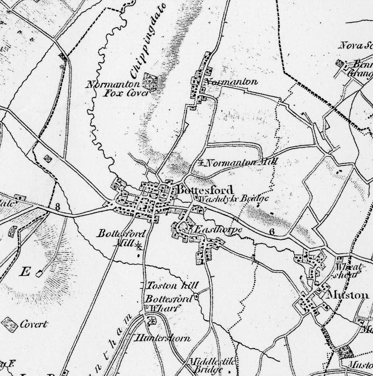
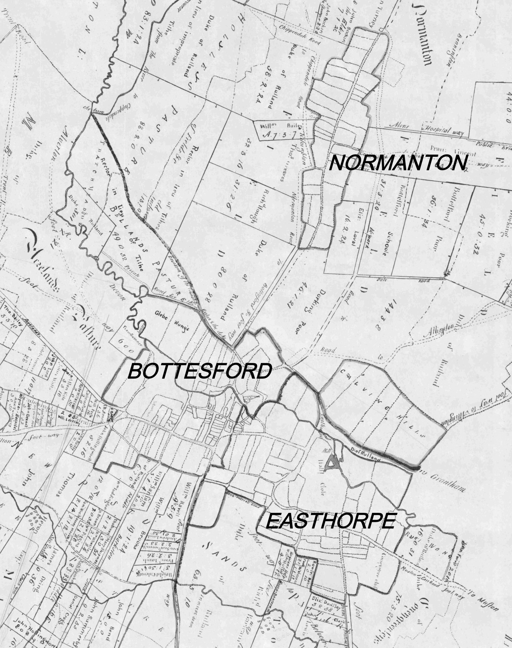
The parish of Bottesford and Muston, part of the Borough of Melton Mowbray, was created in 1936 by combining two ancient parishes, which also included the villages of Easthorpe and Normanton. It lies in the Vale of Belvoir, at the northeastern tip of Leicestershire in the ancient wapentake of Framland, flanked to east and west by South Kesteven and Nottinghamshire respectively. Farmland since Saxon times and earlier, it has links with both the agricultural richness of Lincolnshire and the industrial towns of the East Midlands.
The postal address is Nottingham. Railway and buses connect to Nottingham and Grantham. There is a two hourly bus service from Bottesford via the country lanes to Melton, but no direct public transport to Leicester, an hour’s drive by car. The sorting office is in Nottinghamshire, as is the telephone exchange. The most popular local newspaper is the Grantham Journal, though the Melton Times and Nottingham Post are also widely read, but the Leicester Mercury is a rarity.
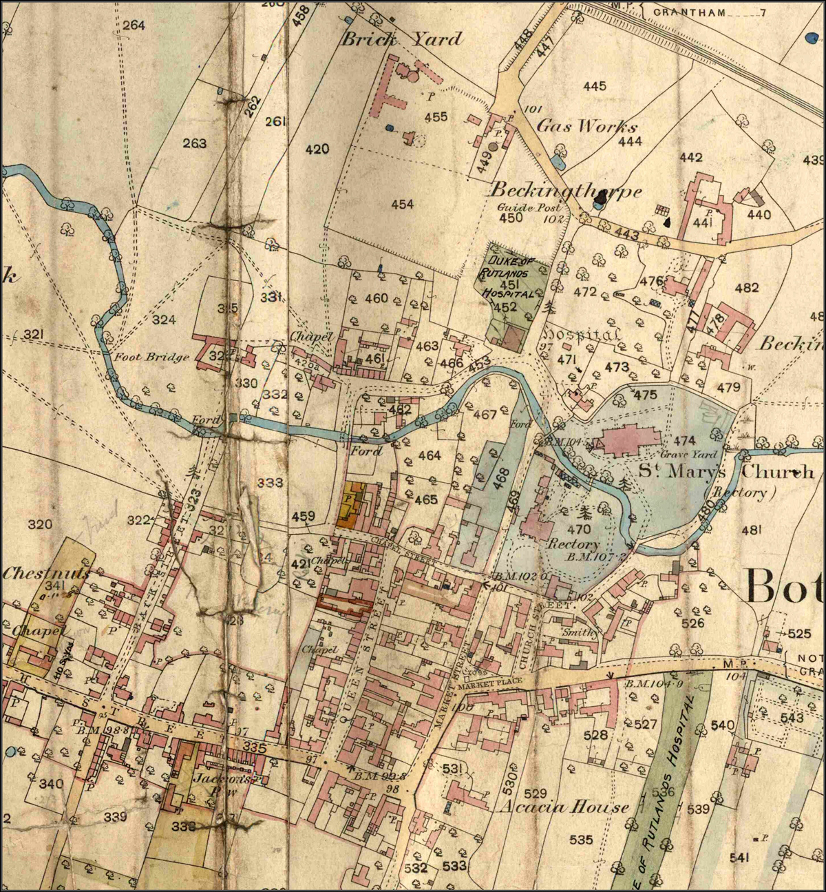
Its pre-Norman origins lie in a cluster of farming communities surrounding a church built on the site of the present St Mary’s parish church. Bottesford itself was an Anglo-Saxon village, located at a ford on the River Devon. The surrounding hamlets of Easthorpe, Beckingthorpe, Wimbishthorpe and Normanton have names recalling the arrival of Danish ‘north-men’, settlers in Eastern England in the ninth and tenth centurys. St Mary’s is sited on the opposite bank of the river from Bottesford itself, and is arguably at a joint boundary between Bottesford, Easthorpe and Beckingthorpe, as though it was a common church to these communities, which also had their own chapels. Bottesford, Easthorpe and Normanton each had a separate set of medieval great fields and associated pastures, but Wimbishthorpe seems to have lost its distinct identity quite early.
Modern Bottesford has perhaps the air of a would-be small town, yet its character and post-medieval history are essentially those of a farming village. There is little evidence of what the medieval village was like. The street pattern suggests a deliberately planned community, but when this was constructed, and why, remain a subject of speculation. The Enclosure Map of 1771 shows the present day streets already in existence, in an established area of gardens and small fields (very like the Village Envelope in the current Melton Borough plan). This layout may date from the development of a market at Bottesford, possibly in the years before the Black Death reduced its population and prosperity. The subsequent history has essentially been that of an agricultural community within the estate of the Earls and Dukes of Rutland.
Muston developed as a separate village and has always remained so. Its plan is that of farms and cottages along two streets separated by the River Devon. The parish church of St John the Baptist stands by the bridge over the river, at a focal point joining these two parts. Muston is different from Bottesford in character and atmosphere, preserving its separate identity.
The gradual changes which followed formation of the joint parish of Bottesford and Muston were somewhat undone by construction in the late 1980s of the bypass that passes between them. This took through traffic of the A52 trunk road out of Bottesford village centre, but enhanced the sense of physical separation of the two villages. In the absence of a bridge or other safe pedestrian crossing, travel between Muston and Bottesford requires the private car (there are currently only two buses in either direction a day) or a hazardous dash on foot across the busy arterial road, not for the slow moving or faint hearted!
The hundred years or so before the outbreak of the Second World War had witnessed a gradual reduction in the populations of both villages, while the neighbouring towns had expanded continuously, as indeed had the overall population of the East Midlands. Farming employed fewer people, but other areas of work were limited and may have appeared less attractive than the work offered by the industries of Nottingham and Grantham, or emigration.
Since 1945, local prosperity has been transformed gradually due to improved utilities, communications and the establishment of businesses and small factories. Bottesford has seen a considerable increase in population over the past fifty years. Muston, on the other hand, has become a quieter place, in contrast with its neighbour.
A striking feature of the pre-war villages was their degree of self-reliance in terms of food production, retailing and local businesses. This is very different from our present day assumption that stores and supermarkets in local towns will provide for our day to day requirements. Whilst there are opportunities for local employment, many people now commute to work in Nottingham and elsewhere. Newcomers have been moving into the villages in considerable numbers. Schooling has greatly expanded, but the parish Church has become less the focus of the village than at any time in the past. These changes must not be over-stated, as agriculture still surrounds the villages and there are many local businesses meeting local needs. Nevertheless, the reliance on local farming for food and work has gone and Bottesford is arguably not the close knit community it used to be.
Change could have been more severe. There has not been a decline into chocolate-box gentrification, neither has there been the wholesale urbanisation seen elsewhere. Instead, the parish has followed a middle path of gradual change and expansion to create a continuingly successful community, while keeping a sense of identity and connection to its history.
The view from ‘Holliers’
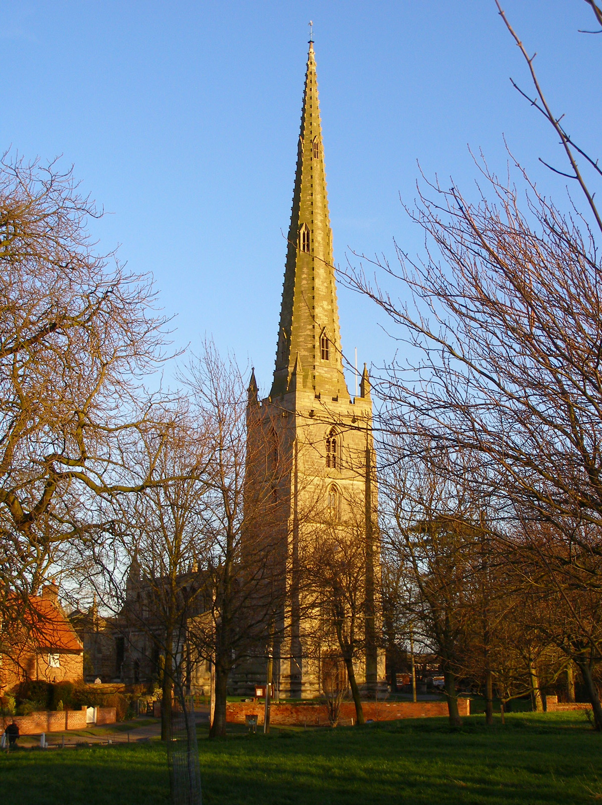
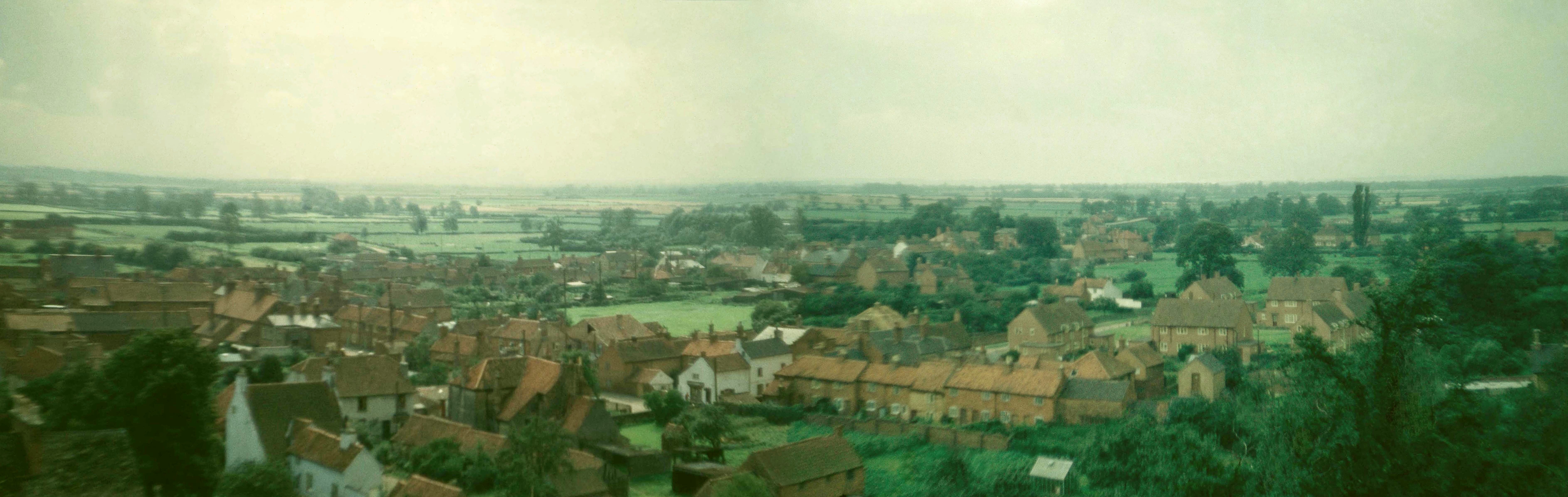
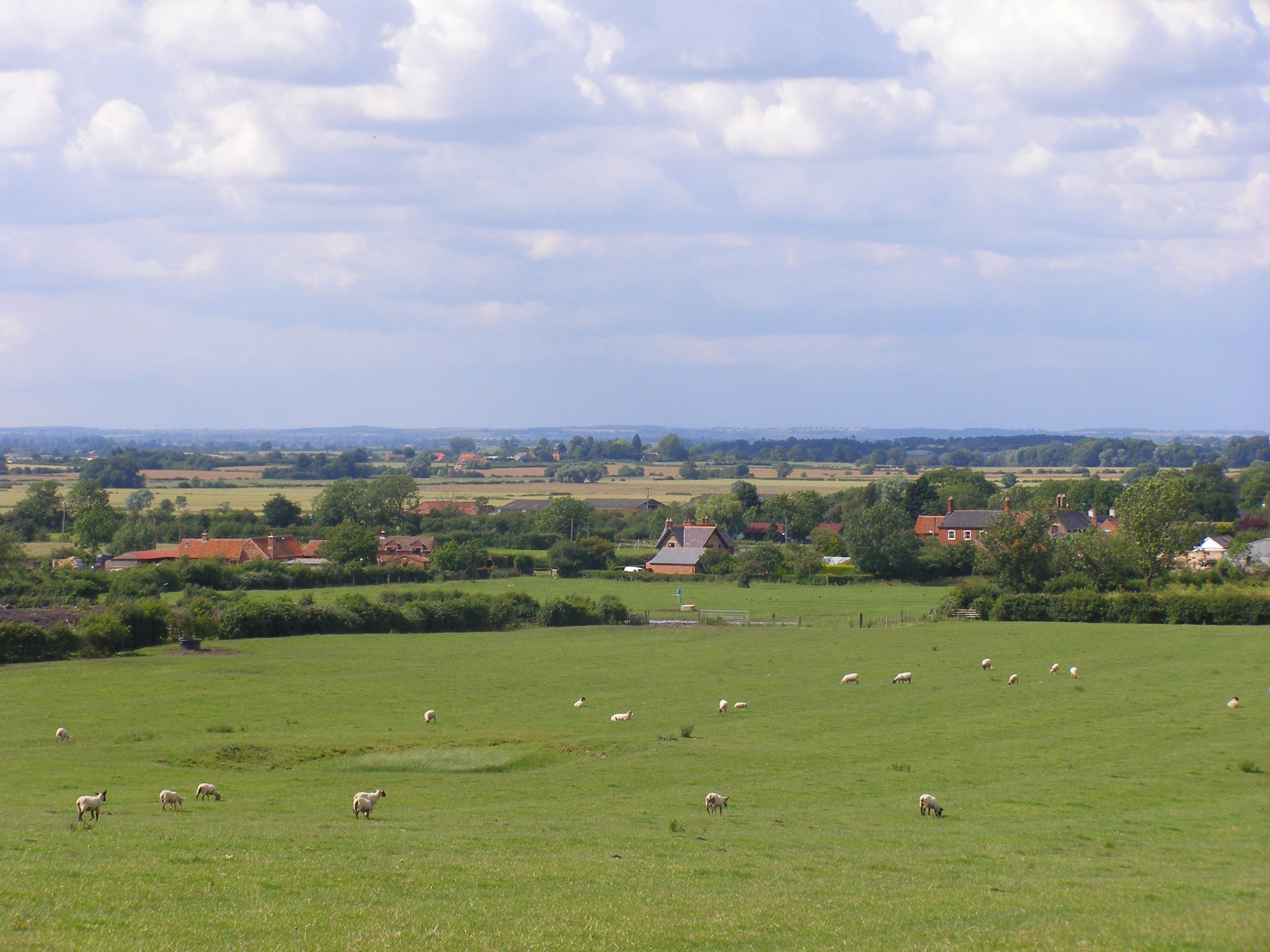
The parish church of St Mary the Virgin, Bottesford, is one of the largest in the East Midlands. Its spire, 212 feet tall and the highest in Leicestershire, is visible for miles, the Lady of the Vale’, a focal point in the Vale of Belvoir. If you visit the Bottesford May Day Gala, on the first Monday in May, you may have the chance to climb the tower by means of its steep and narrow spiral staircase, and crawl through the tight hatch on to the walkway that runs around the foot of the slender spire. Sometimes known as ‘Holliers’, this belvedere spreads Bottesford and the Vale of Belvoir at your feet.
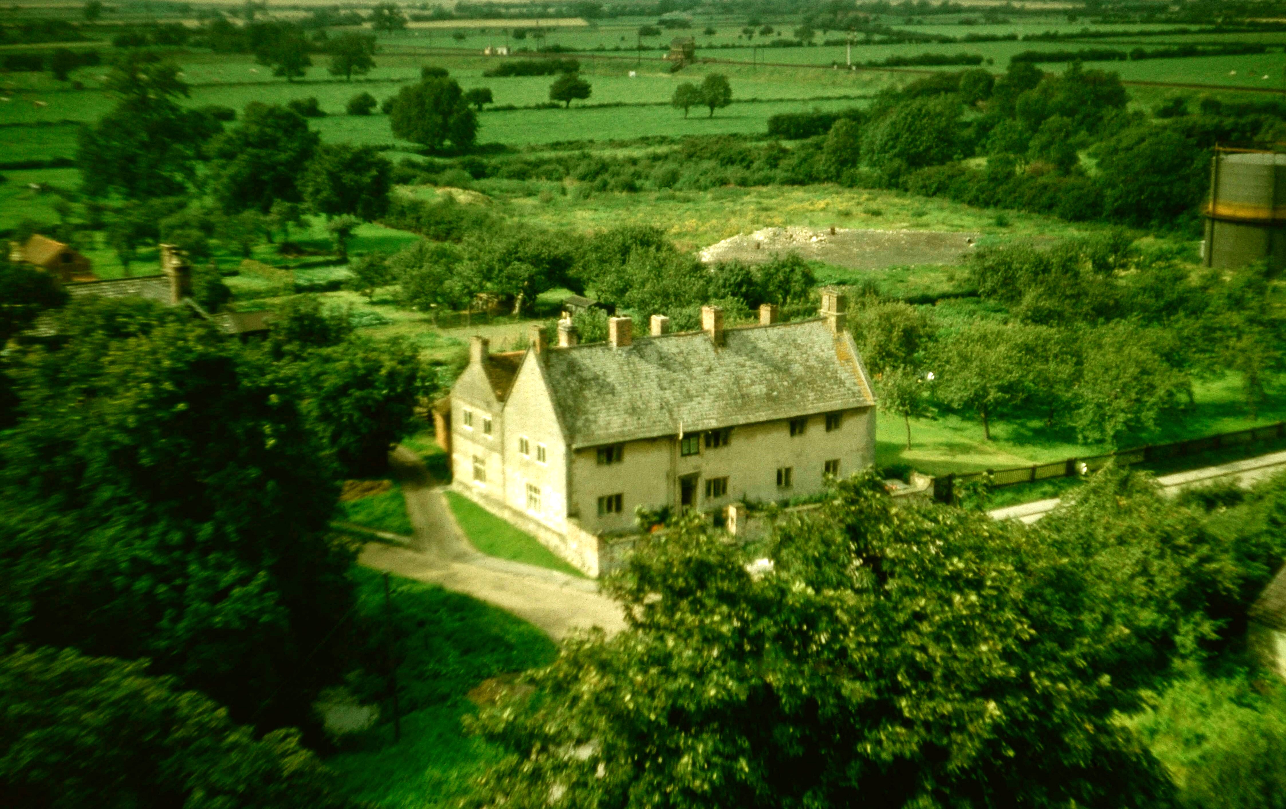
Photographs from Holliers taken about 1950 by Sergeant Arthur Bradshaw, the village policeman, show Bottesford as a spread of red brick houses intermingling with paddocks, gardens and orchards. Singleton’s Farmhouse and Redford’s Cottages can be seen. The Earl of Rutland’s Hospital is surrounded by trees. The village’s gas works is still in operation, close by the level crossing on Normanton Lane with its diminutive gate-keeper’s house.
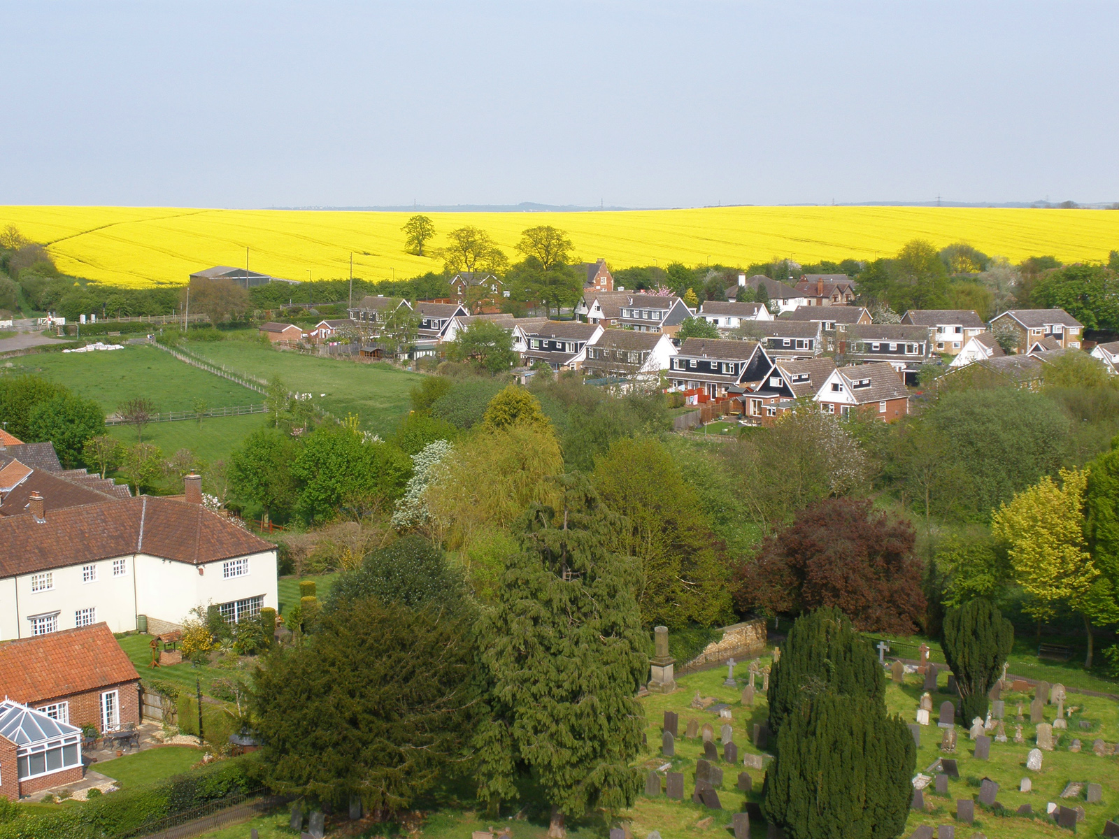
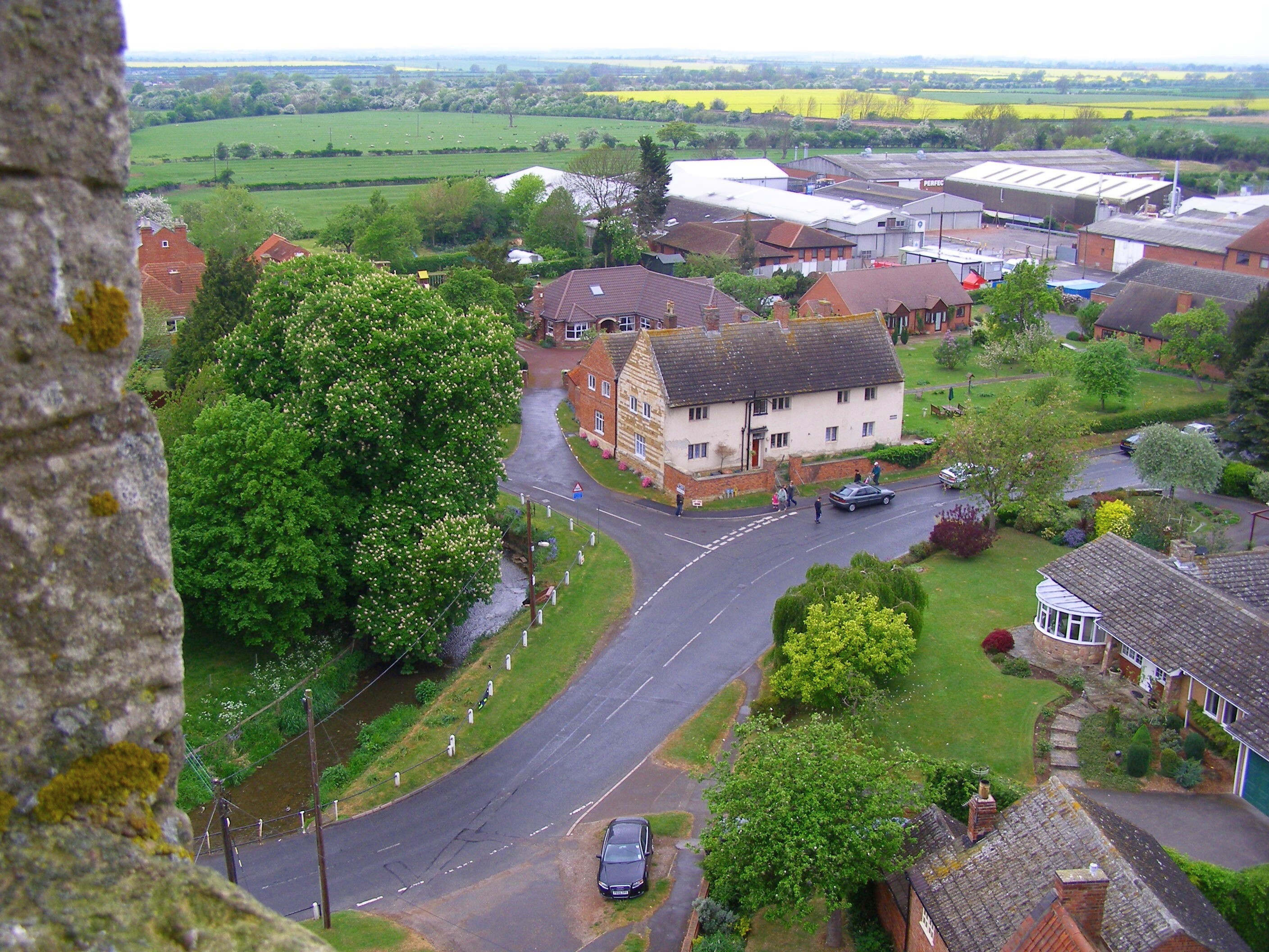
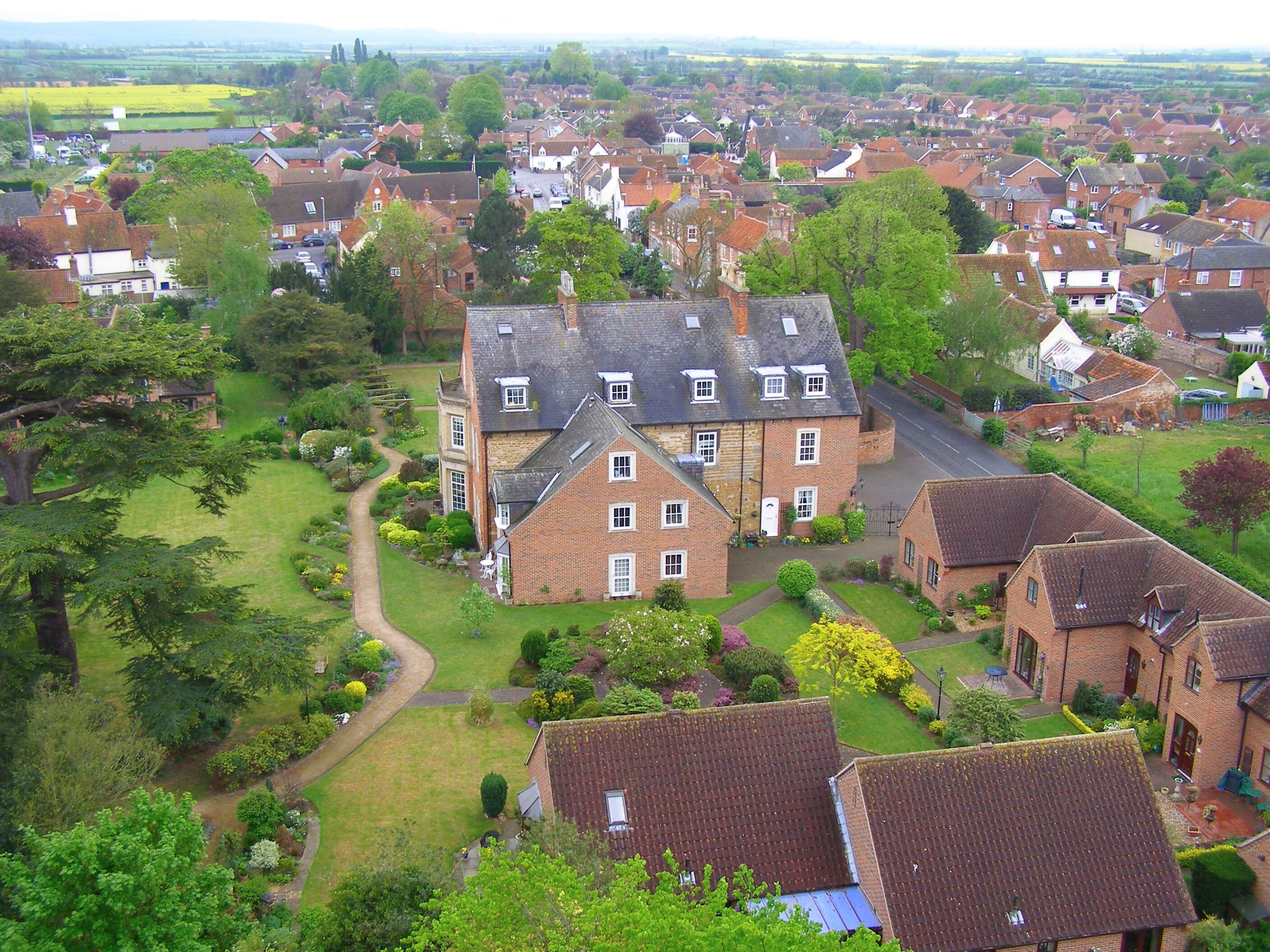
In the first decade of the new Millenium, the view is broadly the same, but inevitably there have been many changes. Some of the old houses have gone, their places taken by newer homes. Housing estates have replaced many of the paddocks and orchards. Industrial units have been developed on the sites of the wartime army camp and the former clay pit and brick works. Gasometers and gate house are gone, as are most of the Victorian station buildings with their sidings, signal box and grain store. Diesel has replaced steam. The handsome old Rectory and gardens are still there, facing the church across the river Devon, but the Rector has moved to a more modest, modern house on Grantham Road. The old Rectory was refurbished and extended into apartments for retired people, surrounded by communal gardens.
Bottesford grew up on sandy soils deposited during the Ice Age, easily worked and a source of good water. It is also where ancient routes crossed the River Devon (pronounced ‘Deeven’), whose tree-lined course runs from beyond Belvoir Castle to the Trent above Newark. This is a modest river by any standards, but wide and marshy enough to be a barrier during medieval and earlier times. The two fords that remain in Bottesford still catch the occasional unwary motorist, but the Devon is safely bridged by the main road to Grantham as well as by the 17th Century packhorse bridge built by Dr Samuel Fleming.
At the southern edge of Bottesford, traffic speeds along the concrete surface of the bypass built in the late 1980s. Spread out further south are the Liassic clay lands of the Vale, a patchwork of fields and hedges, with expanses of yellow flowering rape in the Spring. These were the estate lands of Saxon thegns before the Norman Invasion, and of the medieval Lords Roos and the later Earls and Dukes of Rutland. The open character is still there, but as with the villages, it is not what it was. Hedges have gone and livestock farming has been greatly reduced. No one buys milk straight from the farm as they once did. No herds are driven along the village streets, leaving the signs of their passing.
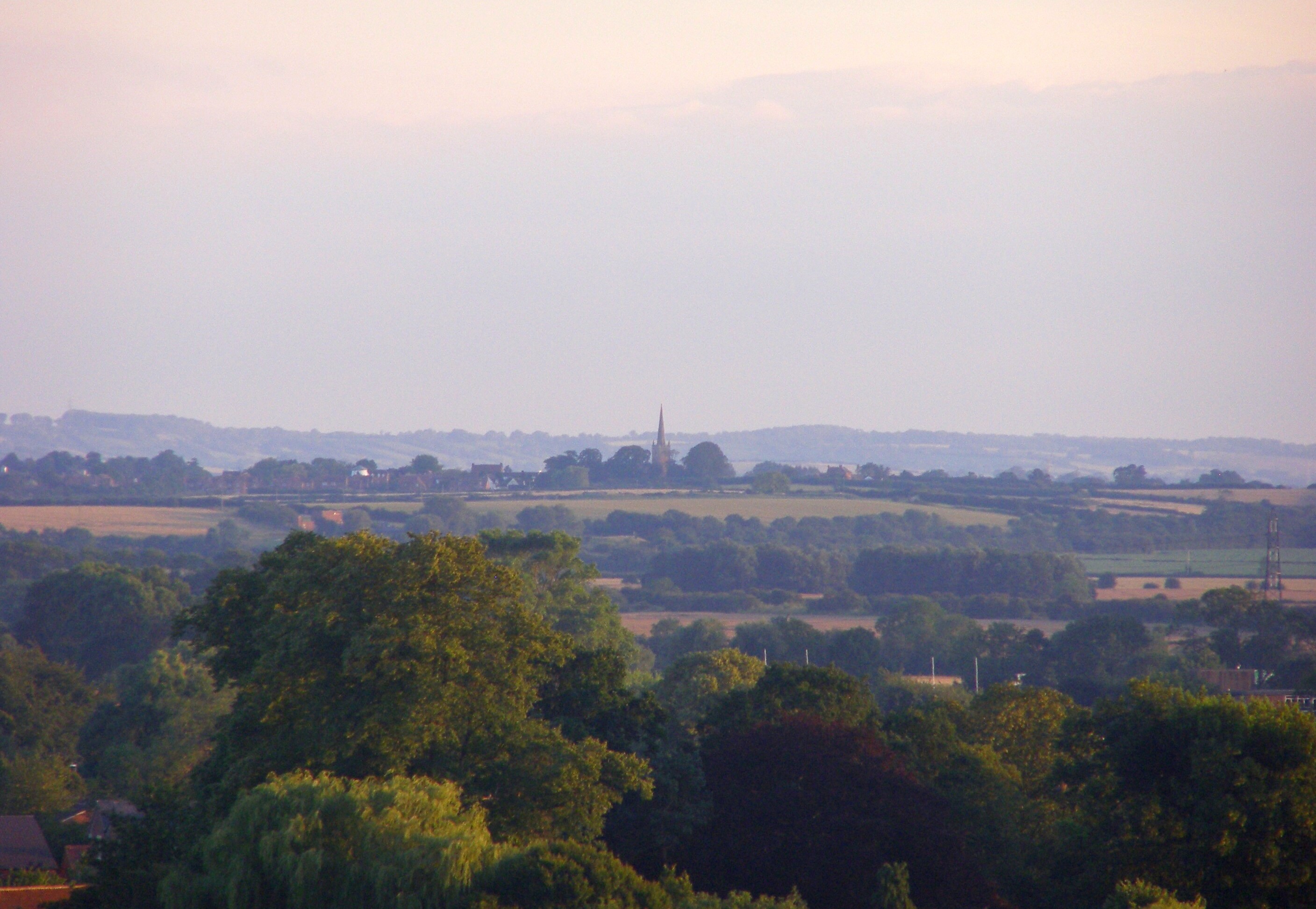
The Vale countryside is punctuated at intervals by compact villages of ancient origin. As seen from Holliers, Muston is one and a half miles away, spire to spire. Farther away, some two miles to the southwest, the slender spire of Barkestone-le-Vale stands out on a low step-like limestone ridge that crosses the centre of the Vale. The spire of Redmile is to its left, closer and lower down. Other villages in the Vale, such as Granby and Orston, grew along a second step-like escarpment beyond which extends the western part of the Vale.
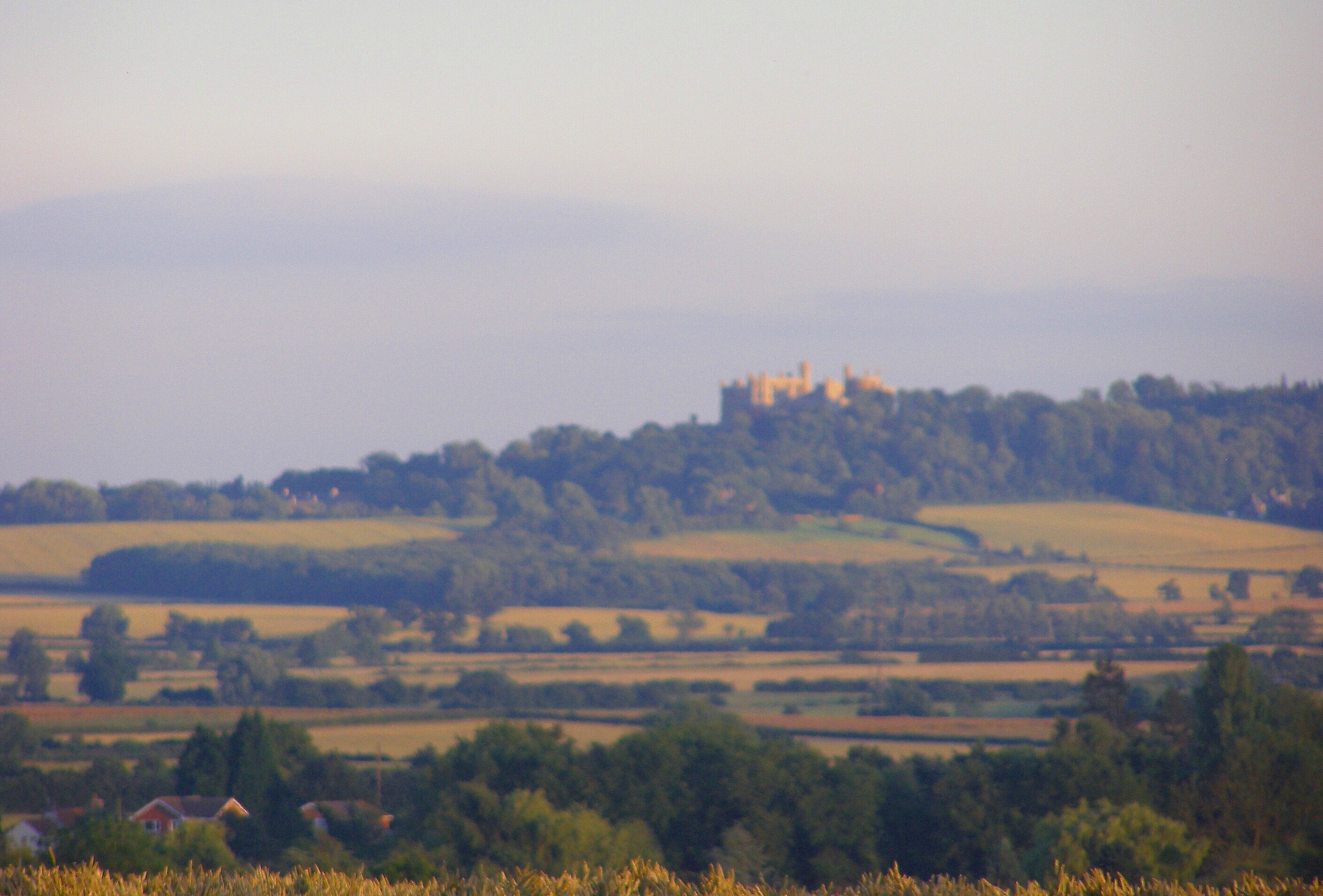
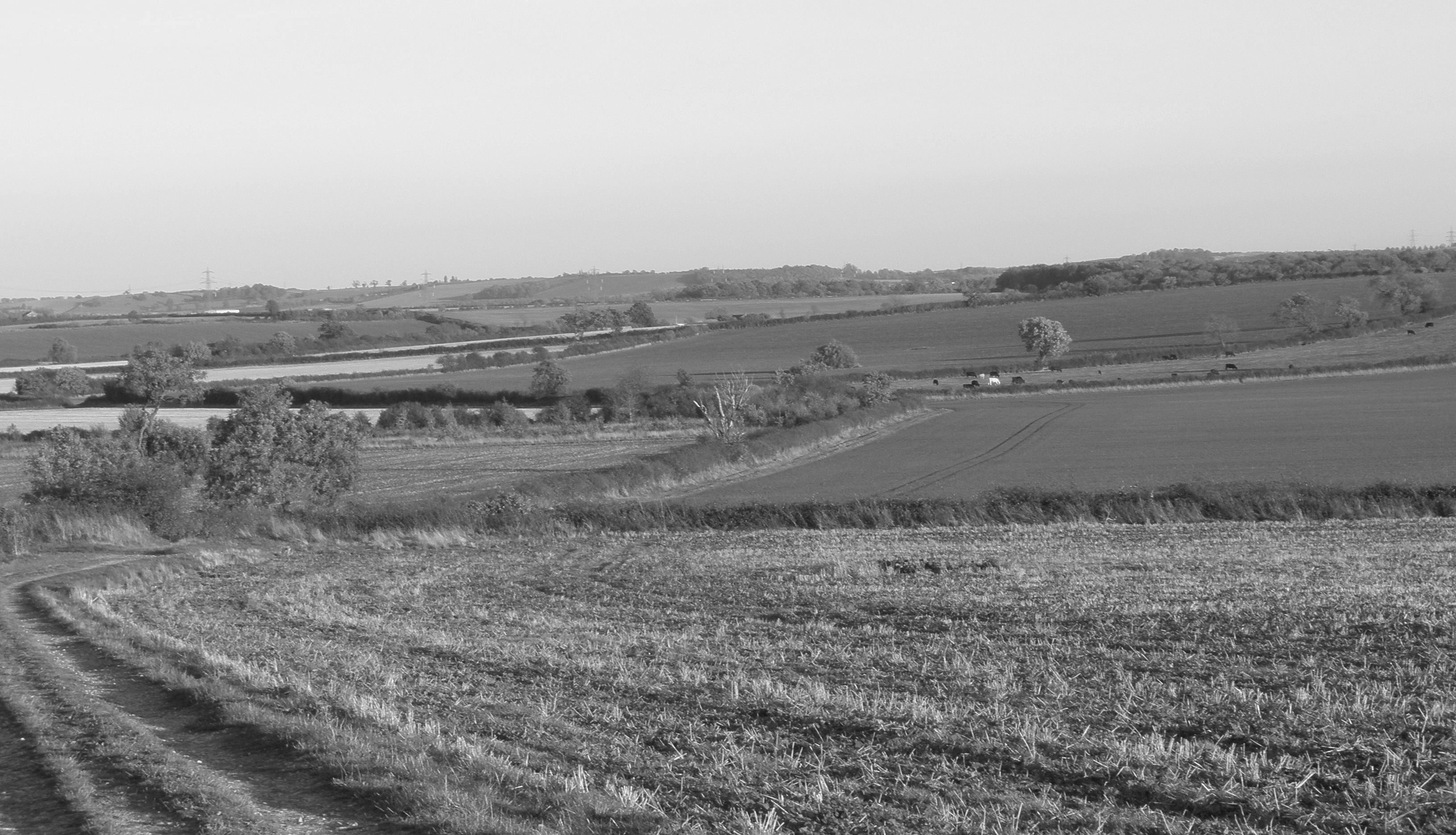
The expanse of low lying, gently undulating topography is bounded by the wooded slopes that form the southern and eastern horizon. Prominent on a spur of this slope is the turreted outline of Belvoir Castle, home of The Duke and Duchess of Rutland. Much of the land in Bottesford and Muston, as well as other parishes in the area, used to belong to them. A sale of land in 1920 reduced this dominance to some extent, but they remain the major land and property owners. It is sometimes said that the term ‘Vale of Belvoir’ referred originally to the land visible from the castle.
Northwards from Holliers the view is cut off by the rounded hump of Beacon Hill (or Palmers Hill as it used to be called), hiding the low lands of Newark and the Trent Valley, and the view towards the distant Lincoln ridge. Across the foot of Beacon Hill runs the railway that connects the east coast route of the old Great Northern Railway at Grantham with that of the Midland Railway at Nottingham. A bridle path leads from the rail crossing by Bottesford station to the top of the hill. Traces of tarmac proclaim its one-time importance as a road through the fields to Allington and Normanton, but today the Allington route is no more than a muddy trail through the prairie-like fields. The old cobbled lane to Normanton passes through a gate carrying a notice saying “Bridle Path Ends in 444 Metres”, as indeed it does though you may wonder who measured the distance so precisely, and why. Its continuation to Normanton is no longer evident other than as a public footpath across the fields.
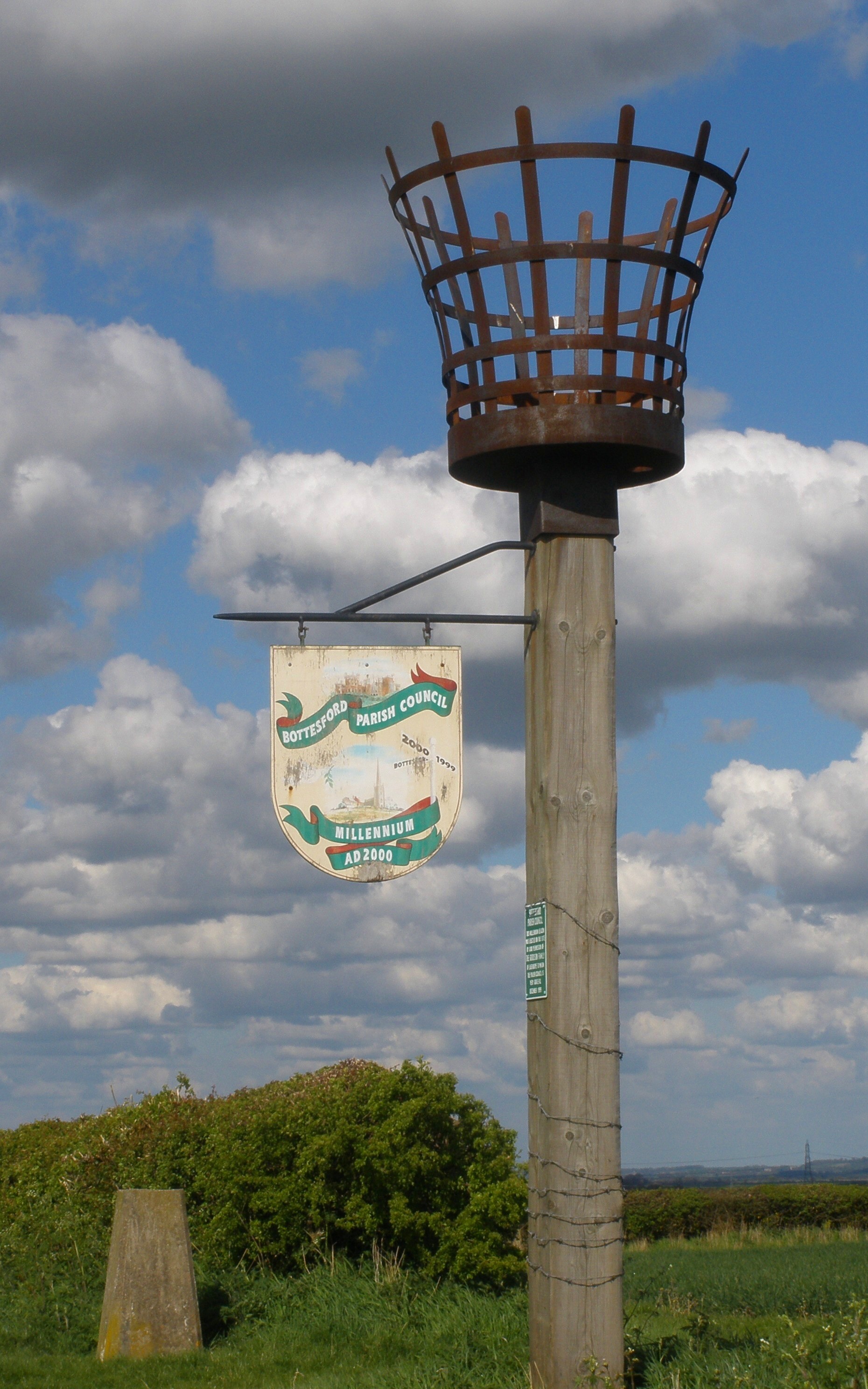
The view from Beacon Hill
At the top of Beacon Hill the bridle path passes below the Millennium post and brazier. Here you can take in the full panorama, nothing of Alpine or Atlantic grandeur it’s true, but nonetheless a wide expanse of rural England stretching over 20 miles westwards to the smoking stack of Ratcliffe-on-Soar power station and northwards past Newark’s spire and the British Sugar factory towards the distant cooling towers of High Marnham & Cottam power station nearer Retford. On the clearest days a tiny pale grey feature on the northeastern horizon can be glimpsed – is this Lincoln Cathedral?
The 2000 Millennium post is about 19 feet in height, including its cast iron brazier. A bracket supports a painted wooden panel proclaiming “Bottesford Parish Council, Millenium 2000”. The First Series Ordnance Survey map of 1824 depicts a windmill at the top of this hill, but no trace is to be seen. Beside the post is a concrete Ordnance Survey trigonometric pillar, and in the corner of the field close by is the grass covered mound covering the remains of a Cold-War Observer Corps post.
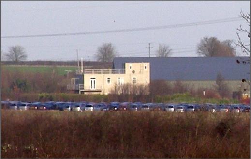
Looking north, the view from Beacon Hill is dominated by rows of shiny cars and vans, and behind them great grey sheds. Sometimes the sun reflects from windscreens like rows of festive lights. This is Normanton Airfield (officially RAF Bottesford) that from 1941 to 1945 was one of the chain of Bomber Command bases. Now it has become the Roseland Industrial Park and the ranks of vehicles are in temporary storage awaiting delivery to their new owners. The grey sheds are the wartime hangers that dwarf the pale grey rectangular control tower, now restored and converted to offices.
To the left (west) of the airfield are the farms and cottages of Normanton, and about two miles further away lies the hamlet of Staunton-in-the-Vale, its church tower just visible among the trees next to Staunton Hall. The curiously-named Three Shires Bush, where Leicestershire, Nottinghamshire and Lincolnshire meet, lies on the raised ground just beyond the airfield buildings, close to the Schlumberger Ltd training centre.
Eastwards, the hills capped by iron-rich Marlstone sweep round, hiding the town of Grantham and its suburbs. The church spire of Barrowby is prominent on the escarpment to the east about five miles away, and that of Great Gonerby can also be picked out to the ENE. The triangular spire of Muston can be seen low down about two miles away to the ESE.
A changing landscape
As you take in the view you may meet local people enjoying the open space and fresh air, many exercising the dog as well as themselves. There may be tractors working in the fields. Vehicles speed along the roads and trains pass to the accompaniment of the flashing lights and warning siren of the level crossing. Often, a light plane or helicopter buzzes overhead, like a demented insect. Otherwise, all is quiet, an oasis of rural peace in the modern world. You might think it had always been so, apart from the Second World War when departing aeroplanes would have passed not far above you, laden with explosives, their Merlin engines at full throttle to clear the ridge and church spire with its red warning light.
If we could go back two hundred years or more, we would find a much busier countryside. Until the Parliamentary Enclosure of Bottesford parish in 1772 much of the land was free of hedges and farmed by the ancient great-field system. Ridge-and-furrow can still be seen in many fields. Muston had already been enclosed in the 17th century. Parliamentary enclosure was a drastic change, highly profitable for some, traumatic for many others. Nevertheless, great as these changes were, agriculture remained the major source of work through the 19th Century and into the 20th. Around our vantage point on Beacon Hill we would see many more people, not walking at their leisure, but working as ploughmen, shepherds and farm labourers.
Many of the farm houses we can see today would have been there by the end of the 19th Century. Some of the labourers lived in brick built cottages and rows of tenements, but others still occupied thatched mud-walled houses. Most had a cottage garden or allotment, where potatoes and other crops were grown, pigs were raised and poultry kept. Horses were in common use up to the middle of the twentieth century, backed up by steam traction power and early tractors. G.E. Marsh & Co, among others, undertook steam ploughing before the Second World War. Diesel powered farming really only took over after the Second World War.
The First World War was felt in the departure of local men to the forces, but there was only limited change in the villages themselves. Agricultural produce, rail transport and iron ore were much in demand, and continued to be so after the war. Village life changed only slowly. At the end of the Second World War, there was still only a partial electricity supply. Bottesford had its own small coal-gas plant for lighting and cooking, which ceased operation only after the modern electricity grid arrived in the early 1950s. Piped water came in 1947, replacing the host of pumps and wells that had met the need until then, but the village sewers were not installed until the early 1960s, and the traditional outside “privy” finally became a thing of the past. Bottesford acquired its own telephone exchange and sorting office. But by the end of the century both had been closed and their functions moved to Bingham. Finally, in 2005, Bottesford’s public call box was removed. To make a public call you have to go to Muston, which still has a traditional red GPO box. Such is progress!
Bottesford (but not Muston) is identified for further expansion in the current Melton Borough plan. Local people may look back with affection and nostalgia, viewing the future with apprehension. A local action group is fighting plans for industrial wind turbines, considerably greater in height than St. Mary’s spire, where there is at present empty countryside.
Despite the changes, these remain friendly down-to-earth places. Long may they remain so!


No Comments
Add a comment about this page