You are here: Home>Tags>Archive>Bottesford Local History Archive>Historic maps of the parish>Plan of Bottesford village, drawn by L.Challands, 1848
Plan of Bottesford village, drawn by L.Challands, 1848

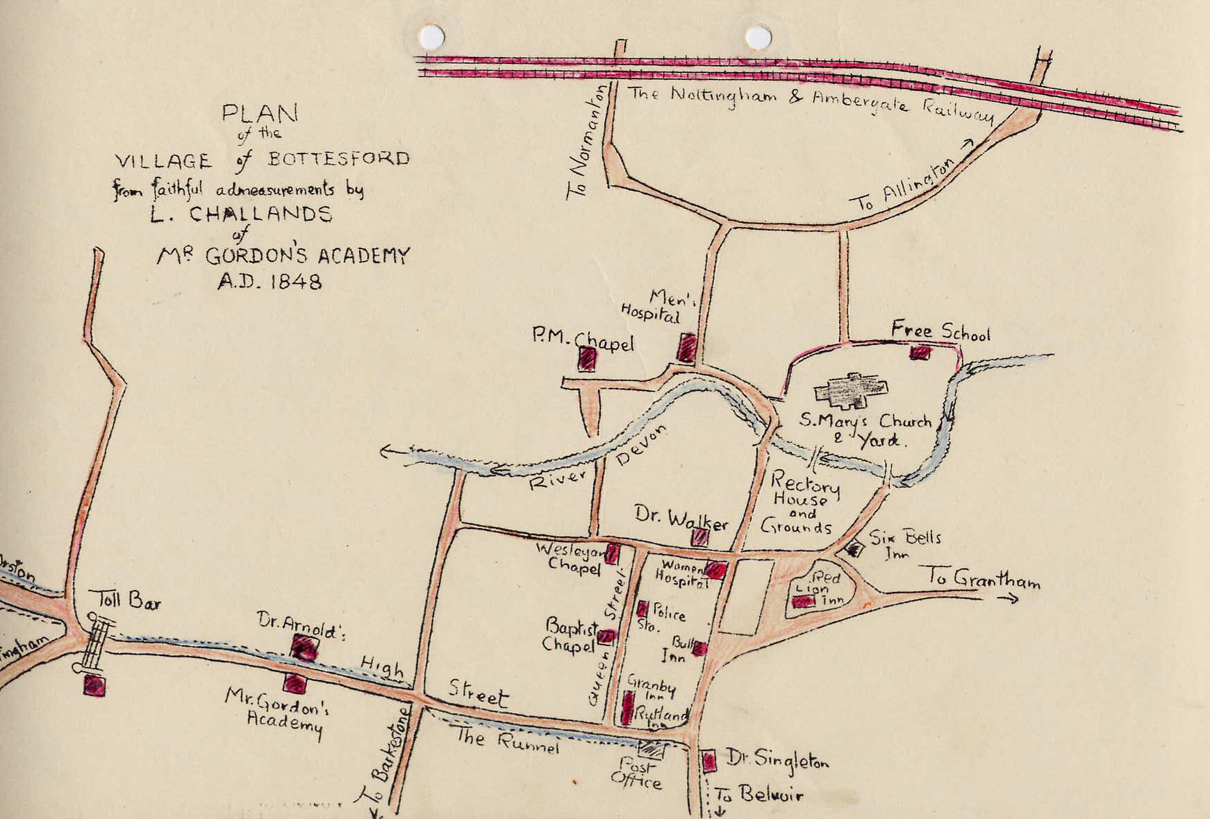
A small, cartoon-like map, apparently drawn by a pupil called Challands, who was attending Mr Gordon’s Academy (which was presumably a privately run school in the village). It shows the old village streets much as they are today. The inclusion of the railway is interesting, in that the line is recorded as having opened in 1950, yet this map is dated 1848!
This catalogue record comes from: Bottesford Local History Archive
Tags
No Comments
Add a comment about this page