Bottesford Local History Trail
Easy walks around Bottesford.
By Neil Fortey


This page is a slightly revised version of the leaflet published by the Bottesford Living History Project in 2007. Copies of the leaflet will run out before long, but a pdf-format copy of the original leaflet can be downloaded for you to print – 4 sides of A4 – by clicking the link at the bottom of this page.
Bottesford is a Domesday village closely associated with the Counts, Earls and Dukes of Rutland, as is the neighbouring village of Muston. The names of adjacent hamlets, Easthorpe, Beckingthorpe and Normanton, indicate a mixed Saxon-Danish-Norse population before the Norman Conquest.
Evidence of the medieval villages includes the parish churches and market crosses of Bottesford and Muston, earthwork traces of lost buildings in fields at Easthorpe and Muston, and extensive “ridge-and-furrow”. Final Parliamentary Enclosure of the great fields and conversion to hedged fields occurred in 1771.
The Grantham Canal was built through the parish in the 1790s, and two railway stations opened in 1850 and 1879 respectively, yet the area remained dominated by farming into the 20th Century. It was a centre of pastoral farming, widely known for cattle and pig breeding, cheese and market gardening. Its vineries once sent grapes and other produce to Covent Garden. Bottesford and Muston are still surrounded by open country close to where Leicestershire, Nottinghamshire and Lincolnshire meet.
There are several features from the 17th and 18th Centuries, such as the packhorse bridge known as Fleming’s Bridge. The Earl of Rutland’s Hospital was started late in the 16th Century. Four chapels were built and the village had five pubs or alehouses, not to mention a small barn theatre.
Most of the village formed part of the Duke of Rutland’s estate till after the 1st World War. It became a local shopping and tourist centre: on May Bank Holiday, 1920, 700 people visited Bottesford by train. Horse-drawn waggonettes took rail visitors to Belvoir Castle. Industries have included brick and tile manufacture, e.g. the “Bottesford Blue” pantiles. The village had its own gas works until the Second World War.
Bottesford Airfield was constructed during the 1941 as a bomber base, and there was also an important military fuel depot on the edge of the village. Bottesford claims the dubious distinction of being the last place in Britain to be bombed during the Second World War, on March 20th, 1945: fortunately, there were no casualties.
Today, the village retains its rural character in the setting of a modern village with shops, pubs and restaurants. It can be reached by train from Nottingham and Grantham, and buses connect with surrounding towns. There is roadside parking and a free car park on Walford Close, signposted from the main road from Nottingham.
We wish you an enjoyable visit, and welcome your comments and suggestions.
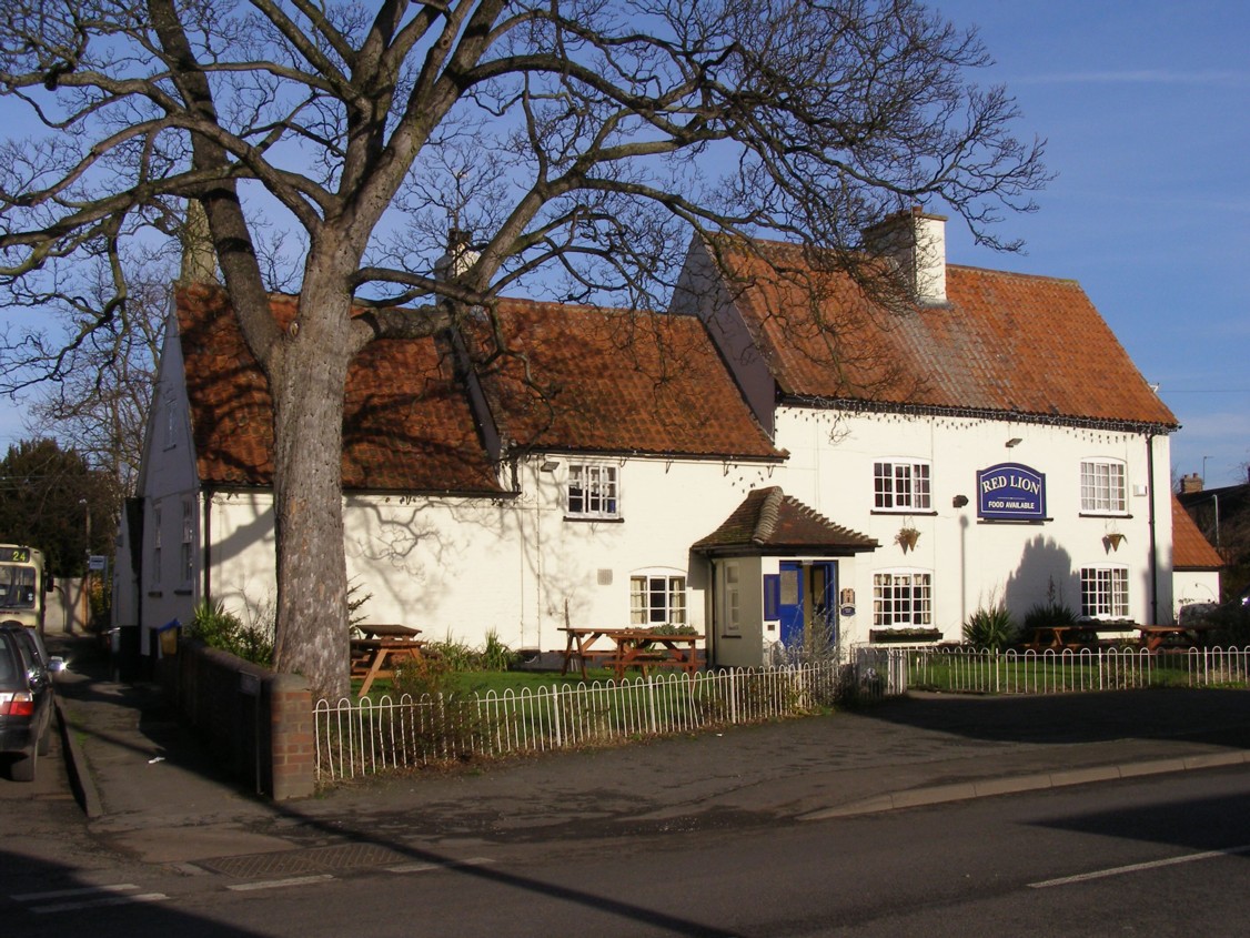
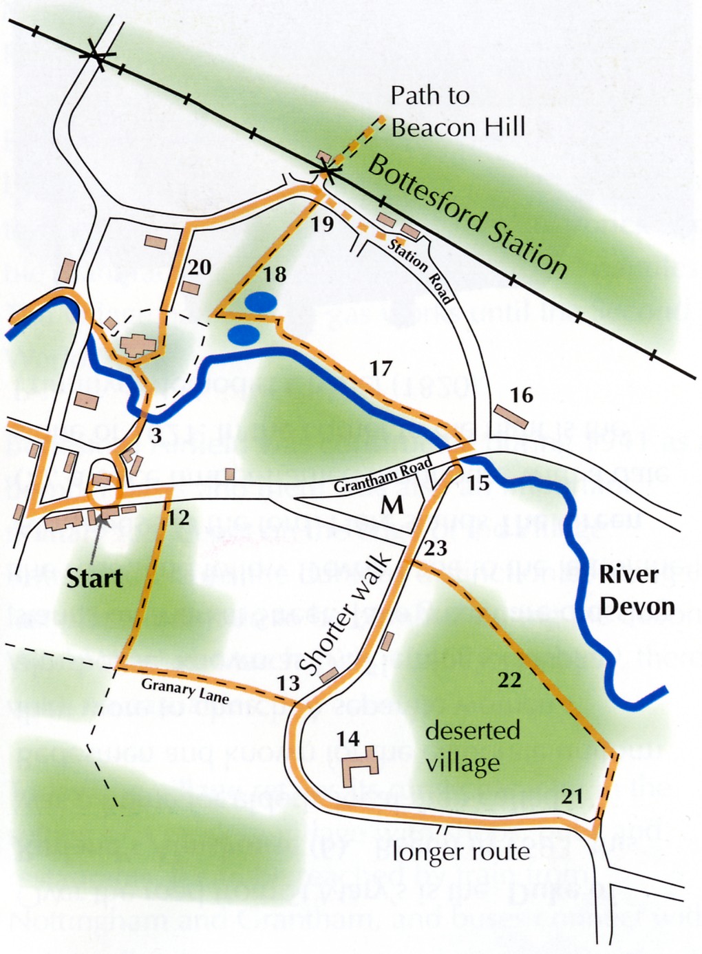
Our walk starts outside the 18th Century Red Lion Inn (1), in the centre of the village on the old A52, once the turnpike road from Nottingham to Grantham. Until Bottesford’s bypass was opened in 1989, this road was extremely busy, but now it is relatively tranquil. The inn car park occupies the location of the former village blacksmith and wheelwright’s workshop. The old boundary between Bottesford and the neighbouring hamlet of Easthorpe ran up the centre of the side street to the left of the inn (Church Street), which thus was not strictly speaking in Bottesford.
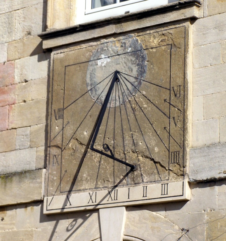
Take St Mary’s Lane, the ‘jitty’ or ‘ginnel’ which runs along the side of the Red Lion car park, then turn right into Church Street, passing Six Bells House (2), an alehouse before the 1st World War. Six Bells and the Wyggeston Cottages behind it, belonged to Wyggeston Hospital, Leicester, from 1518 till fairly recently. To the left, No.7 Church Street is a handsome Georgian house with a date stone of 1761. Behind the wrought iron gate is the formal garden of the Old Rectory, which dates from the 17th Century, but is now converted to comfortable retirement homes. The Rector used to welcome villagers to the May Day church fete in the gardens. The wall to the left of these gates is interesting in that it is built of local iron-rich limestone and may date from the 17th Century. A handsome sun dial can be seen attached to the pale limestone wall of the rectory itself.
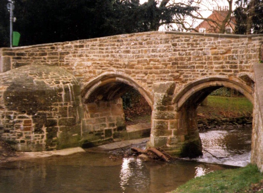
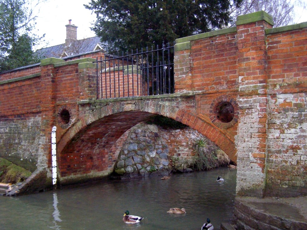
Pass Six Bells, to approach the parish church via Flemings Bridge (3). This arched sandstone footbridge takes its name from that of the rector, Dr Samuel Fleming, who had it built around 1620. The story told is that the Reverend Fleming, crossing the River Devon in spate, was swept from his horse and nearly drowned. To prevent future mishaps, he ordered the bridge’s construction. Alongside the bridge was a ford which was on the old route from Bottesford to Allington, still followed by the footpath which skirts the churchyard, passes the station and then crosses Beacon Hill, beyond which the old road runs as a path (often very muddy) within a strip of thick woodland.
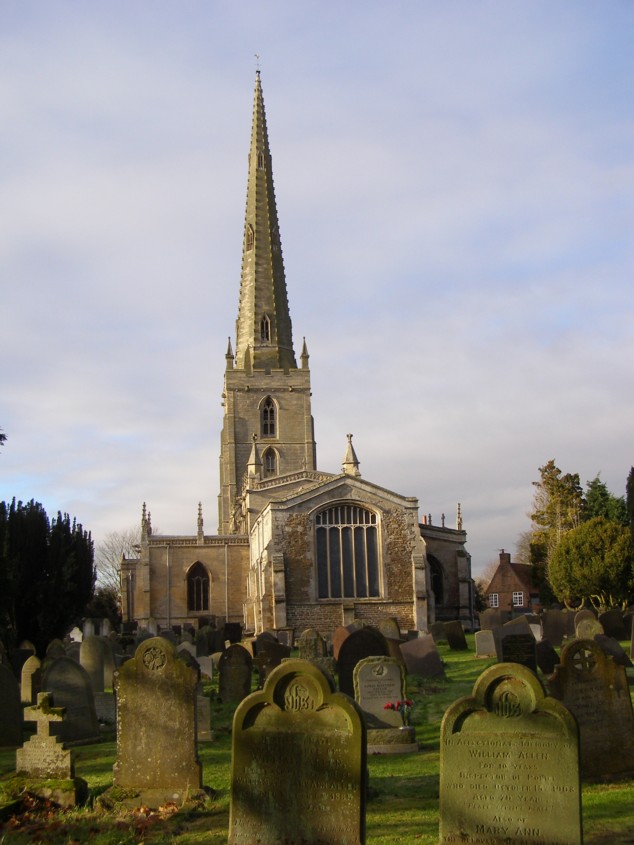
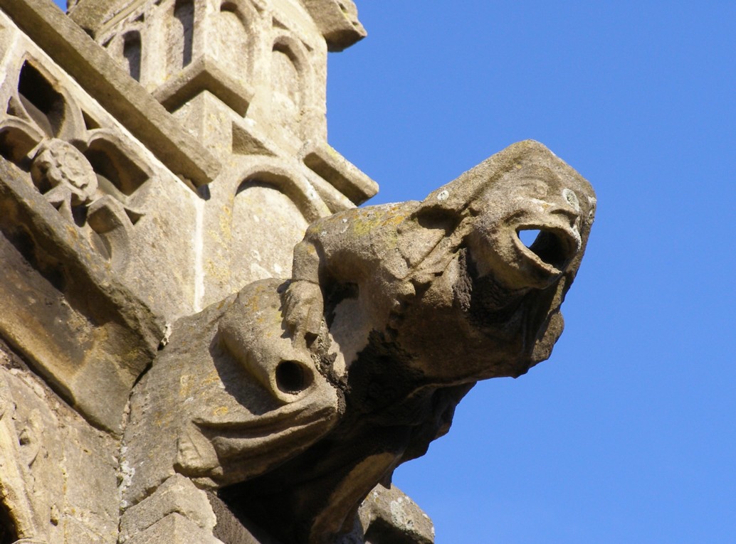
Go through the gateway into St Mary’s parish churchyard. The church (4) is well worth visiting in its own right, for its variety of architecture, its gargoyles, and particularly for the beautiful 17th and 18th Century monuments to the Earls of Rutland, including the famous ‘Witchcraft Tomb’, which refers to the sad story of the Witches of Belvoir. An excellent descriptive leaflet can be obtained on entering the church. St Mary’s extensive churchyard has over a thousand graves going back almost to the Civil War. Some commemorate local servicemen who died in the two world wars. Others are thsoe of airmen from Britain, Australia and New Zealand who lost their lives in the Second World War. Many other airmen from RAF Bottesford came down over continental Europe or on the flight back.
From the path leading to the south door of the church, the Old Rectory can be seen behind the trees on the opposite side of the River Devon, and had its own footbridge until the 1980s. Now, leave the churchyard by the path past the north door, below the tower, where stone plaques show heraldic symbols and the de Roos arms. On the right, you pass Providence Cottage (5), on which the date 1723 is picked out in its gable brickwork, though limestone masonry in the rear wall is probably older. The road fords the river via a raised surface, but is still apt to flood in periods of heavy rain, tempting drivers to run the gauntlet and in some cases become marooned mid stream.
Cross the road with care. A bend obscures your view of oncoming vehicles and there is not a footpath on the opposite side. Once safely over, you pass the Duke of Rutland’s Hospital(6), also known as the Bedehouse. Begun in 1593 by the Countess of Rutland, wife of the fourth Earl. It originally gave a home to six elderly local men, who were called Bedesmen and known for the elaborate uniform they wore to church. Hospital Farm in nearby Muston was established to provide the hospital with an income. A separate women’s hospital, known as Dr. Fleming’s Hospital, stands on Market Street.
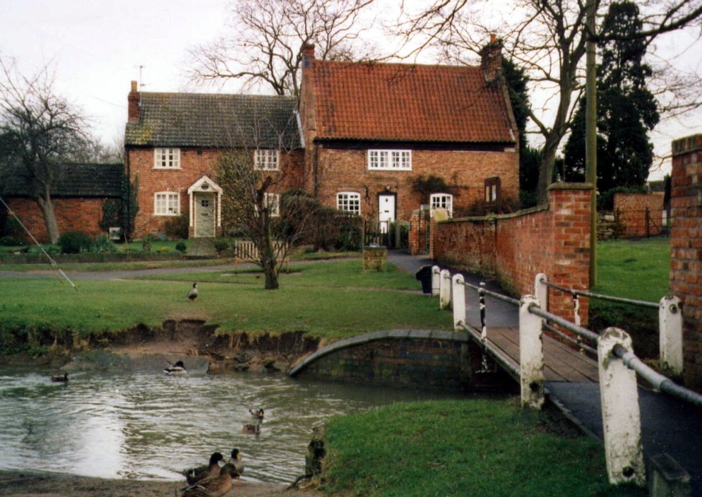
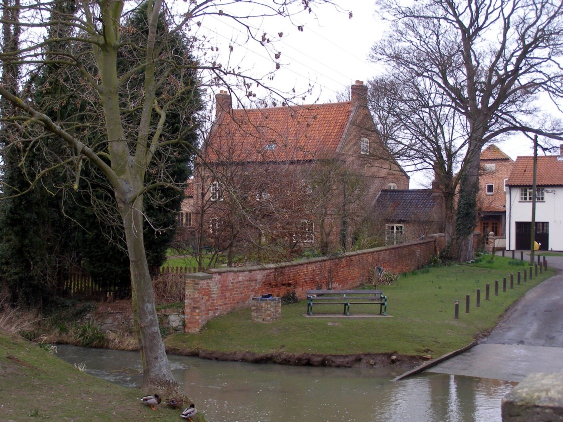
Follow Devon Lane, which runs alongside the diminutive river, to the left of the Bedehouse, to reach another ford by The Green. The patch of grass where the road turns to run down to the ford is all that remains of what must once have been a more extensive open space. Behind the wall alongside this grass stands a house called The Green (7), a once timber-framed farmhouse, with a date stone of 1621. To the right is a group of labourers cottages and then, tucked away in the corner, is the Primitive Methodist Chapel built in 1820 and still very active.
This ford is always flooded and can become deep and hazardous when the river level rises. Walkers should cross by the late 18th Century footbridge, stopping to admire the view of St Mary’s spire with the river and meadow in the foreground. It is the highest spire in Leicestershire (207 feet according to Pevsner, but more generally put at 210 feet). You then come to the junction with Chapel Street. On the left of this corner is the Old Bakery (8) , a shop until the 1950s. A faint date stone over the front door reads 1703. On the other side of Chapel Street, among the old cottages is the Wesleyan Chapel of 1845, now converted to apartments.
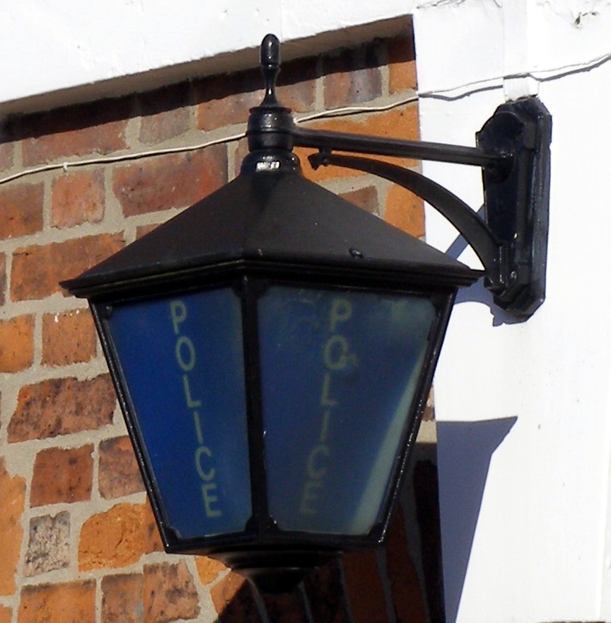
Follow Chapel Street to the left, and then turn right into Queen Street, named after Queen Victoria, which is now the main shopping street. On the left, part way down, is the Police Station with its blue lamp, built in 1842, one of the earliest purpose-built police stations in the country. Almost opposite is an old cottage with typical diapered brickwork, next to the site of Queen Street’s 19th Century windmill and later steam laundry. Further down is a malthouse, now a delicatessan and hair dresser’s, while opposite is the modern Co-op, which replaced a handsome Edwardian co-op that stood on the site. Next to the Co-op is the Baptist Chapel, whose modern entrance hides the small Particular Baptists chapel of 1789.
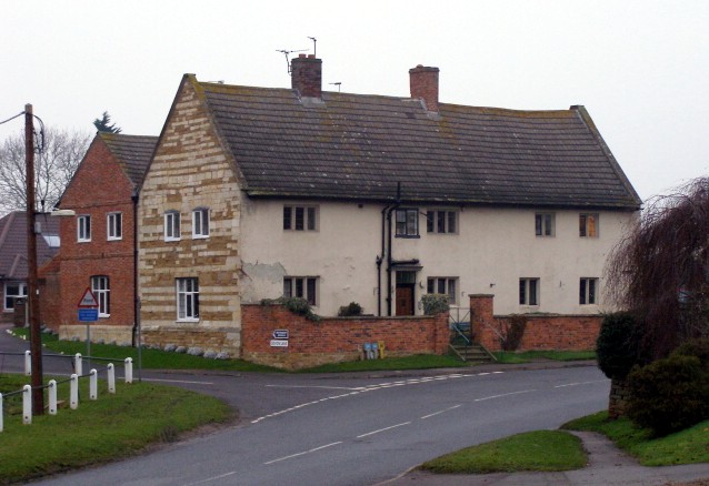
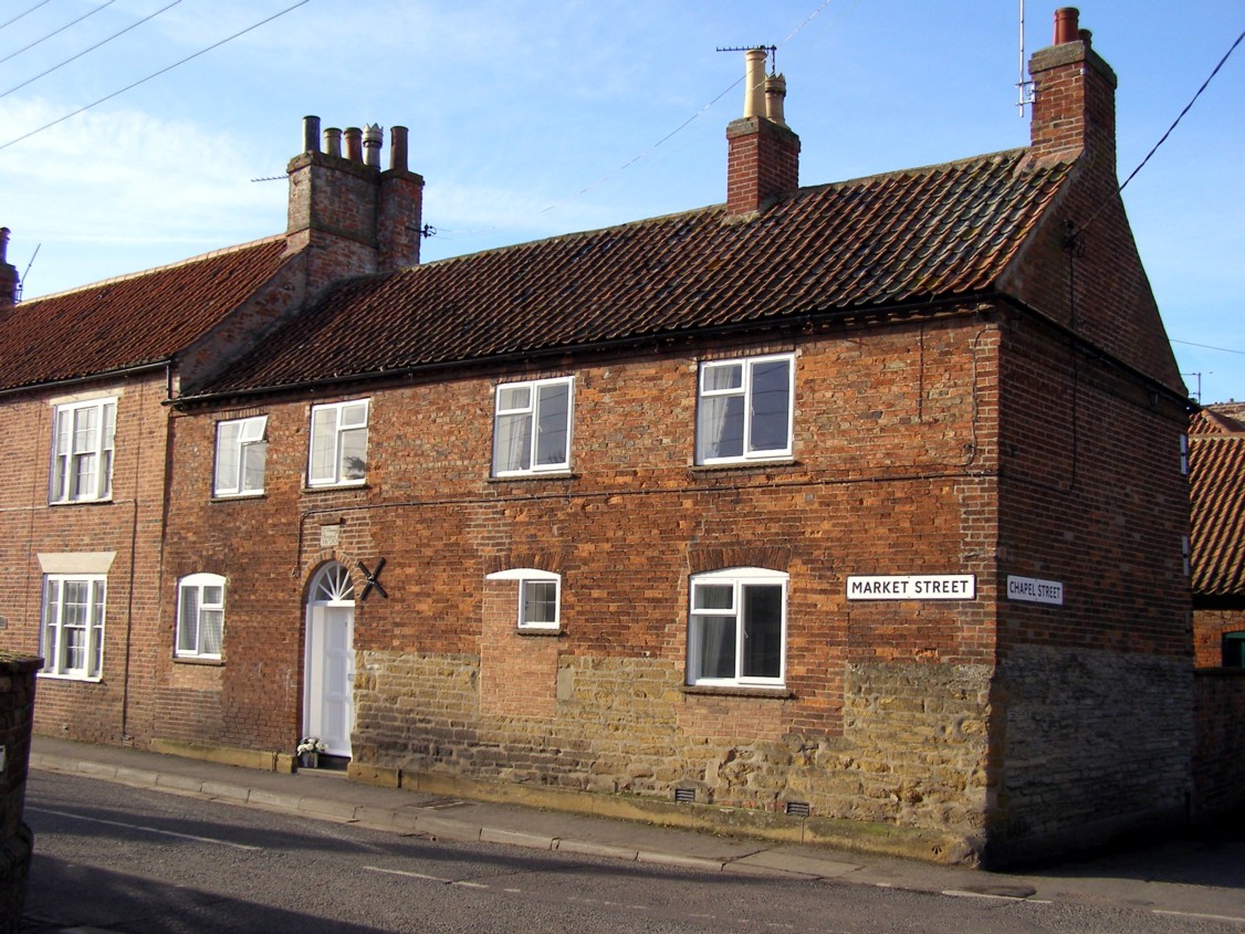
Return to Chapel Street, and turn right to reach the crossroads with Market Street. On the right hand corner stands Fleming’s Hospital (9) almshouse, the women’s counterpart of the larger Bedehouse. Though much altered, parts of the early stone walls remain, that facing Market Street being of the orange-brown ferruginous bulding stone known as the Marlstone Rock, while that on Chapel Street is of local pale grey, soft limestone. A plaque reading “Dr Fleming’s Hospital 1620” embedded in the 18th Century brickwork over the doorway commemorates its establishment. On the left hand corner of this junction is an old farmhouse, known as Glebe Farm, which was the home of the curate, not in the grand style of the Rectory, but probably comfortable enough.
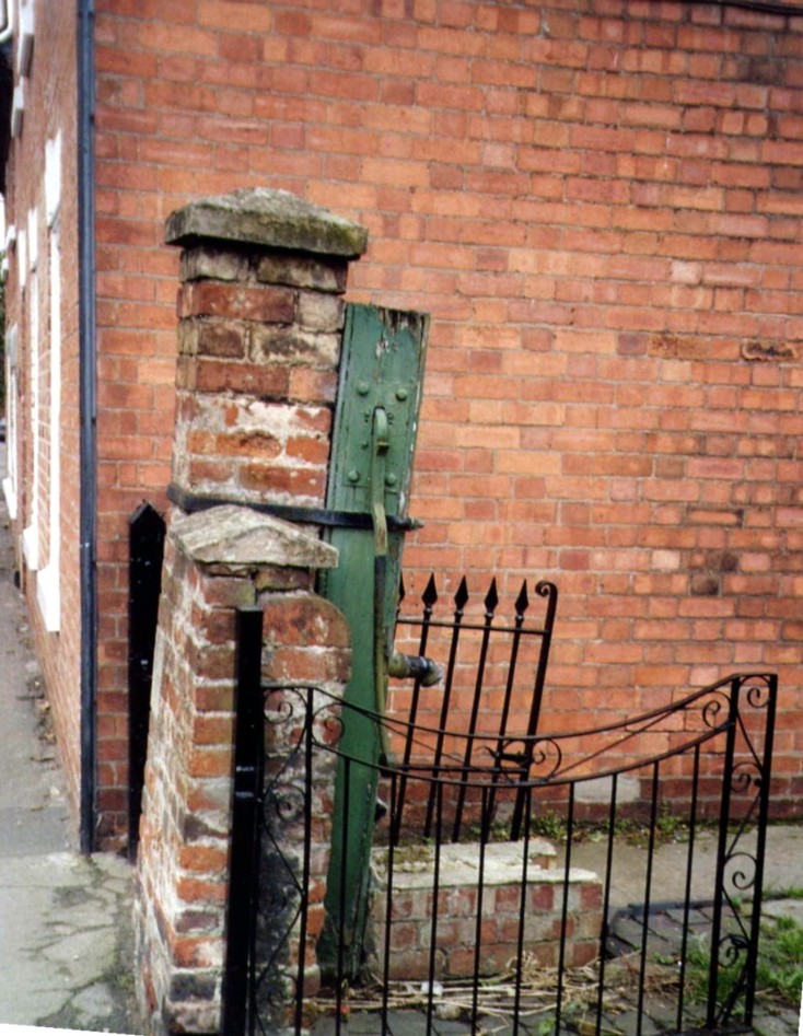
Next door is 18th century Craven House, and then an old close of labourer’s cottages, with its old hand pump. There used to be several such closes, in which rows of cottages were built around a small yard, with its communal water pump, in the early part of the 19th Century. Bottesford stands on an area of glacial sands which provided a ready supply of clean water. Well and pumps used to be numerous, and a small number remain (though not in use). Mains water did not reach the village until 1951. Further down Market Street stands an old coach house, now housing a small gallery and building society office.
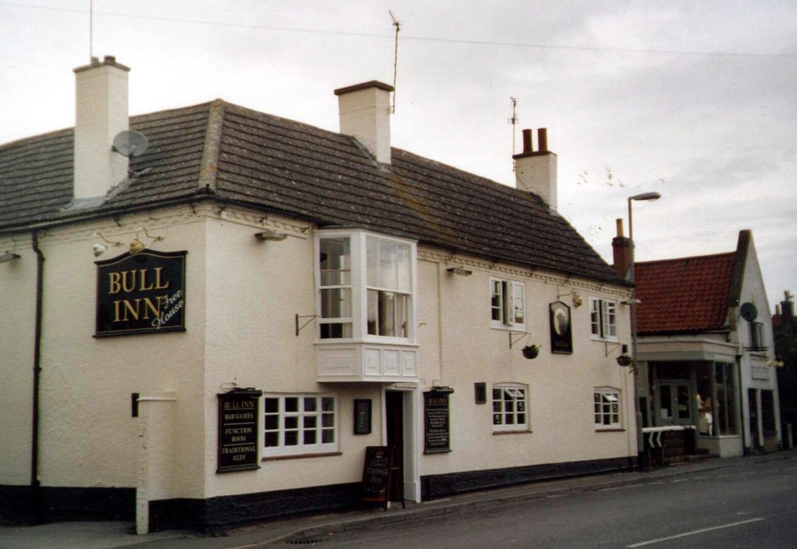
Market Street leads you to The Bull Inn (10). This was once a small coaching inn, and is probably the oldest pub building in the village. In the 1950s that landlady was Olga Healey, sister of the comedian Stan Laurel. Mementos of the visit of Laurel and Hardy to stay at the Bull in the winter of 1954-1955 are proudly displayed. The yard at the back of the Bull used to be the site of weekly auctions of livestock and other goods. Adjacent to The Bull Inn is the former Belvoir Coffee House, built in 1881 during the Temperance Movement by the Rector Canon Norman and his wife Lady Adeliza Norman. These were also responsible for the building and later expansion of the village school, whose buildings still stand on the opposite side of the road, now housing the village library and youth club.
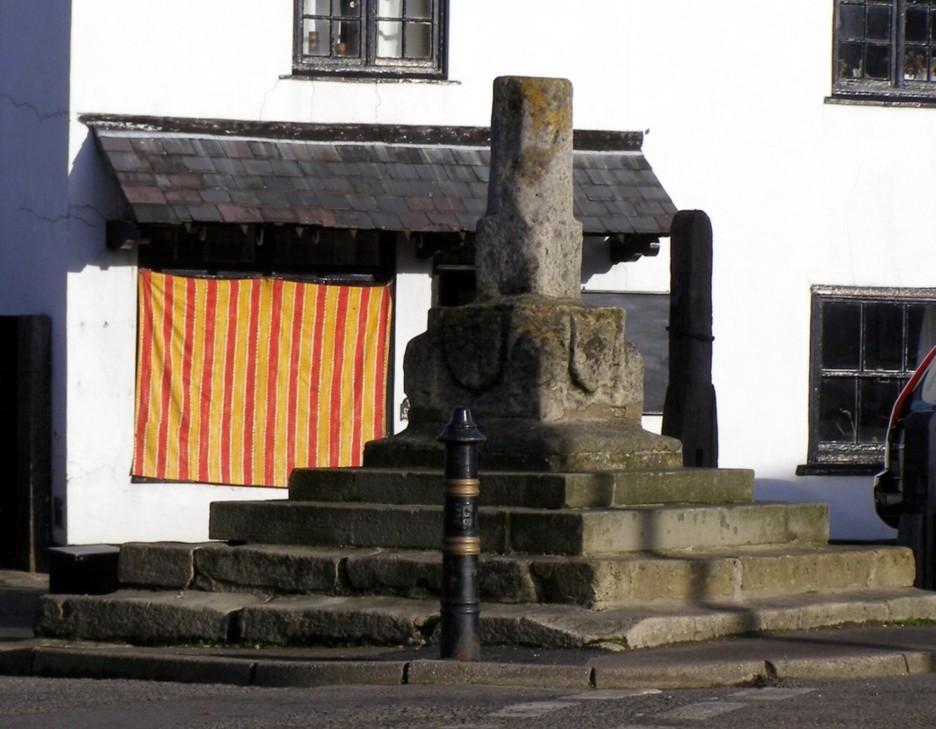
Turn left and cross Market Street (take care!) to the remains of the Fourteenth Century Market Cross and restored village stocks and whipping post (11). The four sides of the basae of the shaft hold shield panels carved with the coates of arms of local families, but these have become eroded and sadly illegible within the last 100 years. Across the main road is the handsome Victorian school building (1854). An 1897 Jubilee Clock looks down from the building which now houses the village library, Parish Room and Youth Club. After passing the stocks, you are back at The Red Lion (1). A good time to stop for a spot of refreshment before going on to the remainder of the trail.
To continue the walk , go eastwards along the main road from the Red Lion. Opposite are old part stone-built cottages, the 18th Century Daybell’s Farmhouse and a stone-built barn. Daniel Daybell, who died in 1930, was an internationally famous pig-breeder who won 174 prizes at the Royal Show. Cross the road (take care!), pass through the gate (12) and follow the path through the paddocks, with traces of ridge-and-furrow in adjoining fields, to a gate into the corner of the playing field.
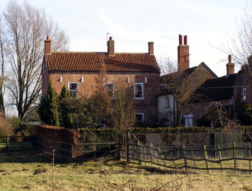
Now turn left along the leafy path, Granary Lane, to Easthorpe Lane (13). To the left are ornate Victorian farm worker’s cottages erected by the Duke of Rutland’s estate. Opposite is the group of buildings known as Easthorpe Manor (14). This is a medieval or even pre-medieval site, though no original buildings remain above ground. The almost circular area of land is surrounded by the remains of a moat.
Shorter route. At this point you can go to the left, passing the Millennium Green (M) to the old main road. Cross this (again, with care!) and walk a few yards to the right, crossing the modern bridge over the River Devon, to the junction with Station Road (15). In the trees a short way upstream is Bottesford water mill, now a private house (no access). On the opposite corner is a late 18th Century terrace, Bunkers Hill Cottages (16), named after the battle in the American War of Independence. One carries the words “Erected for the Poor, 1779”. In 1851 they housed 17 families with 71 people.
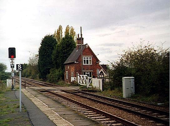
Retrace your steps and take the footpath beside the River Devon (17) past modern houses and then between the ponds, usually occupied by noisy flocks of geese and ducks. At the junction with the footpath from the church, turn right and ascend the path (18) between paddocks to reach Station Road (19). To your right is what remains of Victorian station buildings erected in 1850 by the Nottingham architect T.C. Hine for the Ambergate Railway.
A little closer is the later Station Master’s house and opposite a level crossing keeper’s cottage: both examples of Victorian workmanship. If you wish you can take the footpath carefully over the level crossing to the top of Beacon Hill (10 minutes) to enjoy the wide view of Bottesford and the Vale to Belvoir Castle.
At the end of the field path (19) turn left along Station Road until you come to Church Lane on the left. Follow Church Lane with on your left converted buildings of Church Farm, formerly the Dorking Poor Farm (20), which once provided twice-daily milk deliveries to the villagers. The handsome Victorian building to the right is Beckingthorpe House. When you reach the churchyard gate, turn left and then continue to the right long the riverside path, skirting the churchyard to cross back over Fleming’s Bridge, and so back to the Red Lion.
Alternatively , at point (13), if you have stout footwear and are prepared to clamber over two stiles, turn right and follow the road around the curved perimeter of Easthorpe Manor, passing old cottages in the right.
The road reaches a small green where a public footpath leads to the left (21) while the road itself bears right past Corner House, once a row of old cottages. Take the footpath and then, after 100 yards or so, cross a stile into the large field on the left. Keep dogs under strict control: the field often has cattle in it.
The path leads diagonally over this large rough field, crossing a series of mounds and marshy hollows that mark the site of a medieval village (22) (Scheduled Ancient Monument) that was abandoned at some point, perhaps when the Black Death afflicted the area in the 14th Century. A second stile leads up and out on to the road (23). Turn right and rejoin the route already described past the Millennium Green.
We hope you enjoy your exploration. Although this booklet describes a tour largely confined to Bottesford, the parish also includes the small villages of Muston and Normanton, both of which have their share of old farmhouses and cottages. Muston also has a beautiful medieval parish church dedicated to St. John the Baptist, a late Georgian rectory, the remains of a medieval market cross and earthworks on the site of a medieval glebe farm.
For more information we recommend “The Book of Bottesford”, by Michael Honeybone (the 2nd edition, 2002, may still be in print, and copies can be found in local libraries).
Download:-


No Comments
Add a comment about this page