Maps of Village History
Digital copying at the British Geological Survey
By Neil Fortey


History Revealed
Historic maps reveal the villages at different times in their history. The Living History Project is fortunate in having access to a number of high quality maps dating from the Enclosure of Bottesford in 1770-71 to the major sale of land and buildings by the Duke of Rutland’s estate in 1920.
Generous support from the British Geological Survey
Copies of these maps can be used to allow study and display of these rare and often delicate documents, safeguarding them from unnecessary handling and possible damage. Electronic digital have been made with the generous support of the British Geological Survey at Keyworth, Nottingham. This national scientific organisation, part of the UK’s Natural Environment Research Council, is using sophisticated reprographic equipment to build up a digital archive of its vast library of maps and plans. In keeping with its Public Understanding of Science policy, it granted the Bottesford Living History Project a couple of day’s use of its facilities. The results form part of the project’s research archive.
How It Is Done
One of these days was used to make copies of eight historic maps belonging to Mike Saunders and Peter Topps. These maps are up to two feet wide, far too large for common PC scanners, but they fit easily into the 54-inch wide scanner used at Keyworth. Printing the scanned images is likewise impossible using normal computer printers, but BGS has jumbo-sized inkjet printers that breeze through the job. The printed copies have been encapsulated in clear plastic to protect them, and are ready for display at the project’s exhibitions. To round the job off, BGS gave us electronic copies of the maps on CD. The images shown on this page are selected parts of these copies.
The maps selected for copying were:
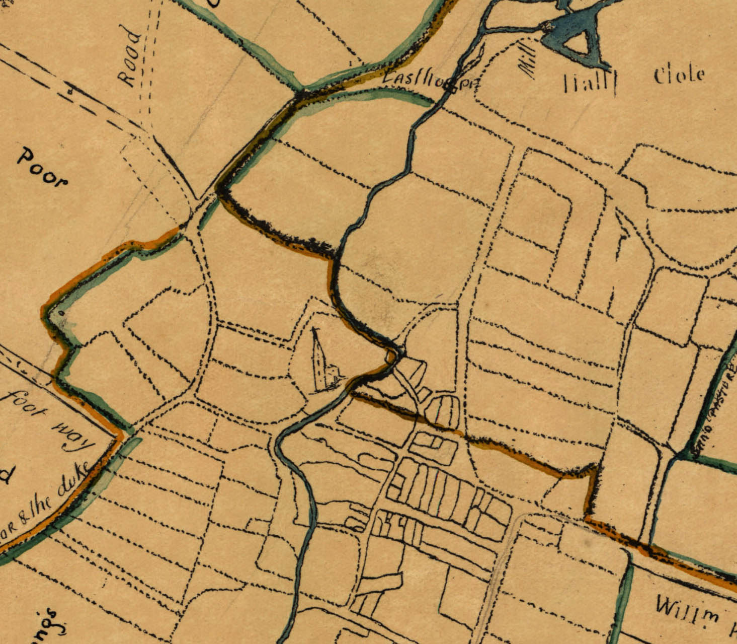
Map 1. Bottesford Enclosure Map of 1771 – a copy of the detailed, large-scale map made by the surveyor W.Fillinghane for the purpose of enclosing the open fields of the old farming system. Almost every parish in the Midlands underwent Enclosure during the latter part of the 18th Century and first half of the 19th Century, each requiring its own Act of Parliament.
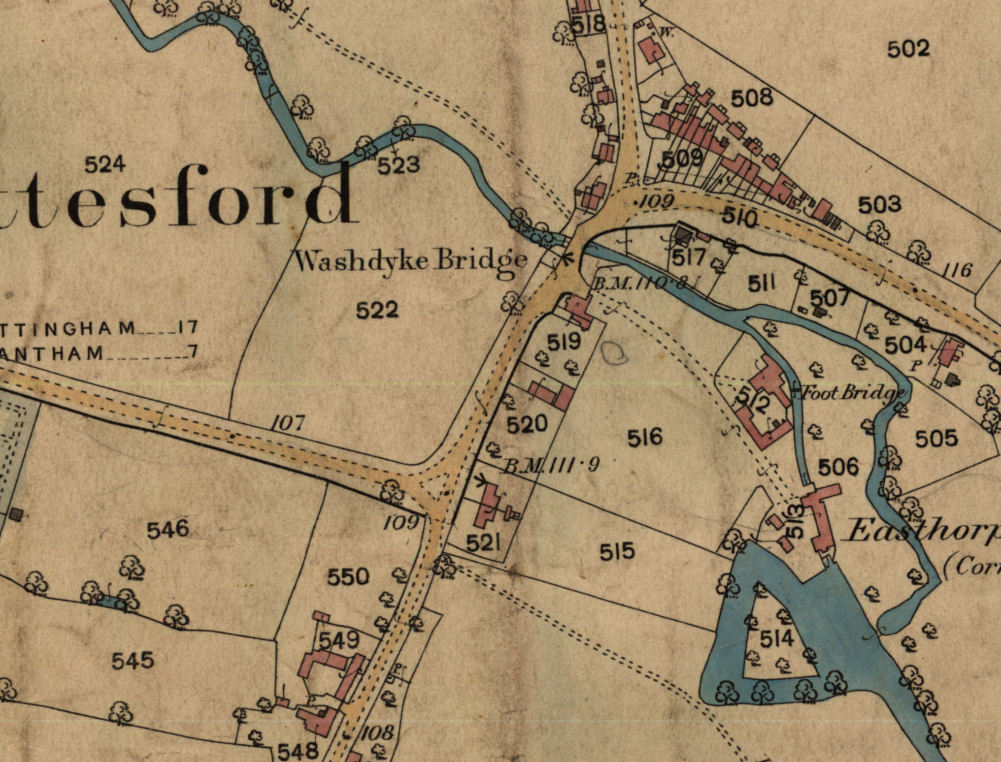
Map 2. Bottesford and Easthorpe, Ordnance Survey, 1884 – a marvellously detailed map of Bottesford and Easthorpe. The map has been damaged and part of its western extent lost, so that it covers only as far west as Pinfold Lane. The scale is 1:2500 (one inch on the map represents 208.33 feet on the ground, 25.344 inches represents one statute mile).
Map 3. Normanton, Ordnance Survey, 1884 – an extremely detailed map, again at the scale of 1:2500 (one inch on the map represents 208.33 feet on the ground, 25.344 inches represents one statute mile).
Map 4. Redmile, Ordnance Survey, 1884 – another extremely detailed map, this at the scale of 1:2500 (one inch on the map represents 208.33 feet on the ground, 25.344 inches represents one statute mile).
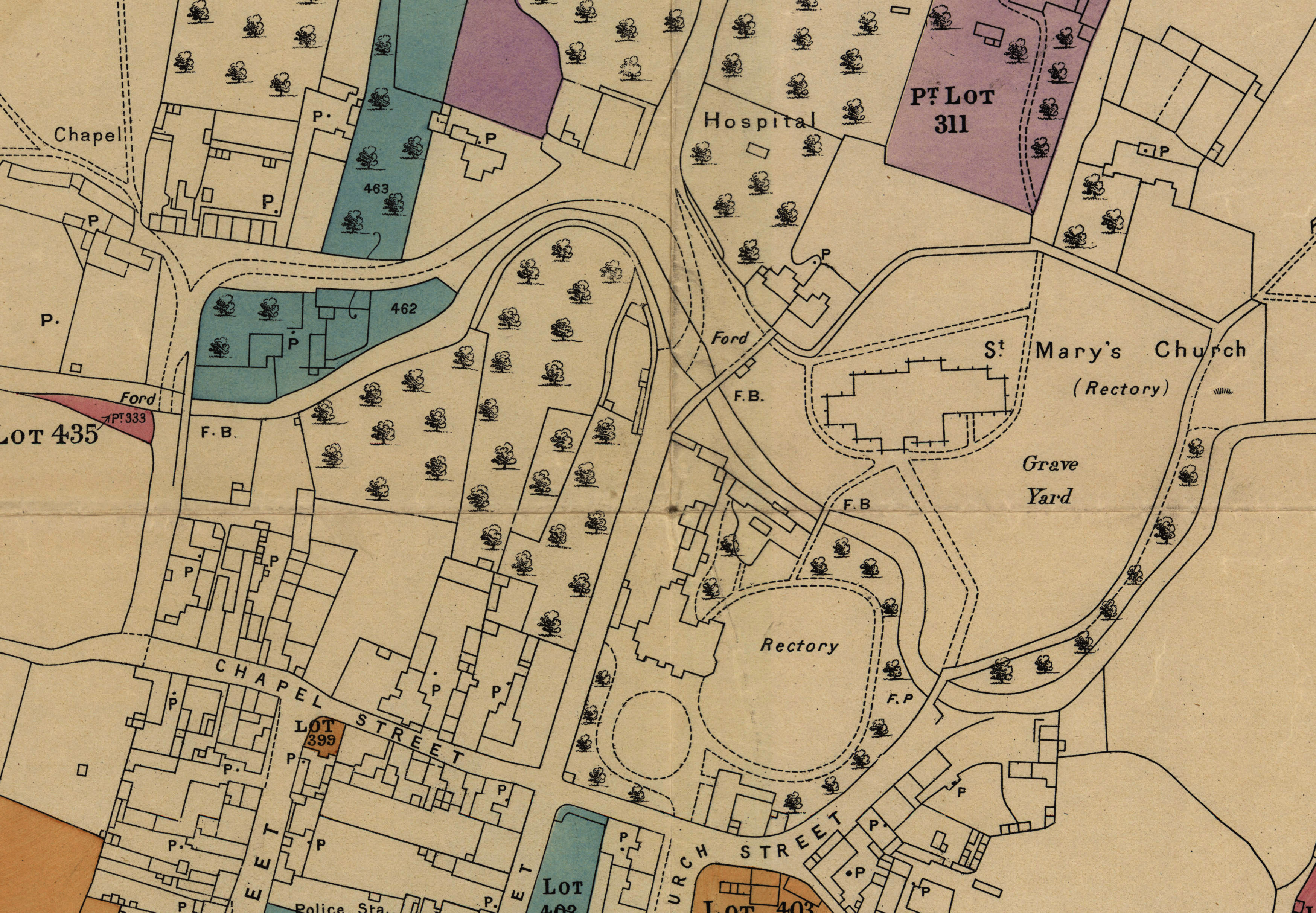
Map 5. Duke of Rutland’s 1920 Plan No.9, Bottesford and Redmile – one of the set of splendidly detailed and clear maps based on the Ordnance Survey’s maps, that were provided to prospective buyers. Nos 5 to 8 are large scale maps, though the exact scale is not stated on them.
Map 6. Duke of Rutland’s 1920 Plan No.10, Bottesford – one of the set of splendidly detailed and clear maps based on the Ordnance Survey’s maps, that were provided to prospective buyers.
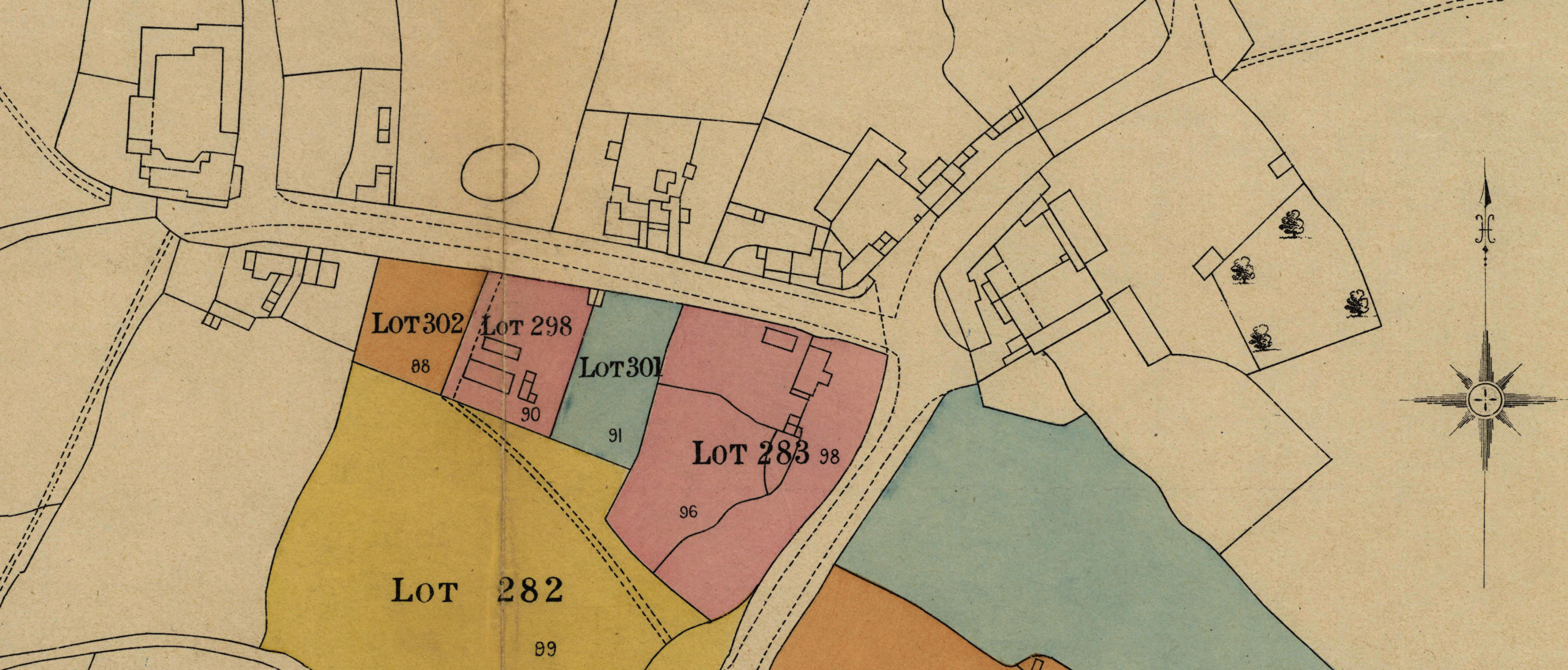
Map 7. Duke of Rutland’s 1920 Plan No.11, Easthorpe – one of the set of splendidly detailed and clear maps based on the Ordnance Survey’s maps, that were provided to prospective buyers.
Map 8. Duke of Rutland’s 1920 Plan No.12, Muston – another of the set of splendidly detailed and clear maps based on the Ordnance Survey’s maps, that were provided to prospective buyers.


Comments about this page
Im not clear from the website whether you have the entire village covered by these scans – and if so is it possible to log on and pan over them?
Hi Richard, You have raised a good point. The maps on this page are indeed crops from large maps that cover the entire village. However, the full-village maps create very large digital files which are not practicable to display at present. We could reduce them in size, but the results would be pixelated images of poor resolution. Also, we have no facility to pan over images at present. So I’m afraid we are unable to meet your wishes for the moment.
Add a comment about this page