Muston Heritage Trail
A tour of the historic village
By Neil Fortey
This is a companion to the Bottesford Heritage Trail which is also on this website. Both are updated versions of the leaflets which can be obtained in the villages and nearby libraries (free, as long as stocks last). The leaflets can also be downloaded as pdf files using the links at the bottom of the respective pages.
We wish to thank Mr Mike Saunders, Miss Sue Dunsmore, Mrs Margaret Langton, Miss Norah Parkin and Mr David Wright for contributing their knowledge and pictures to this leaflet.
Introduction
Muston (pronounced ‘Musson’) is a peaceful, secluded village close to the busy A52, at the northern tip of Leicestershire in the Vale of Belvoir. This area has for centuries been known for its wheat, wool and dairy produce. The village retains its distinctively rural character, and in the past had its own Rector, Chapel, shops, school, post-office and sports team which challenged Bottesford and other Vale of Belvoir villages in friendly rivalry. Muston and Bottesford were combined into a single parish in 1936, but are physically separated at the concrete barrier created by the A52 trunk road. A century ago, Muston was a busy place where most men worked on the land, on the railways or in the nearby ironstone quarries. There are still working farms in the village, which has become a tranquil place ‘off the beaten track’. Visitors can refresh themselves at the Gap Inn or the Forge Tearoom before walking through the village and then out into the surrounding countryside with its canal and disused railway footpath. In spring, a visit to Muston Meadows National Nature Reserve is recommended.
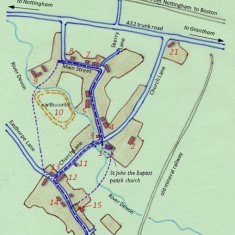
Our route (see map 1) starts at Muston’s St John the Baptist parish church.
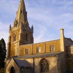
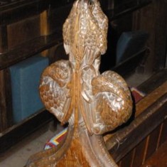
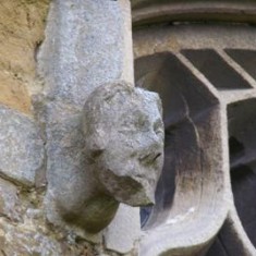
St John the Baptist* stands at the heart of the village, a medieval church built of local ironstone (Marlstone Rock) and Lincolnshire limestone (1). The site is beside the bridge over the River Devon which links the two parts of the village. St John the Baptist is entered through its ornate North Porch. The church has a handsome medieval carved font and decorative pew ends which originally came from Belvoir Priory. Memorials include plaques to past rectors including Dr Robert Sanderson (Chaplain to Charles I) and to Sarah, wife of the poet Crabbe. Headstones in its churchyard date back to the 17th century, and there are also graves of 20th Century servicemen and War Memorial. There is an excellent leaflet describing the church in detail (Note: * denotes Listed Buildings).
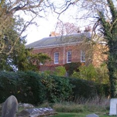
Next to the church is the handsome mid-19th century Glebe House* (2) behind an avenue of horse chestnuts, built during the rectorship of George Gordon to replace the building that had housed George Crabbe and his successor Henry Byron, uncle of poet Lord Byron.
From the church, make your way along Main Street opposite.
The Old Forge tearoom (3) is on the site of the former village blacksmith’s and wheelwright’s workshop. The bus shelter on the adjacent grass verge by the bridge on Church Lane sometimes raises a smile, because no bus service has ever passed it, the bus route turning along Main Street. From here Main Street runs close to the picturesque course of the River Devon.
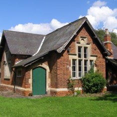
On the other side of the junction of Main Street and Church Lane, Brinsley House is a modern building on the site of what was a terrace of seven workers’ tenements where 45 people lived in 1851. Next to this is the School building built in 1875, now the village meeting room (4), and next to that is the somewhat older school master’s house, with its octagonal chimney stacks. Then come two 1930s council houses before Cherry Cottage, which, like many of the older village houses, was once a row of small cottages. In the 19th Century the village population was much larger than today, most of them agricultural labourers and their families. The Duke’s Cottages, opposite (5), was once at least four cottages built by the Duke of Rutland. Next comes No.17, another example of a brick cottage partly of 18th Century construction, as suggested by the small 2.25 inch thick bricks making parts of its walls.
At this point Main Street bends and leads away from the river and up to the junction with Skerry Lane. This is now a cul-de-sac, but it used to head out across the old main Grantham road and into the fields around Debdale Farm. The name of this old lane may refer to the grey limestone or ‘Skerry’ that was once dug out of the fields and was used for building and lime production.
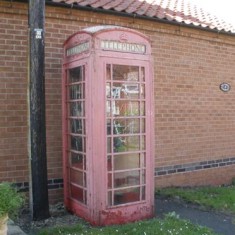
At the junction, Main Street itself turns very abruptly and there is a small patch of grass which may once have been a village green (one of two in Muston). No.32, on the right here, is a C19th farmhouse that was probably once a terrace of cottages. On the left of Skerry Lane is a traditional red telephone kiosk, worth mentioning as a survivor of a bygone age: in recent cuts neighbouring Bottesford had its kiosk removed. If you need to make a call from a call box, come to Muston and all will be well!
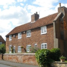
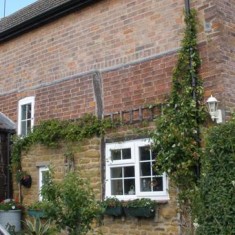
Leaving Skerry Lane to the right and passing along Main Street, No.34 (6) is an old cottage with Mid-18th Century brickwork, distinguished by the small size (2 and a quarter inches thick) of the individual bricks, in the lower part of its front wall. This was originally a terrace of three cottages, one of which was once used as the parcels delivery office. Like many village cottages, they had gardens where the occupants grew fruit and vegetables and also kept a pig. An old sty can be glimpsed at the rear of the garden. The terrace was formerly joined to the farm house that occupied the corner of Skerry Lane, where a new house now stands, and the chimney of the old farm house can still be seen, against the gable of No.34.
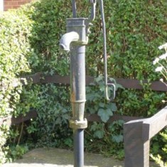
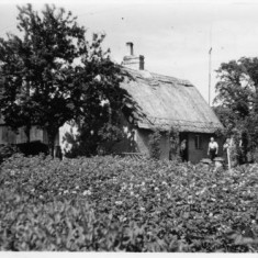
No.38 (7), ‘Hospital Cottage’, shows four stages of construction: ironstone, masonry and remnants of timber framework which suggest a 17th Century origin. There is early brickwork in the gable facing the road, but the upper brickwork was added during creation of upstairs bedrooms. The building, which is still divided into two cottages, was thatched until the severe winter of 1962/3. Opposite, in a garden hedge, is an old village pump re-installed some four years ago, though this apparently not its original location (so don’t expect a refreshing drink if you try to work it!).
After No.38 come two modern houses built on the site of the village pond, as confirmed by the name of one of them, ‘Pond’s Edge’.
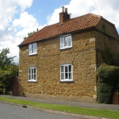
No.44 (8), ‘Stonehouse’, is a small farmhouse whose front part has complete ironstone walls and ashlars but with later windows. Its pantiled roof has hipped gables. This appears to be an old building in an unusually complete state of preservation. However, it is not shown on the Muston Tithes Map of 1849, so there is some question as to its true age (we would be delighted to learn more about the age of this building).
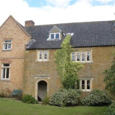
Stonehouse stands at the corner where Main Street turns sharply right. Opposite is Corner House Farm, its outbuildings converted to modern houses. Set back on the left is Hospital Farm* (9), so named because it was owned by the Earl of Rutland’s Hospital at Bottesford. The oldest part of this handsome building is a 17th Century stone farmhouse, with stone window frames and carved oval panels mounted high on the gable. An C.18th brick range adjoins this at right angles and is the part of the house that can be seen from the field on the opposite side of the River Devon. The barn displays the date 1807 in its brickwork, marking the prosperity of farmers following enclosure of the parish.
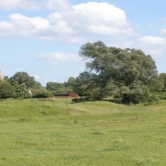
The River Devon flows behind Hospital Farm, and on the opposite (southern) bank is pastureland in which are ditches and banks (10) on the site of a probable pre-Reformation monastic grange farm (A Scheduled Ancient Monument.). Nichols reported, in The Antiquities of Leicestershire (1790), that it was owned by Olveston Priory (near Stroud in Gloucestershire) Medieval ridge-and-furrow can be examined in the fields up the gentle slope from the earthworks.
The site is reached by a public footpath which passing to the left of the modern barns at Hospital Farm then crosses a concrete footbridge over the River Devon. Please be careful not to disturb the cattle that often graze around here.
Return to the parish church and follow the lane southwards, crossing the bridge over the Devon.
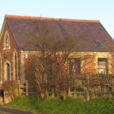
On the left is the small United Methodist Free Church of 1879 (11) (now a private house), facing the parish church across the stream. This is not the first Methodist Chapel in Muston, as records show that the Methodists became established in the village in the first decade of the 19th Century. The chapel was built in fields south of the river, which still separate Muston into two parts linked by Church Lane. The parish church stands by the bridge where this lane crosses the diminutive river which in medieval times was probably marshy and liable to flood. The first part of the tour was through one part of the village, along Main Street from the church to Hospital Farm. The second part examines the other part of the village, developed along Woolsthorpe Lane, an ancient route from Bottesford through Muston and on to Woolsthorpe and beyond. A series of farms extends along the southern side of the road, with cottages, the green and market cross on the northern side.
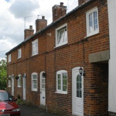
On the left of Church Lane where it joins Woolsthorpe Lane is Post Office Row (12), a terrace or tenement of labourer’s cottages, one of which housed the village shop and post office. An old photograph has shown that the appearance of these houses has changed little for more than a hundred years.
At the junction with Woolsthorpe Lane, an old brick farm cottage (13) displays two stages of brickwork, possibly late C.18th and early C.19th. Facing it across Woolsthorpe Lane are barns and outhouses of ‘Peacock Farm’*. Many farms in the area have seen their buildings and yards converted to private housing, but this still keeps their former appearance, its ironstone and brick barns and sheds extending back from the road. The brickwork in the barn at the corner of the roads may well be 18th Century, and the stonework may be older still.
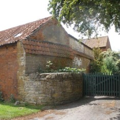
More possibly C.17th ironstone walling can be seen by the gateway adjoining ‘Spray Farm’. With its pantiled top, this is said to have been part of a cottage or farm house, though today it forms the gable of a brick barn. The name comes from the Spray family who had this farm in the 19th Century. Peacock Farm takes its name from the emblem of the Dukes of Rutland.
There used to be at least eleven working farms in Muston in the 19th Century, the larger farms employing as many as fifteen people. Today, many have been converted to residential use, but farming remains a major part of Muston. Moreover, in the past most houses had gardens where vegetables and fruit were grown, and poultry and pigs were raised, so that Muston people enjoyed a degree of self-sufficiency. The village was a hive of rural activity, very different from today.
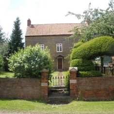
Next is a handsome stone-built farmhouse, standing discretely back from the road, behind its wall and wrought iron gate (14). The building material suggests an early building, though the style and setting have the feel of an 18th Century gentleman’s residence.
Then comes the third farm in this series, No.6 Woolsthorpe Lane, which has a brick built farm house, probably 19th Century. Further along Woolsthorpe Lane, the last house on the southern side is Padget’s Farm, once the post office.
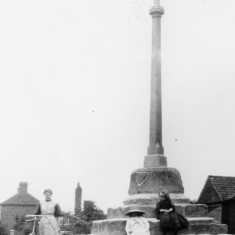
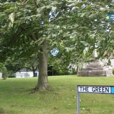
Back-tracking slightly, opposite Peacock Farm is ‘Branston House’, a symmetrical brick villa probably of late C18th or early C19th age. Then the small leafy village green (15) extends back from the street. May Day celebrations used to be held here, and there may have been a small market. At its centre is a Victorian stone cross mounted on the plinth of the medieval village cross*. At the back of the green is an old cottage which once was divided into four small dwellings. To its right is Holly Cottage*, a low-roofed, stone-built cottage of considerable age and recently restored. The path leading down from the rear of the green crosses the river via a footbridge and then crosses the paddocks back to Muston church.
On the right hand corner of The Green is made up of another old terrace now converted to one house. There was once a blacksmith’s shop here. Continuing along Woolsthorpe Lane, No.15, ‘Glen Cottage’, has ironstone walling and also an area built out of flat pieces of the local grey limestone. The ironstone is an iron-rich oolitic limestone, known to geologists as the Marlstone Rock, that was quarried from the hills that bound the Vale of Belvoir to the south, surmounted by Belvoir Castle. Today it is hard to say where the quarries were, especially as the same area was more recently extensively worked as a source of iron for the iron and steel industry. Interestingly, an extension of this building is also faced in ironstone, but this is modern, demonstrating the continuing use of this material up to the present day.
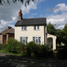
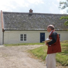
At the end of Woolsthorpe Lane is ‘Thatch Cottage’ (16), originally a thatched single-storey farmworker’s dwelling, but thatched no longer. The lane at the side of this house goes to an old farmhouse called Calcraft’s farm after the long-established family who lived there. These are the last village houses in this direction. Woolsthorpe Lane continues towards the Grantham Canal, and an old green lane, now a bridle track, heads to the right towards Muston Meadows nature reserve, as indicated in the final part of this tour.
Further afield
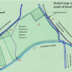
The southern part of Muston parish is crossed by the disused Grantham Canal (17) opened in 1798, whose tow-path provides a delightful walk. Belvoir Castle dominates the skyline. Most of the village and surrounding land formed part of the Duke of Rutland’s estates, until the sale of 1920.
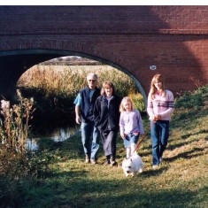
Woolsthorpe Lane crosses the canal via a restored humpbacked bridge, but un-restored Longore Bridge (18) stands a short way westwards along the canal. Beyond this the towpath reaches the modern bridge at Muston Gorse Farm (19). A canal basin was constructed here at the foot of the Belvoir Castle tramway, arguably one of the world’s first railways. Opened in 1815, the line remained in operation until the early years of the 20th century, horse power having given way to steam. A short length of rail and wagons is preserved at the terminus in the cellars of Belvoir Castle.
Muston Meadows National Nature Reserve (20), administered by Natural England, is easily reached from Woolsthorpe Lane or the canal towpath. A rare example of untreated meadowland in the Midlands, it must be visited with care not to trample the rare flora or otherwise damage the site.
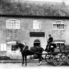
The Muston Gap pub* (21) (formerly the Wheatsheaf) is a mid eighteenth century building, though it contains a strapwork over-mantle from about 1650,suggesting there may have been an earlier building on the site. It is located where Church Lane met the turnpike (now the A52).
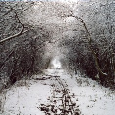
The disused mineral railway (22) was constructed in the 1880s to carry iron ore from the quarries around Harston. The route runs through wooded cuttings and embankments east of Muston church and Rectory, then southeast wards towards Woolsthorpe. South of Muston, it forms part of the Sustrans National Cycling Network.
Useful information
FOOTPATHS: Visitors can take advantage of a network of footpaths around the village displayed on Ordnance Survey Explorer Maps 260 (Nottingham Vale of Belvoir) & 247 (Grantham). The village roads are mostly quiet and safe to walk on with due care, but the A52 itself is strictly for motorists.
WALKING FROM BOTTESFORD: Visitors are recommended to make their way to Easthorpe and then follow Muston Lane, crossing the A52 bypass with great care, and continuing to Muston, a total walk of about a mile.
REFRESHMENTS and TOILETS: The Gap Inn pub, Old Forge Tearoom.
PUBLIC TRANSPORT: The No.6 bus from Grantham to Bottesford serves Muston once a day.
PARKING: There is no public carpark, but cars can be parked with discretion on the village streets. We suggest parking on Church Lane by the parish church.
ACCOMMODATION: Information about places to stay in the area can be obtained from Tourist Information Office at Grantham Town Hall (01476 406166) or from website www.valeofbelvoir.co.uk .






Comments about this page
Many, many thanks for this. Just gone over it with my mother, nee Betty Patricia Donger, born in 1920 at peacock Farm.
Thank you for your kind feedback, very much appreciated. We would welcome any information about your mother’s childhood and life in Muston. We are currently collecting stories of life in Muston that were passed down from the generation who served in the 1st World War.
Add a comment about this page