
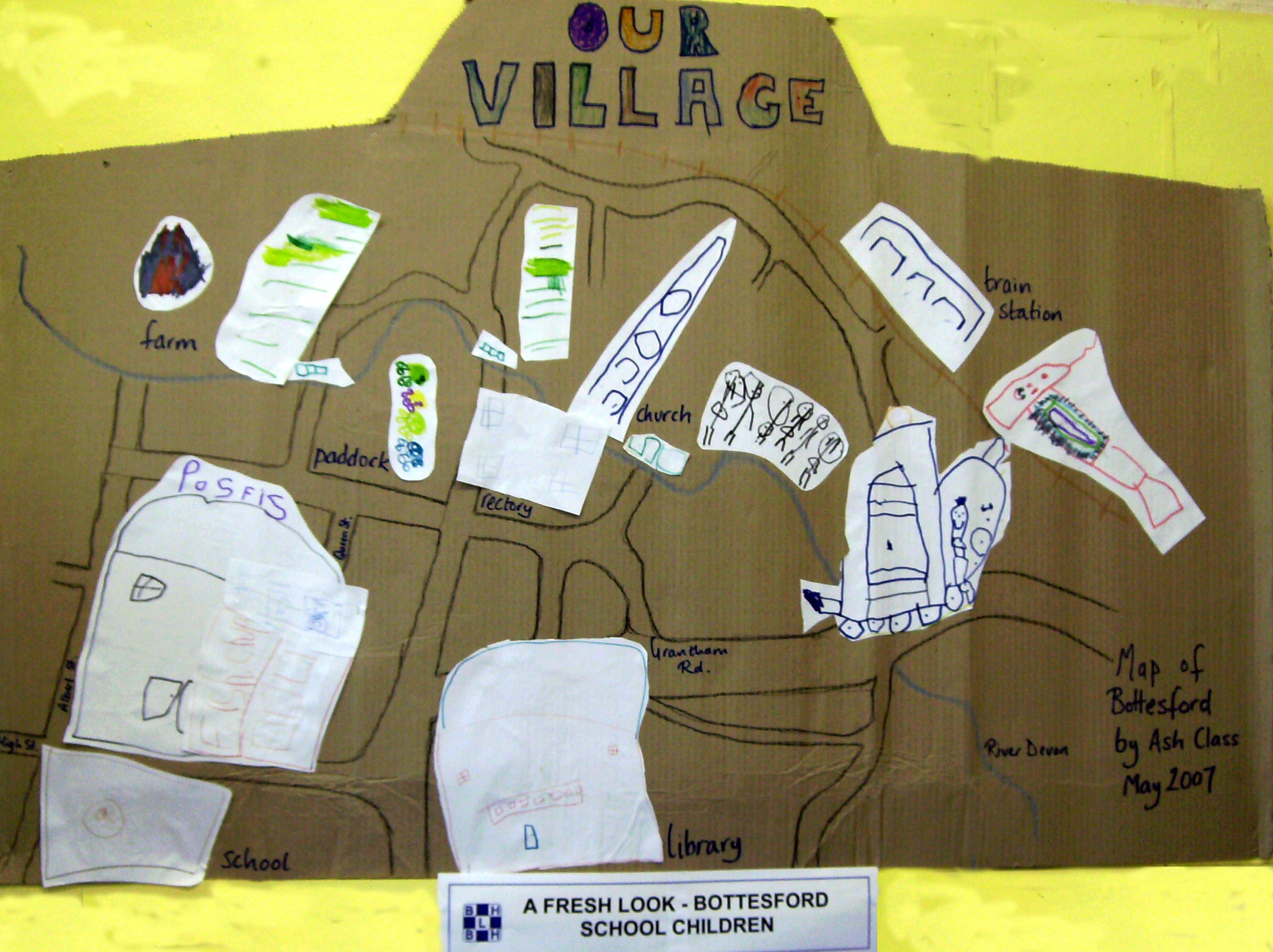
Bottesford Community Heritage Project held its first ‘Living History’ exhibition on May 5th – 7th this year. There were over 600 visitors to the exhibition and one of the most admired exhibits was this splendid illustrated map of Bottesford completed by a group of four year-olds from the reception class. Ash class have shown in pictures all the places in the village they thought were important, including the station, the church, the library, the post office (posfis), the fish and chip shop and of course the school. A great team effort!
Our Village by Ash Class, Bottesford Primary School
An Illustrated Map of Bottesford by Ash Class
Map of Bottesford by children of Ash Class, Bottesford Primary School, displayed at the Living History Exhibition, May Day weekend 2007.
Ash Class, Bottesford Primary School
Time period
This page was added on 10/05/2007.


No Comments
Add a comment about this page